The Deep South is Thailand's last stretch before Malaysia: Phatthalung on Songkhla Lake, and Yala, Pattani and Narathiwat, where most people are Malay-speaking Muslims. Phatthalung is visited normally. The UK FCDO advises against all but essential travel to Yala, Pattani and Narathiwat, four Songkhla districts (Chana, Thepha, Na Thawi, Saba Yoi) and the Hat Yai to Padang Besar railway, citing regular attacks in the provinces by the Malaysian border, and warns this can invalidate travel insurance. The US advises increased caution in the three provinces, and its staff need special authorisation to go.
Read that before you plan anything. For most foreign visitors, Phatthalung is the straightforward part of this guide: the Thale Noi lotus wetland and the Khuan Nok Ten mist viewpoint make a good two-day trip. Betong and the Aiyoeweng mountains in Yala are mainly visited by Thai and Malaysian travellers arriving by road.
Hat Yai is the gateway, about 1 hour 30 minutes by air from Bangkok. Phatthalung is on the southern railway and around 2 hours by road from Hat Yai; Betong is a 4 to 5 hour minivan ride from Hat Yai on Highway 410. Hire a car and driver for rural spots.
February to September is drier; the north-east monsoon brings heavy rain from about October to January. For Thale Noi's red lotus, come between February and May.
How to split your days. In Phatthalung, be on the water at Thale Noi at first light one day and at Khuan Nok Ten before 06:00 the next. With a third day, add a sunrise boat past the Pak Pra lift nets, the boardwalk at the botanical garden, the climb up Khao Ok Thalu and an evening at Grand Canyon Khuan Noi. If you do go to Betong despite the UK advice, which covers all of Yala, the pattern is the same: dawn at the Aiyoeweng Skywalk, then Rama IX Waterfall on the way back; another morning for Piyamit Tunnel, the hot spring and Inthasorn Waterfall; and late afternoon at Wat Phutthathiwat. Gunung Silipat needs an overnight booked in advance, and Toh Ku Chae Bridge is a quick stop on the drive in from Yala. In Pattani, the Sky Walk and the Central Mosque fit into an afternoon in town, and Laem Ta Chi is a separate trip of its own. In Narathiwat, Narathat Beach is on the edge of town, Talo Mano Mosque and Pa Cho Waterfall are 12 km apart on the Bacho side, and Sipo Waterfall is a half day inland.
Good to know
- Tourist Police: 1155
- Emergency (ambulance): 1669
- FCDO: Thailand regional risks (southern provinces)
- US State Department: Thailand travel advisory
- DASTA: Thale Noi, Phatthalung
Phatthalung
Phatthalung is the easy, low-key province of the region, with limestone peaks, rice fields and the wetlands of Thale Noi at the top of Songkhla Lake. It is not covered by the travel warnings and makes a two-day trip from Hat Yai or Trang. Both of its highlights are at their best at sunrise, so stay overnight rather than day-tripping.








01Thale Noi Waterbird Park
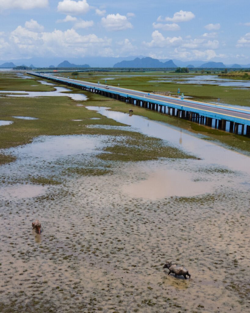
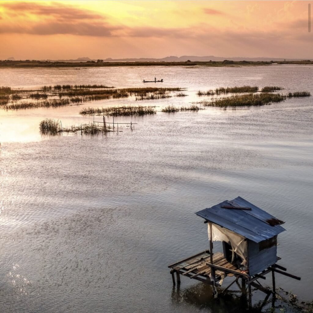
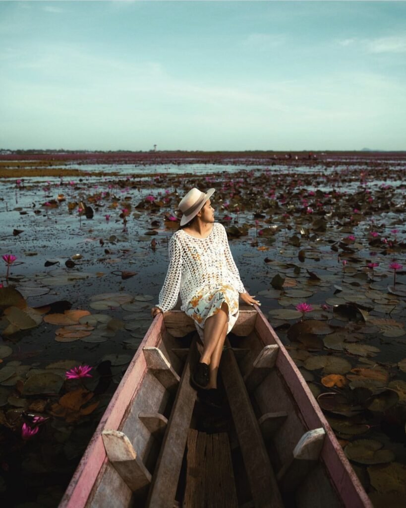
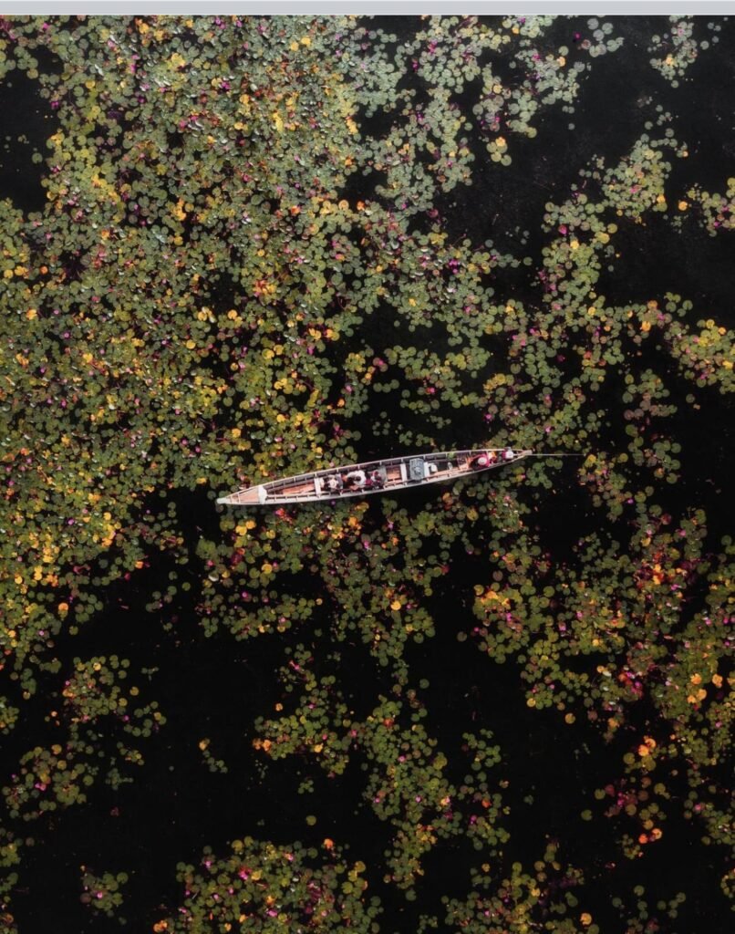
Thale Noi, at the northern tip of Songkhla Lake in Khuan Khanun district, was Thailand’s first Ramsar wetland. From about February to May the shallow water is carpeted with red lotus that opens each morning, while herons, swamphens and migrant birds feed in the reeds and herds of swamp buffalo graze the marsh. The 5.5 km Chaloem Phrakiat (Ekachai) Bridge crosses the wetland nearby.
Timing is everything. Take a longtail from the pier by the non-hunting area at first light, before the flowers close in the late-morning heat. Boats take about an hour and carry up to 10, so a group brings the cost right down. Outside the peak months the flowers can be sparse: ask at the pier how the bloom looks before you book.
For photos, a telephoto and a low angle from the bow work well.
- Attraction Type
- Wetland, wildlife sanctuary, boat trip
- Location
- Open in Google Maps
- Cost
- Boat about 550 THB per boat (up to 10 people, around 1 hour); sunrise charters from Ban Pak Pra cost more (check before you go)
- Opening Hours
- Boats daily, 05:00 to 17:00; sanctuary office 08:00 to 18:00
- Best Time To Visit
- February to May for the lotus; October to April for migratory birds; sunrise to about 09:00
- How To Get There
- About 32 km north of Phatthalung town by car or hired songthaew. Phatthalung is around 2 hours by road from Hat Yai, or on the Bangkok to Hat Yai railway.
- What to Pack
- Telephoto lens, insect repellent, dry bag

02Khuan Nok Ten Viewpoint
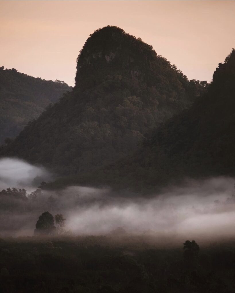
On still mornings at Khuan Nok Ten, mist fills the valleys of the Banthat range and the limestone peaks and forested ridges stand out like islands as the sun rises behind them. The hilltop, at Khlong Sai Khao in Kong Ra district south-west of Phatthalung town, is one of the province’s best-known sea-of-mist spots, and still fairly new to visitors.
Be at the top before 06:00, ideally on a cool morning after overnight rain, when the mist is most reliable. Park at the foot of the hill and ride the steep last stretch in a local 4×4 pick-up. There are small cafés at the top and simple rooms, so the easiest way to make sunrise is to sleep up there. Bring a warm layer.
- Attraction Type
- Viewpoint (sea of mist)
- Location
- Open in Google Maps
- Cost
- Local 4×4 ride up about 30 THB per person each way; small community fee possible (check before you go)
- Opening Hours
- Daily, 05:30 to 19:00
- Best Time To Visit
- Sunrise, about 05:30-07:30; cool mornings after rain
- How To Get There
- About 35 km south-west of Phatthalung town, under an hour by car or motorbike; no public transport.
- What to Pack
- Head torch, warm layer, tripod



03Ban Pak Pra Lift Nets
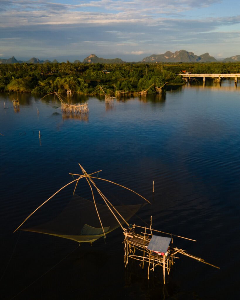
At Ban Pak Pra several canals join to form Khlong Pak Pra, which carries water from the Thale Noi wetlands south into Songkhla Lake. Both banks are lined with yo yak, giant square lift nets tied at the corners to bamboo frames and raised on counterweighted beams, a design that lets one fisher lift a very large net. Silhouetted against the sunrise or sunset, they are among the most photographed scenes in Phatthalung.
For sunrise, leave before dawn and board a boat at around 05:30 to 06:00, when the nets are often being worked. A 45-minute to one-hour boat loop past the nets starts from about 1,000 baht per boat, and a two-hour trip on to Thale Noi from about 1,200 baht; confirm the price, pier and time in advance. February to April adds red lotus at Thale Noi. Bring a jacket for the early boat, and ask before photographing fishers up close.
- Attraction Type
- Fishing village, canal and sunrise viewpoint
- Location
- Open in Google Maps
- Cost
- Viewing from the bank free. Boat past the nets from about 1,000 baht per boat; to Thale Noi from about 1,200 baht per boat (check before you go)
- Opening Hours
- Open access; boat trips about 05:30 to 17:00 (check before you go)
- Best Time To Visit
- Sunrise or sunset; February to October for calmer boat trips, February to April for Thale Noi lotus
- How To Get There
- Own transport from Phatthalung town towards Lam Pam or Khuan Khanun, then follow signs to Ban Pak Pra; search 'Pak Pra Pier, Ban Ton Lam Phu' in maps


04Phatthalung Botanical Garden Boardwalk
On the southern edge of Thale Noi in Phanang Tung subdistrict, the Phatthalung Botanical Garden protects about 6,100 rai of freshwater peat swamp. Its 930-metre wooden nature trail runs through white cajuput (samet khao) forest and over channels thick with lotus, water lilies and sedges, with viewpoints across the lake and fishermen’s lift nets along the shore. The garden was set up in 1994, and boat trips through the swamp forest also leave from here.
Come soon after opening, when the light is soft, birds are active and lotus flowers are still open. Allow one to two hours for the walk, more with a boat trip. Planks can be slippery after rain, so wear shoes with grip, and bring a hat and insect repellent. Stay on the walkway, as the swamp is protected. Combine with Thale Noi Waterbird Park on the same morning.
- Attraction Type
- Wetland boardwalk and nature trail
- Location
- Open in Google Maps
- Cost
- Free (check before you go); boat trips extra
- Opening Hours
- Daily 08:00 or 08:30 to 16:30 (check before you go)
- Best Time To Visit
- Early morning; lotus is generally best in the drier months
- How To Get There
- Own transport from Phatthalung town, about 30 to 40 minutes north towards Thale Noi (check before you go)



05Khao Ok Thalu
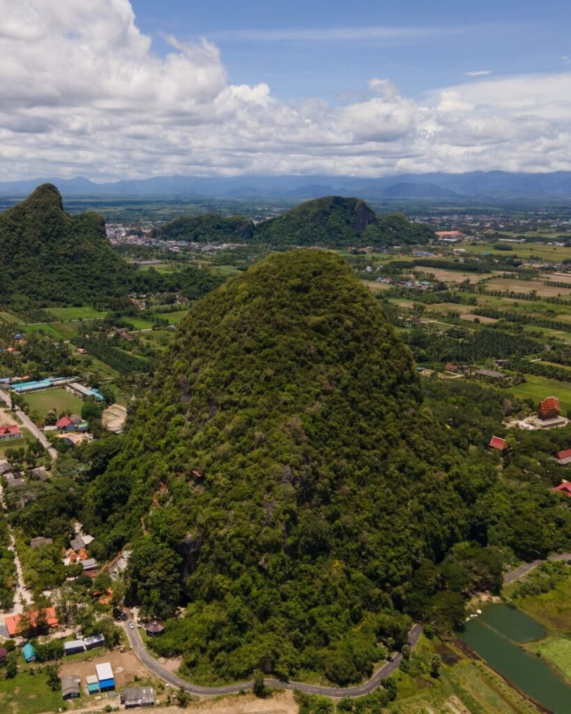
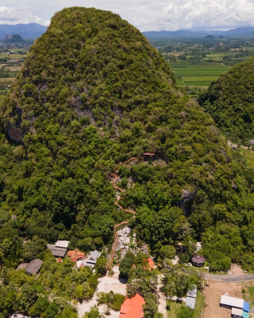
Khao Ok Thalu is the limestone peak on Phatthalung’s provincial seal, about 250 metres high, rising straight out of the eastern edge of town. Near the summit a large hole runs right through the rock, which gives the hill its name, roughly ‘the mountain with a pierced chest’, and a flag flies from the top. A stairway of about 1,066 steps climbs to a rock platform with wide views over the town and the surrounding rice plains.
The climb takes around 30 minutes for fit walkers and longer in the heat, so go early in the morning or a couple of hours before sunset. Bring plenty of water and wear proper shoes. There are two stairways: an older, steeper one straight to the top and a newer route past statues and a forest monastery that ends at a nuns’ meditation hermitage. Dress modestly and keep quiet on the temple sections. Entry is free.
- Attraction Type
- Mountain viewpoint and hike
- Location
- Open in Google Maps
- Cost
- Free
- Opening Hours
- 08:30 to 17:30 (check before you go)
- Best Time To Visit
- Early morning or late afternoon; February to August for drier weather
- How To Get There
- About 1 km east of Phatthalung railway station; walk, or take a motorbike taxi (about 80 baht return with waiting time, per Travelfish)


06Grand Canyon Khuan Noi
Known locally as Grand Canyon Khuan Noi, this is a former laterite clay pit in Phraek Ha subdistrict, Khuan Khanun, where digging reached groundwater and the hollows filled to form deep turquoise and emerald ponds. Steep cut banks and narrow earth ridges divide the pools, and from above they make a patchwork of colour that shifts with the light and the season.
Late afternoon into sunset puts warm light on the banks, while early morning can bring a thin mist over the water. Swimming is not allowed: the water is reported to be around 30 metres deep, and the banks can crumble, so keep well back from edges, especially with tripods. Take your rubbish home. Allow about an hour. You need your own transport, as the site is roughly 12 km north-west of Phatthalung town.
- Attraction Type
- Former quarry lakes and viewpoint
- Location
- Open in Google Maps
- Cost
- No fee found in sources (check before you go)
- Opening Hours
- Daily 08:30 to 17:30 (check before you go)
- Best Time To Visit
- Late afternoon to sunset, or early morning for mist
- How To Get There
- Own car or motorbike from Phatthalung town, about 20 minutes (check before you go)
Yala
Yala is Thailand’s southernmost province, and its mountain town of Betong, on the Malaysian border, has a large Chinese community, cool mornings and sea-of-mist viewpoints. The UK advice against all but essential travel covers all of Yala, including Betong; most visitors are Thai and Malaysian and arrive by road. If you do go, base yourself in Betong town and use a driver for the dawn viewpoints.


07Toh Ku Chae Bridge
A 15 to 20-minute roadside stop, not a destination. Toh Ku Chae Bridge carries Highway 410 across the Bang Lang reservoir, often called Hala-Bala lake, in Mae Wat subdistrict, Than To district. The reservoir formed behind Bang Lang Dam on the Pattani River, completed in 1981, and from the middle of the bridge you look over open water to forested hills.
Stop in the early morning or late afternoon for the best light. Traffic on Highway 410 moves fast, so park only where it is safe and stay well in from the road. There is little shade on the bridge.
- Attraction Type
- Bridge and roadside viewpoint
- Location
- Open in Google Maps
- Cost
- Free
- Best Time To Visit
- Early morning or late afternoon
- How To Get There
- On Highway 410 between Yala and Betong, in Mae Wat subdistrict, Than To district; stop on the way by car

08Rama IX Waterfall
The easy add-on to a dawn at the Aiyoeweng Skywalk. Chaloem Phrakiat Rama IX Waterfall drops over five tiers through forest in Aiyoeweng subdistrict, with a main fall of more than 30 m, just off Highway 410 at about km 32 to 33, around 32 km from Betong. The air is cooler than in lowland Yala, and the falls carry most water after rain.
A concrete walkway of roughly 300 m leads from the car park to the base. It gets busy with Thai visitors in the cool season and at weekends, so come early. The rocks near the water are slippery: wear sandals or shoes with grip.
- Attraction Type
- Waterfall
- Location
- Open in Google Maps
- Cost
- Free
- Opening Hours
- About 08:00 to 16:30 daily
- Best Time To Visit
- Morning, after the skywalk; weekdays are quieter
- How To Get There
- Highway 410 to about km 32 to 33 in Aiyoeweng, then the signed side road; about 30 to 40 minutes from Betong; 300 m walk from the car park
- What to Pack
- Shoes or sandals with grip, insect repellent, swimwear



09Aiyoeweng Skywalk
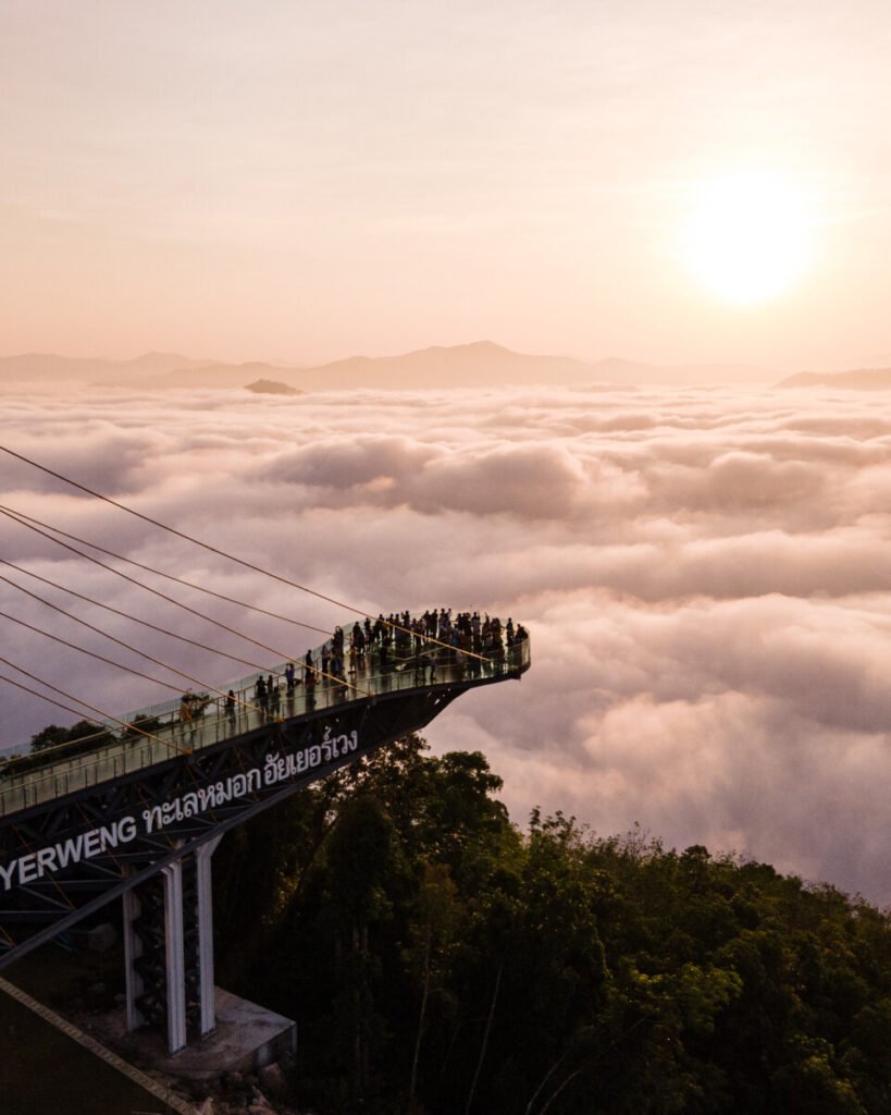
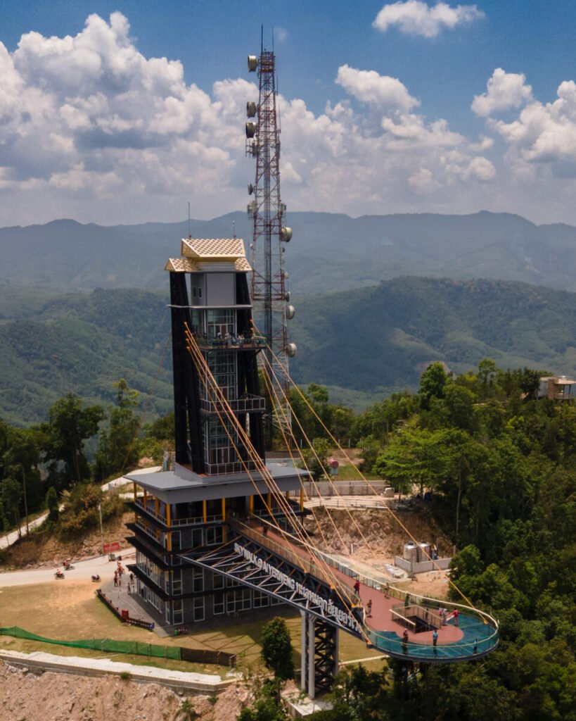
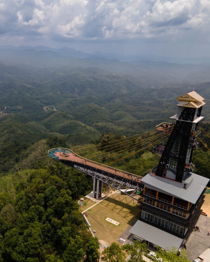
If you make one dawn start in Betong, make it here. The Aiyoeweng Skywalk stands on Khao Microwave at about 621 m, north of Betong town: a six-storey steel tower around 45 m tall carrying a glass-floored walkway of about 61 m out over the forest. On cool mornings cloud fills the valleys below and the border hills rise out of it.
Arrive by 06:00, because the mist usually thins by mid-morning. There is no public transport over the 25 to 30 km from Betong, so drive or hire a driver. From the car park a steep 500 m concrete path leads up, or take the shuttle for a small fee. Pre-dawn temperatures can fall into the low teens, so bring a warm layer, and expect queues on Thai and Malaysian holiday weekends.
- Attraction Type
- Viewpoint and glass skywalk
- Location
- Open in Google Maps
- Cost
- Foreigners 200 THB, Thais 40 THB; foot covers about 30 THB; shuttle from car park 20 to 50 THB; parking 20 to 40 THB (check before you go)
- Opening Hours
- Daily from 05:30; closing time reported between 15:00 and 16:30 (check before you go)
- Best Time To Visit
- Sunrise, about 05:30 to 07:00; mist can form all year but varies day to day
- How To Get There
- About 25 to 30 km north of Betong via Highway 410 and the Aiyoeweng road; self-drive, motorbike or hired driver; 500 m steep path or shuttle from the car park
- What to Pack
- Warm jacket, torch for the pre-dawn walk, cash for fees and shuttle


10Gunung Silipat
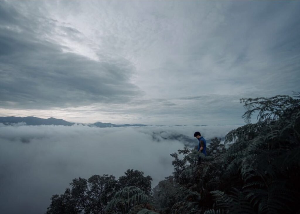
Gunung Silipat (Khao Kunung Silipat) is a bare rocky summit of about 670 m on the border of Aiyoeweng and Ta No Mae Ro subdistricts. The open top, which holds around 100 people, gives a 360-degree view over a sea of mist at dawn, and on clear nights it is a good place for stars. Local community groups run the trips, and most visitors camp near the top so they are there for sunrise.
You cannot just turn up. Book two or three days ahead by phone (081 093 8549 or 082 265 6900); the organisers also confirm the route is open. A 4WD takes you part of the way, then you walk through forest, rubber and durian orchards:
- Aiyoeweng route: about 2 km
- Ta No Mae Ro route: about 400 m
Both finish with a steep final 200 m. The summit has no shelter, so bring a rain layer.
- Attraction Type
- Mountain viewpoint and campsite
- Location
- Open in Google Maps
- Cost
- Overnight package with 4WD transfer, guide, tent and two meals about 800 to 900 THB per person (2021 to 2022 figures, check before you go)
- Opening Hours
- By advance arrangement only; sunrise trips and overnight camping
- Best Time To Visit
- Sunrise on a clear morning; stay overnight to be at the top for dawn
- How To Get There
- Highway 410 about 30 km from Betong to the meeting point, then community 4WD and a walk of 600 m to 2.2 km
- What to Pack
- Warm jacket, head torch, shoes with grip, rain layer, cash


11Betong
Betong is Thailand’s southernmost town, close to the Malaysian border, with a strong Chinese character. Walk the old shophouse streets around the clock tower, where a 1924 postbox, billed as Thailand’s largest, still takes letters. From about September to March, swiftlets gather on the wires and buildings at dusk.
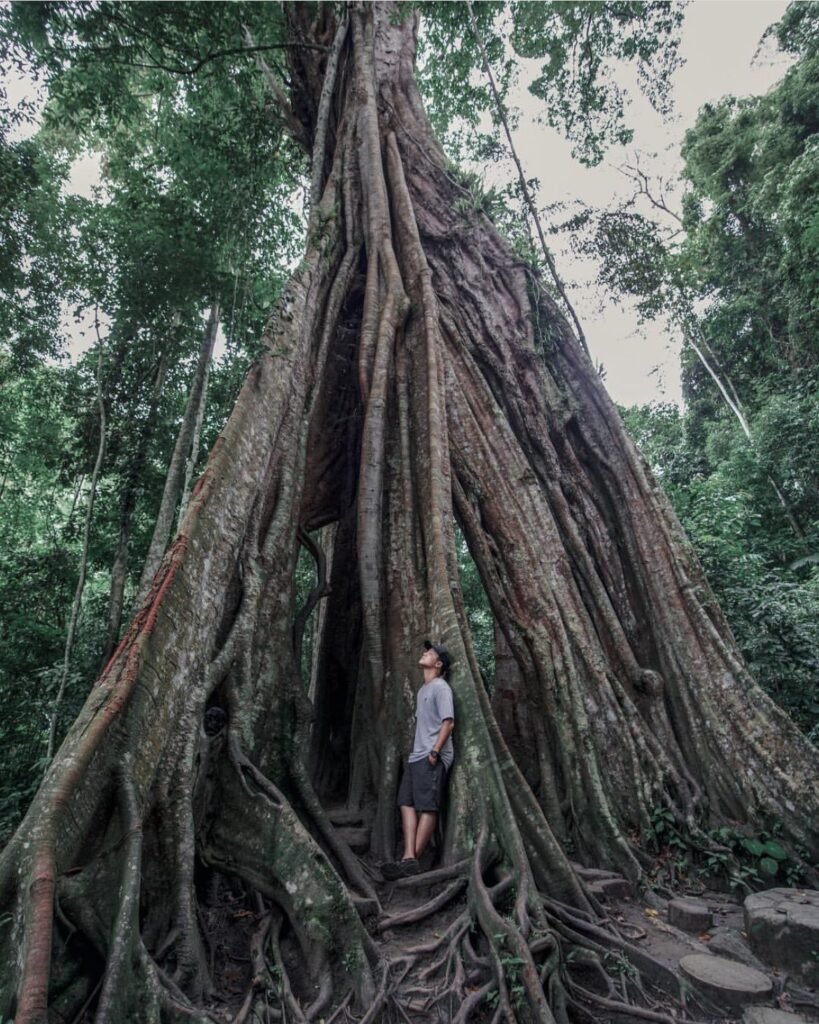
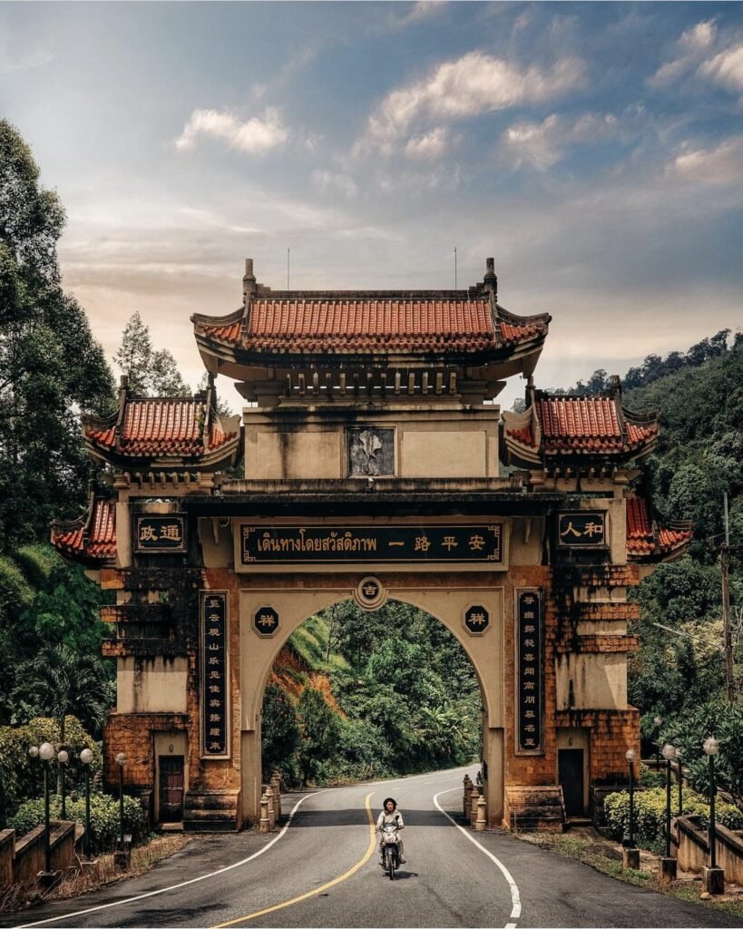
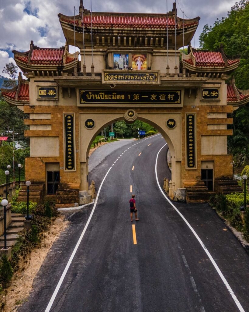
Give a morning to the sights outside town. Drive out through the Chinese-style gateway into Ban Piyamit 1 for Piyamit Tunnel, a roughly 1 km tunnel dug in 1976 by the Communist Party of Malaya; bring a torch. Then follow the forest path to the giant fig known as the thousand-year-old tree, and stop at Betong Hot Spring on the way back to soak your feet or boil an egg.
Expect routine army checkpoints in the area, and carry your passport.
- Attraction Type
- Town, historic tunnel and hot spring
- Location
- Open in Google Maps
- Cost
- Town sights free; Piyamit Tunnel about 40 THB for Thai adults, foreign visitors report 80 to 100 THB (check before you go); hot spring public pools free
- Opening Hours
- Piyamit Tunnel 08:00 to 16:30; hot spring about 05:30 to 20:00 (check before you go)
- Best Time To Visit
- September to March for swiftlets at dusk; tunnel and hot spring in the morning
- How To Get There
- Highway 410 from Yala (about 140 km); vans from Yala and Hat Yai; small-plane flights from Hat Yai (check schedules); own transport for the tunnel and hot spring
- What to Pack
- Torch for the tunnel, towel for the hot spring, passport, cash


12Wat Phutthathiwat Chedi
Betong’s golden chedi, Phra Mahathat Chedi Phra Phutthathammaprakat, stands on a hill above the town centre at Wat Phutthathiwat. Built in an applied Srivijaya style to mark the 60th birthday of Queen Sirikit, who gave it its name, it is 39.9 m tall and houses Buddha relics. From the terrace you look over the rooftops to the hills along the Malaysian border.
Come in the late afternoon, when the light is softer and there are fewer people, and allow 30 to 45 minutes, including the large bronze Buddha image in the grounds. Cover shoulders and knees, take your shoes off before entering buildings and keep your voice low.
- Attraction Type
- Buddhist temple and chedi
- Location
- Open in Google Maps
- Cost
- Free (donations welcome)
- Opening Hours
- About 08:00 to 17:00 daily
- Best Time To Visit
- Late afternoon for softer light and fewer visitors
- How To Get There
- Rattanakit Road, central Betong; walk up from the town centre or take a local taxi
- What to Pack
- Clothing covering shoulders and knees, slip-on shoes


13Inthasorn Waterfall
A small forest cascade (also spelt Inthason) in Ta No Mae Ro subdistrict, about 15 km from Betong town and roughly 2 km past Betong Hot Spring on the road towards the Piyamit villages. Water runs all year into pools at the base, so it makes a good place to cool off after a morning at the hot spring and Piyamit Tunnel. It is a minor stop, not worth a separate trip.
Signs are poor and the side road is narrow, so save the location in your map app before you set off. Visitors report old, little-maintained buildings and slippery steps and rocks, so take care, especially after rain. There are almost no facilities: bring water, snacks and a towel, and take your rubbish away with you.
- Attraction Type
- Waterfall and swimming pools
- Location
- Open in Google Maps
- Cost
- Free, no fee reported
- Opening Hours
- No set hours reported; visit in daylight
- Best Time To Visit
- Late morning or early afternoon, with the hot spring and Piyamit Tunnel
- How To Get There
- From Betong, take the Ta No Mae Ro road towards Piyamit; about 2 km beyond Betong Hot Spring; own transport needed
- What to Pack
- Swimwear, towel, shoes with grip
Pattani
Pattani was the seat of a Malay sultanate for centuries and is still the cultural heart of the Malay-Muslim south. It has the region’s best-known mosques and a wide, shallow bay sheltered by a long sand spit. Most visitors are Thai or Malaysian and services for foreign tourists are thin, so plan to sort out your own transport. The travel advice at the top of this guide covers this province.



14Pattani Sky Walk
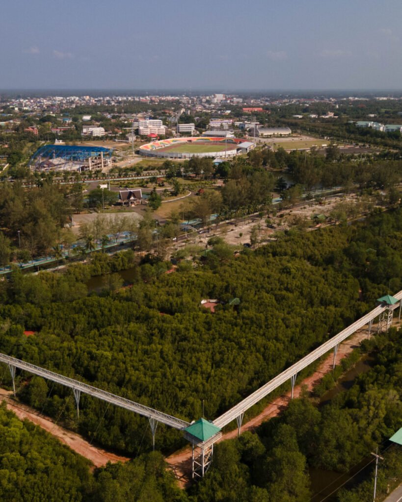
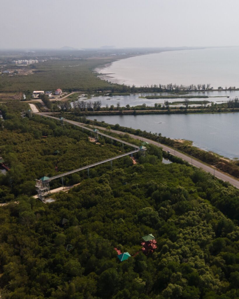
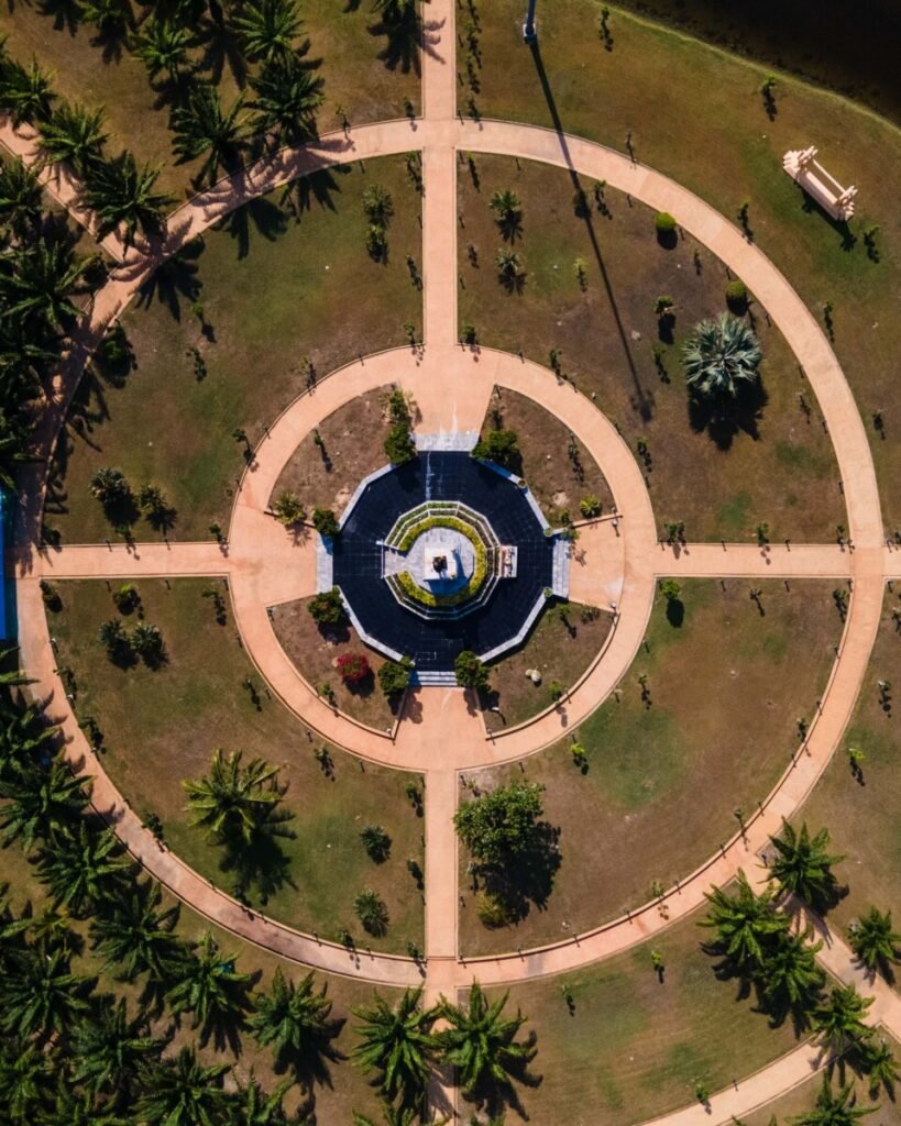
A steel walkway about 12 m up, running for roughly 400 m over the mangroves at Rusamilae, on the shore just north of Pattani town. The floor is open steel mesh, so you look straight down into the roots. Shaded pavilions along the route look out over the Pattani river mouth, the bay and the Laem Ta Chi sand spit. It sits in the royal park grounds below the Princess Galyani Vadhana monument, with a mangrove trail and Rusamilae beach next door.
Entry is free. Come in the late afternoon: bare steel in the midday sun is hard going, and the bay looks best near sunset. Sources disagree on opening hours, so go in daylight and don’t count on it being open late. If you’re nervous of heights, the see-through floor takes some getting used to.
- Attraction Type
- Viewpoint / mangrove walkway
- Location
- Open in Google Maps
- Cost
- Free
- Opening Hours
- Daily; reported as early morning to evening, sources disagree (check before you go)
- Best Time To Visit
- Late afternoon to sunset
- How To Get There
- A short drive north of Pattani town centre in Rusamilae subdistrict; taxi or motorbike taxi from town
15Pattani Central Mosque
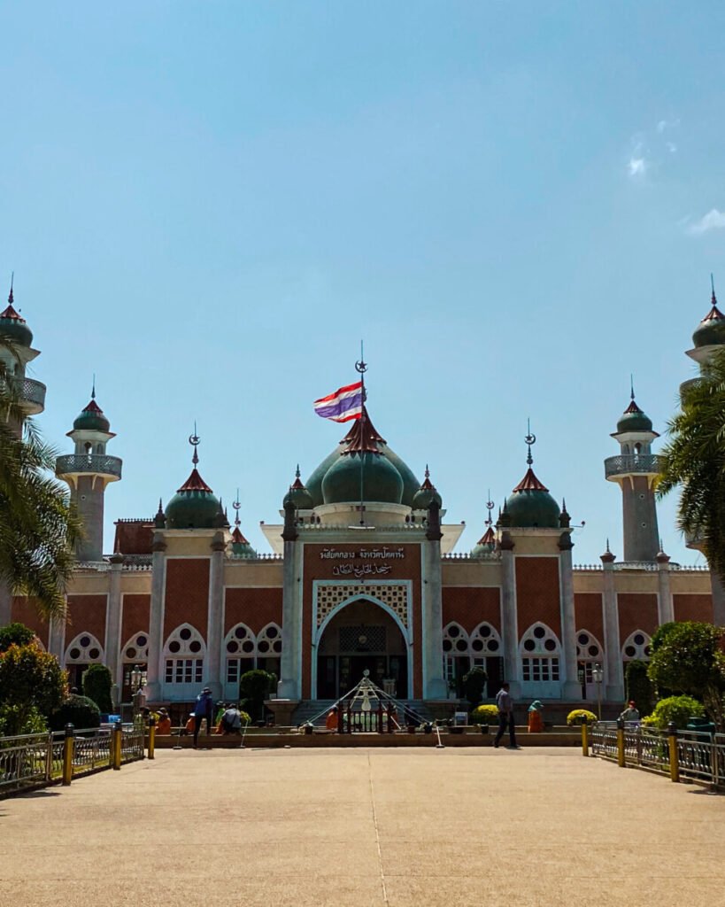
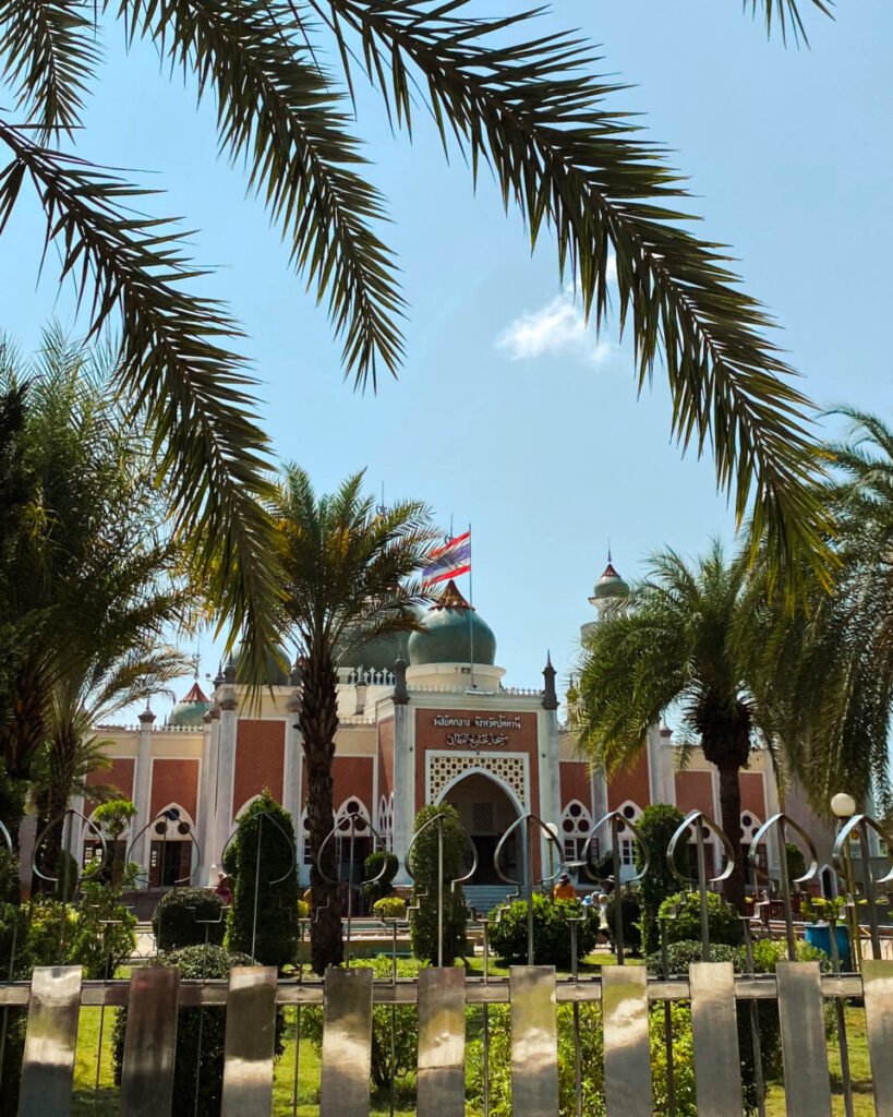
This is the landmark of Pattani town and one of the best-known mosques in Thailand. The government approved funding in 1954, construction took nine years, and Field Marshal Sarit Thanarat opened it in 1963. The design borrows from the Taj Mahal: a large green central dome ringed by smaller ones, with a long reflecting pool in front. After a royal visit in 1993 it was renovated and enlarged, and two minarets were added to make four.
It is a working mosque, not a monument. Non-Muslims are generally welcome outside prayer times. Stay away on Friday from late morning to early afternoon, when it fills for Jumu’ah. Cover your shoulders and knees (men in long trousers), women should bring a headscarf, and take your shoes off before the prayer hall. Photograph the building from across the pool, but ask before photographing people and never photograph anyone at prayer.
- Attraction Type
- Mosque
- Location
- Open in Google Maps
- Cost
- Free
- Opening Hours
- Daily outside prayer times; a 2016 report gave 09:00–15:30 and no visits on Fridays (check before you go)
- Best Time To Visit
- Weekday mornings; avoid Friday midday
- How To Get There
- On Yarang Road (the Pattani–Yala road) in town, walkable or a short taxi ride from the centre



16Laem Ta Chi
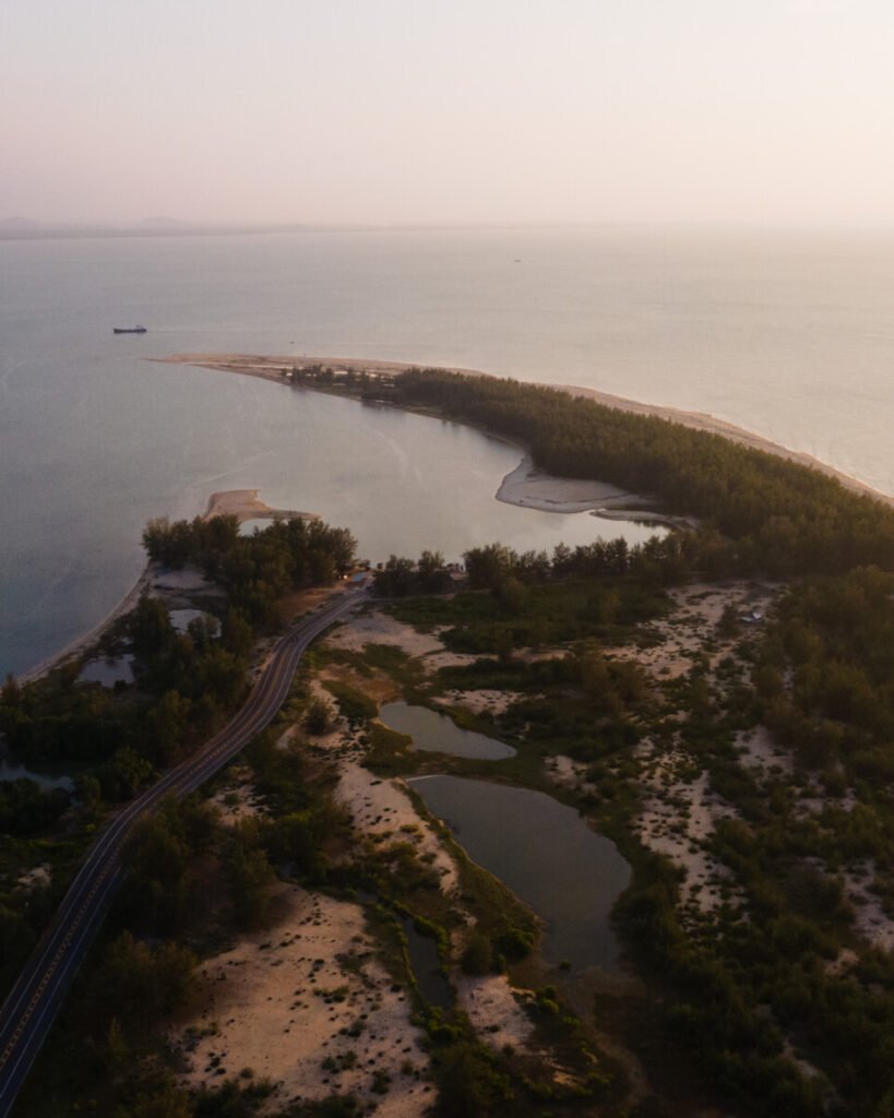
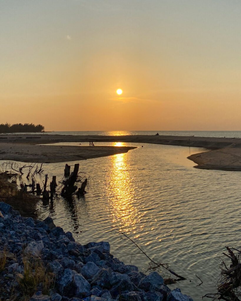
A long, hooked sand spit that curls west from the Yaring coast and almost closes off Pattani Bay. One side faces the open Gulf of Thailand and the other the calm bay, with its mangroves and fish farms, so the tip is a good place for both sunrise and sunset. Fishing villages line the road out.
It is much further by road than it looks from Pattani: about 43 km. Take Highway 42 east to Yaring, then head back west along the spit past Hat Talo Kapo; the last 16 km is the narrow Laem Pho road. You’ll need your own transport or a driver. A local boat from the Pattani river mouth or Yaring pier is quicker, but it has to be arranged in advance and depends on the sea. Facilities at the tip are minimal, so bring water and set off back while there’s still plenty of light.
- Attraction Type
- Beach / sand spit
- Location
- Open in Google Maps
- Cost
- Free
- Opening Hours
- Open access
- Best Time To Visit
- Late afternoon; avoid rough seas in the November to January monsoon
- How To Get There
- About 43 km by road from Pattani via Highway 42 to Yaring, then the Laem Pho road along the spit; or a pre-arranged local boat from the Pattani river mouth or Yaring pier
Narathiwat
Narathiwat is Thailand’s south-eastern corner. It runs from the Gulf coast up into the forested Budo hills and down to the Malaysian border at Su-ngai Kolok. Our stops are a café in the provincial town, Narathat Beach on the edge of town, two waterfalls and a wooden mosque that is around four centuries old. Distances are short but public transport to the sights barely exists, so budget for a car or a hired driver.
17Narathat Beach
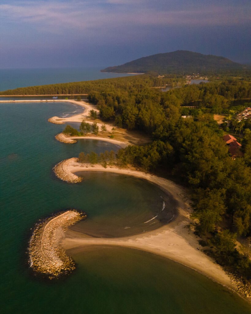
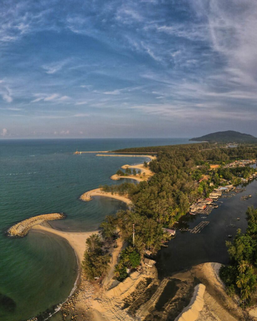
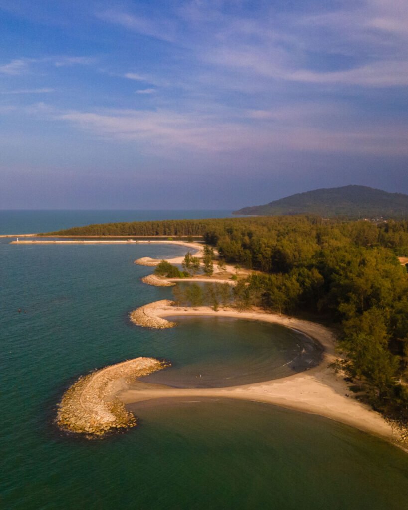
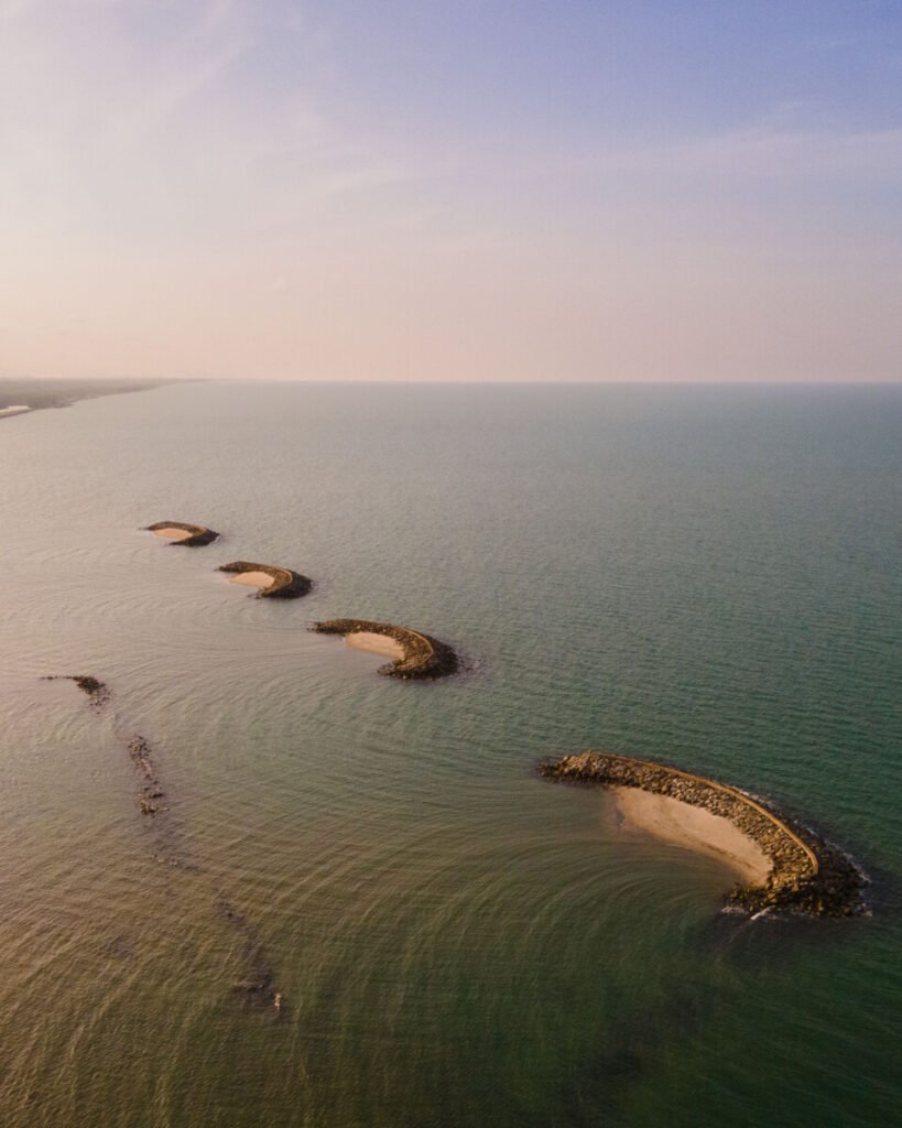
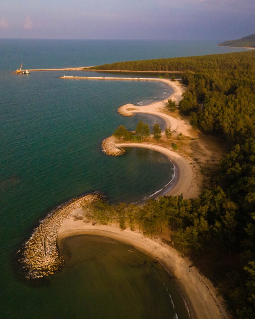
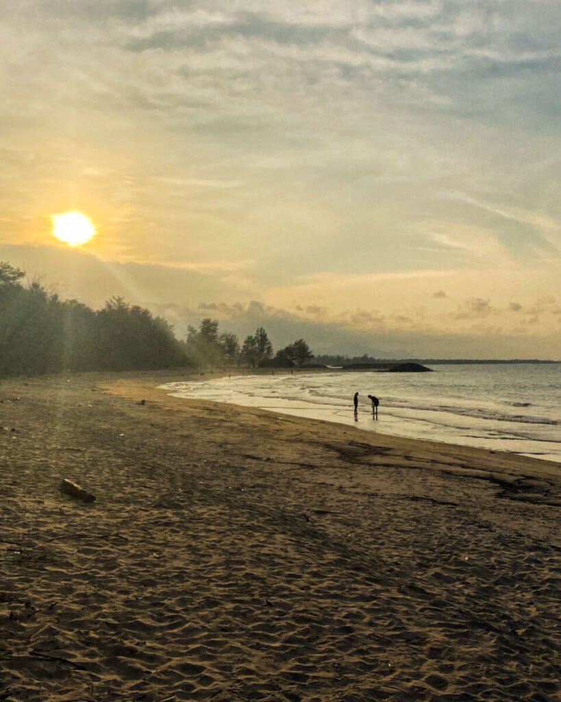
Narathiwat town’s own beach runs for about 5 km north from the mouth of the Bang Nara River, 1 to 2 km from the centre. Casuarina trees give shade along the beach road, and a line of offshore breakwaters has shaped the shore into a row of curved sandy bays, which is what you see from the air. Painted kolae fishing boats are moored around the river mouth, where the town holds kolae boat races during festivals.
Come in the late afternoon, when locals walk the sand and food stalls open along the road. It is open Gulf coast and conditions change with the tide and weather: in January 2020 two children drowned here on a single weekend. Swim only when the sea is calm, stay inside the breakwaters, and stay out of the water from November to February.
- Attraction Type
- Beach
- Location
- Open in Google Maps
- Cost
- Free
- Opening Hours
- Open access
- Best Time To Visit
- Late afternoon, March to October when the sea is calmer
- How To Get There
- 1 to 2 km from Narathiwat town centre on Phichit Bamrung Road; tuk-tuk, motorbike taxi or songthaew


18Talo Mano Mosque
A wooden mosque at the foot of the Budo hills, and one of the oldest mosques in Thailand. Local tradition dates it to 1624 and credits Wan Hussein As-Sanawi, who came from Pattani, so despite the “300-year mosque” nickname it is closer to 400 years old. Two linked halls are built of takhian hardwood, joined with wooden pegs instead of nails. The style mixes Thai gables and Malay forms, and a Chinese-style pavilion on top once served as the minaret. A handwritten Quran is kept here.
It is about 25 km from Narathiwat town off Highway 42, 4 km short of Bacho. It is still the village mosque. You can look round the outside freely, but to go in you need permission from the imam or caretaker. Cover arms and legs, women should wear a headscarf, and shoes come off at the door. Avoid prayer times and Friday midday. Don’t photograph worshippers, or take close-up shots of the cemetery beside the mosque. Pa Cho Waterfall is 12 km away.
- Attraction Type
- Mosque / historic building
- Location
- Open in Google Maps
- Cost
- Free
- Opening Hours
- Grounds daily 08:00–18:00; interior only with the imam's permission (check before you go)
- Best Time To Visit
- Weekday mornings, outside prayer times
- How To Get There
- About 25 km from Narathiwat town on Highway 42 towards Bacho, then the village road to Ban Talo Mano; car or hired driver



19Pa Cho Waterfall
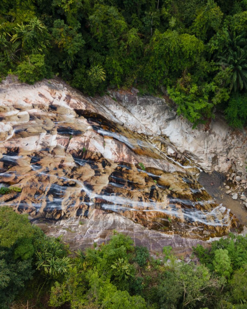
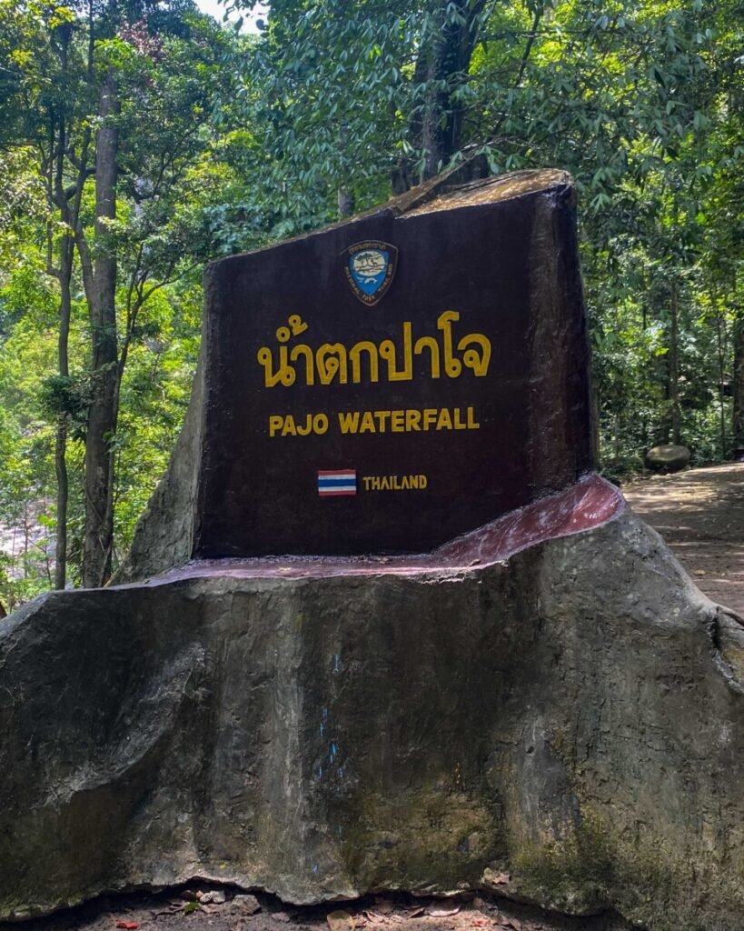
The best-known waterfall in Narathiwat, on the Bacho side of the Budo hills in Budo-Su-ngai Padi National Park. The main drop falls about 60 m from a wide rock ledge into a large pool. The smaller tiers above it mean scrambling over wet rock. The site became a forest park in 1974, before the national park was created around it, and the surrounding rainforest is known for hornbills.
It is about 26 km from Narathiwat town: take Highway 42 towards Bacho, then the park road. The lower fall is a short walk from the car park. Go early on a weekday for cooler air and a better chance of seeing birds. Water flows all year, but in heavy rain the rocks are slick and staff may close the falls.
- Attraction Type
- Waterfall / national park
- Location
- Open in Google Maps
- Cost
- Foreigners 100 baht (children 50); Thais 20 baht (children 10); car 30 baht, motorbike 20 baht; cash
- Opening Hours
- Daily 08:00–16:30
- Best Time To Visit
- Early morning on a weekday; avoid days of heavy rain
- How To Get There
- About 26 km from Narathiwat town: Highway 42 towards Bacho, then about 2 km on the park road; car or hired driver, as no public transport reaches the park




20Sipo Waterfall
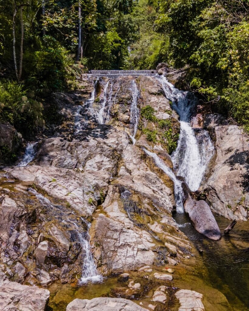
A tiered waterfall in the forest at Ban Sipo, inland from Tanyong Mat in Ra-ngae district. Sources list nine named levels. The seventh is the one people come for: the water spreads across a wide rock face into a pool below. It was declared a forest park in 1976 and is now run by the national parks department as Sipo Waterfall National Park. Its boundaries were still under public consultation in 2026.
The falls are reported to close every year from 1 November to 31 December for the monsoon, so plan on January to October. From Tanyong Mat, which is on the railway, it is about 8 km on Highway 4055, and you’ll need a car or driver for that stretch. Wear shoes with grip if you plan to climb to the upper levels.
- Attraction Type
- Waterfall / national park
- Location
- Open in Google Maps
- Cost
- No fee listed (check before you go)
- Opening Hours
- Daily 09:00–16:45; reported closed 1 November to 31 December (check before you go)
- Best Time To Visit
- January to October, in the morning
- How To Get There
- About 8 km from Tanyong Mat railway station on Highway 4055 towards Ban Sipo; car or hired driver


21Laugh Coffee
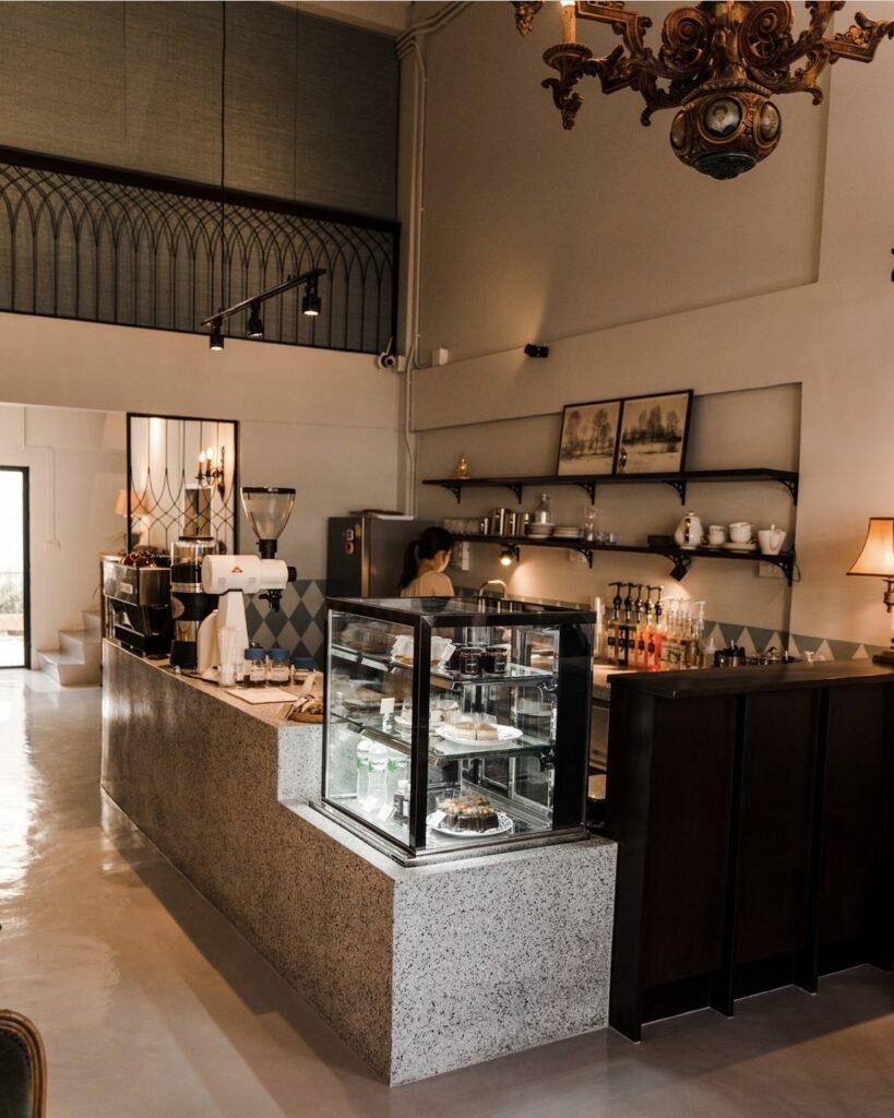
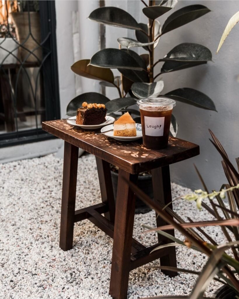
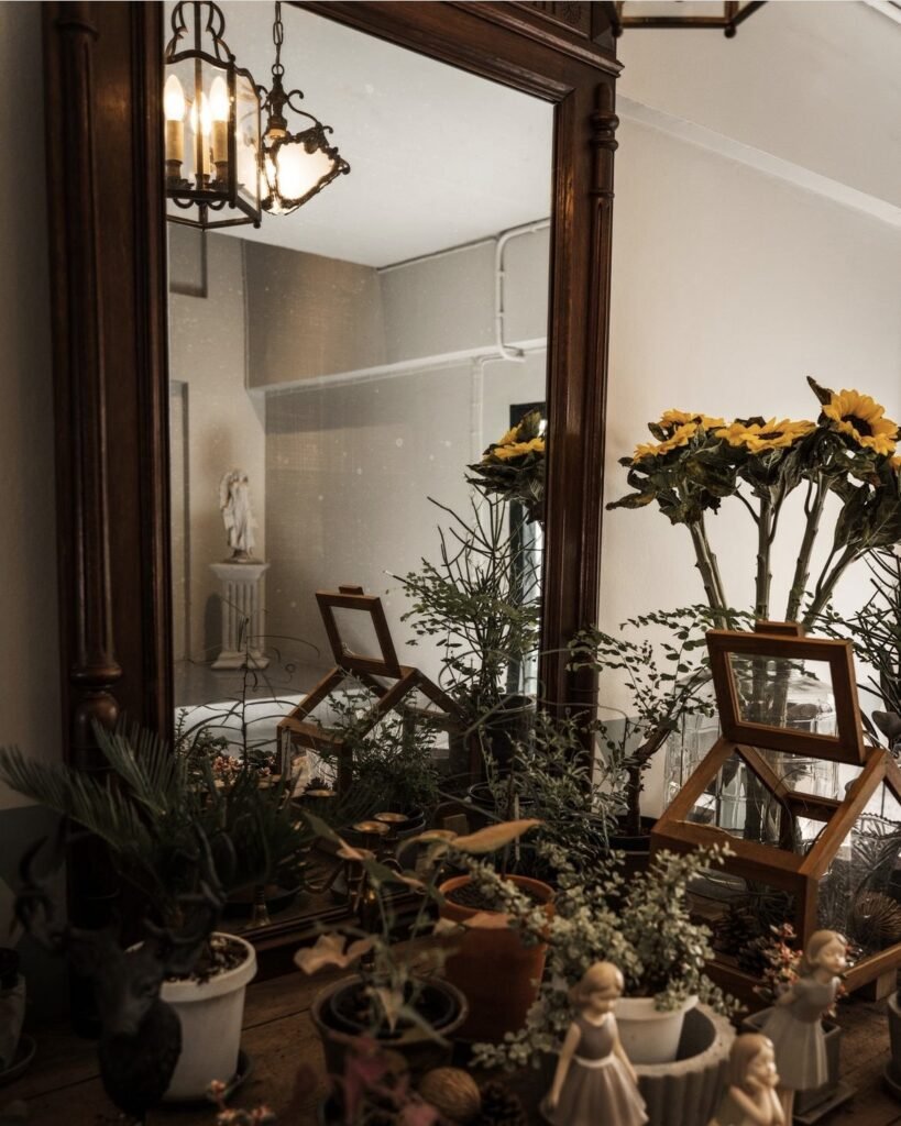
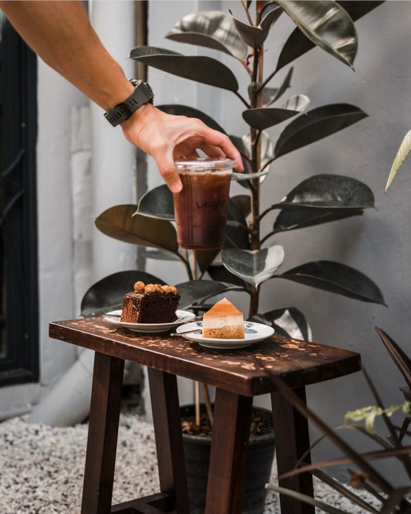
Narathiwat is under UK advice against all but essential travel. Laugh Coffee (ลาฟ คอฟฟี่) is a small café in the town centre, known locally for its pleasant interior and drinks such as honey yuzu coffee, and a calm break between the town’s markets, mosques and riverside. Reviewers praise the friendly service, the quiet atmosphere and the pastries and food.
Mid-morning brings soft window light and fewer customers. Dress modestly, as you would anywhere in Narathiwat, check the café’s social pages that it is still open before you go, and ask before photographing staff or other customers.
- Attraction Type
- Café
- Location
- Open in Google Maps
- Cost
- Budget; drinks likely 50-90 THB
- Opening Hours
- Daily, 10:30 to 18:30
- Best Time To Visit
- Mid-morning
- How To Get There
- In Narathiwat town centre; a short taxi ride from Narathiwat Airport, which has flights from Bangkok (check current schedules).
- What to Pack
- Modest clothing