Songkhla sits on the Gulf of Thailand coast in the lower south, between the sea and Songkhla Lake, and it has two very different centres. Songkhla town is the one with character: an old trading port of Sino-Portuguese shophouses, Samila Beach and its mermaid statue, and the pottery island of Koh Yo across the lake bridge. Hat Yai, 30 km inland, is the busy commercial city that Malaysian weekenders love, and the place you'll arrive.
Hat Yai International Airport is about 1 hour 30 minutes by air from Bangkok, and overnight trains reach Hat Yai Junction in around 16 hours. Minivans link Hat Yai and Songkhla town in under an hour. Hat Yai was badly flooded in November 2025 and has been recovering through 2026.
February to September is the drier period; the north-east monsoon brings heavy rain from about October to January. Hat Yai and Songkhla town are visited normally, but the UK advises against all but essential travel to the southern districts of Chana, Thepha, Na Thawi and Saba Yoi, so check your government's current advice before going there.
How to split your days. Spend one day in Hat Yai, with the street life at dawn, the Central Mosque in the morning and Kho Hong hill later on. Give a second, unhurried day to Songkhla old town, walking it early or in the late afternoon. With a car, add a third day for the sunrise climb at Khao Khuha and Ton Plio Waterfall near Rattaphum, or for the rice fields of Ranot on the way to Thale Noi. Liwong is in Chana, so only add it once you've checked the travel advice and your insurance.
Good to know
- Tourist Police: 1155
- Emergency (ambulance): 1669
- FCDO: Thailand regional risks (southern provinces)
- US State Department: Thailand travel advisory
- TAT: Southern Thailand recovery and Hat Yai (March 2026)
Songkhla Town
Songkhla town sits on a narrow strip of land between the Gulf of Thailand and Songkhla Lake. The old town, Samila Beach and the bridge to Ko Yo are all within a few kilometres of each other, so one full day covers the main sights.
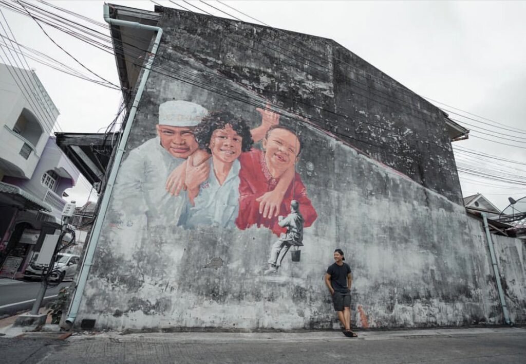

01Songkhla Old Town
The best reason to leave Hat Yai. Songkhla’s old town is a narrow grid of Nakhon Nai, Nakhon Nok and Nang Ngam roads, where Chinese traders from Fujian and Guangdong built Sino-Portuguese shophouses with wooden shutters and tiled roofs. Murals of everyday local life cover many walls. Step into Baan Nakhon Nai, a restored merchant house that is now a community museum and small hotel, to see how these homes looked inside.
Walk it early, when the shutters are down and the lanes are quiet, or in the late afternoon for warm light on the façades. It’s a lot of walking in strong heat, so use the cafés along the way to cool off. Eat on Nang Ngam Road, which also has the City Pillar Shrine. These are homes and businesses, so ask before photographing people.
- Attraction Type
- Historic district, street art
- Location
- Open in Google Maps
- Cost
- Free
- Best Time To Visit
- Early morning or late afternoon; drier months February to September
- How To Get There
- In Songkhla town, about 30 km from Hat Yai (under an hour by minivan or bus); explore on foot.
- What to Pack
- Small change for snacks

02Samila Beach and the Golden Mermaid
Samila is Songkhla city’s main beach, a long strip of pale sand backed by casuarina trees on the Gulf of Thailand. Its best-known sight is the bronze mermaid, put up in 1966, who sits on rocks at the northern end combing her hair. She is painted gold, and visitors touch her for luck. Offshore lie the small islands of Ko Nu and Ko Maeo (Mouse and Cat islands), and Khao Tang Kuan hill rises at the northern tip of the peninsula.
Come at sunrise, when the light comes up over the Gulf and the crowds and tour buses have not yet arrived. The beach is free and open all day. Check conditions before swimming, as the north-east monsoon from about November to January brings rough seas. Seafood stalls and cafes line the road behind the sand. Please do not climb on the statue, which was damaged by a bomb in 2018 and later repaired.
- Attraction Type
- Beach and landmark statue
- Location
- Open in Google Maps
- Cost
- Free
- Opening Hours
- Open all day
- Best Time To Visit
- Sunrise; February to September for calmer seas
- How To Get There
- About 40 minutes by car or minivan from Hat Yai to Songkhla city, then a short walk, tuk-tuk or Grab to the beach


03Tinsulanonda Bridge and Ko Yo
The Tinsulanonda Bridge, opened in 1984, crosses Songkhla Lake in two sections via the island of Ko Yo, linking Songkhla city with Singhanakhon. At 2.64 km it is often called Thailand’s longest concrete bridge. Ko Yo is known for fly-shuttle cotton weaving: the Ratchawat pattern was named by King Prajadhipok during a 1932 visit, and weaving is shown at the learning centre at Wat Khok Bieo. Near the second section of the bridge, the Institute for Southern Thai Studies runs a large folklore museum with a lookout over the lake.
Do not stop on the bridge itself; shoot it from the Ko Yo shore or by drone, which must be registered with CAAT and NBTC. The museum is open daily 08:30 to 17:00. Allow half a day for the museum, a weaving shop and a seafood lunch at one of the lakeside restaurants. Late afternoon gives the best light over the water.
- Attraction Type
- Bridge, island village and museum
- Location
- Open in Google Maps
- Cost
- Bridge and island free. Institute for Southern Thai Studies: 60 baht foreign adults, 30 baht Thai adults; 30/10 baht children (check before you go)
- Opening Hours
- Bridge open at all times. Museum daily 08:30 to 17:00 (check before you go)
- Best Time To Visit
- Late afternoon; February to September for drier weather
- How To Get There
- About 20 minutes by car from Songkhla city via Highway 4085 and Route 4146; local buses run from the clock tower, then a motorbike taxi
Hat Yai
Hat Yai, 30 km inland, is the south’s commercial hub and transport junction, with the region’s main airport and railway station. Its sights are spread around the edge of the city, so use Grab or a hired driver to link them.

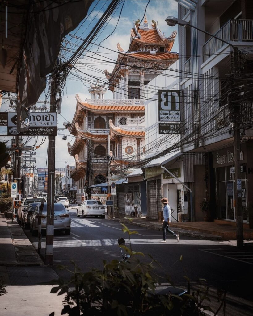

04Hat Yai
You’ll almost certainly pass through Hat Yai, and it’s worth a day. Its large Thai-Chinese community fills the downtown streets with shrines, gold shops, dim sum cafés and red lanterns, with temple towers rising between the shophouses and evening markets full of food stalls.
Go out at dawn, when the shrines open and breakfast shops are busy, or at dusk as the signs light up. Chinese New Year and the Vegetarian Festival bring processions. Dress modestly in shrines.
For the view over the city to Songkhla Lake, head up Kho Hong hill to the Municipal Park. A shuttle bus runs from the park entrance. The cable car is closed on Mondays and is sometimes out of service or stops selling tickets early, so don’t make it the point of the trip.
- Attraction Type
- City, Chinese temples and street life
- Location
- Open in Google Maps
- Cost
- Streets and shrines free; Hat Yai cable car foreigners 200 THB, Thais 100 THB
- Opening Hours
- Streets open access; Municipal Park daily, 05:00 to 21:00; cable car Tuesday to Sunday, 09:00 to 16:00, closed Mondays (check before you go)
- Best Time To Visit
- Dawn and dusk; Chinese New Year; Vegetarian Festival (ninth lunar month, usually October)
- How To Get There
- Hat Yai International Airport is about 12 km from the centre; get around by Grab, songthaew or tuk-tuk.
- What to Pack
- Modest clothing for shrines, small change for offerings

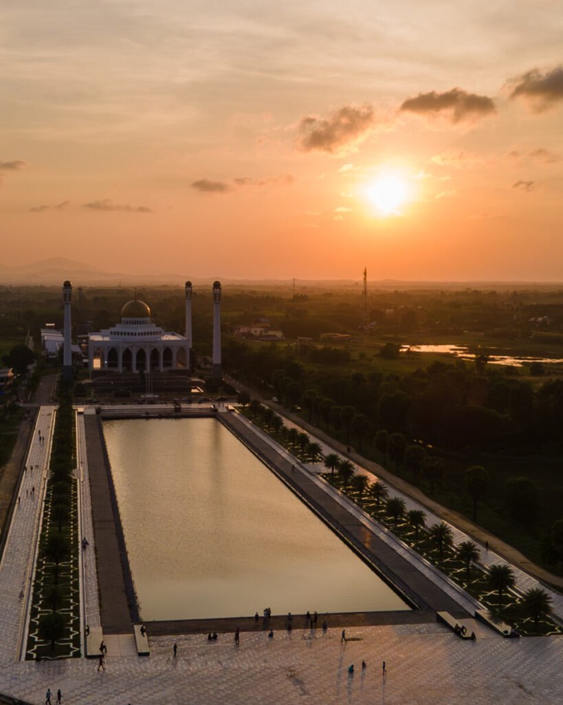


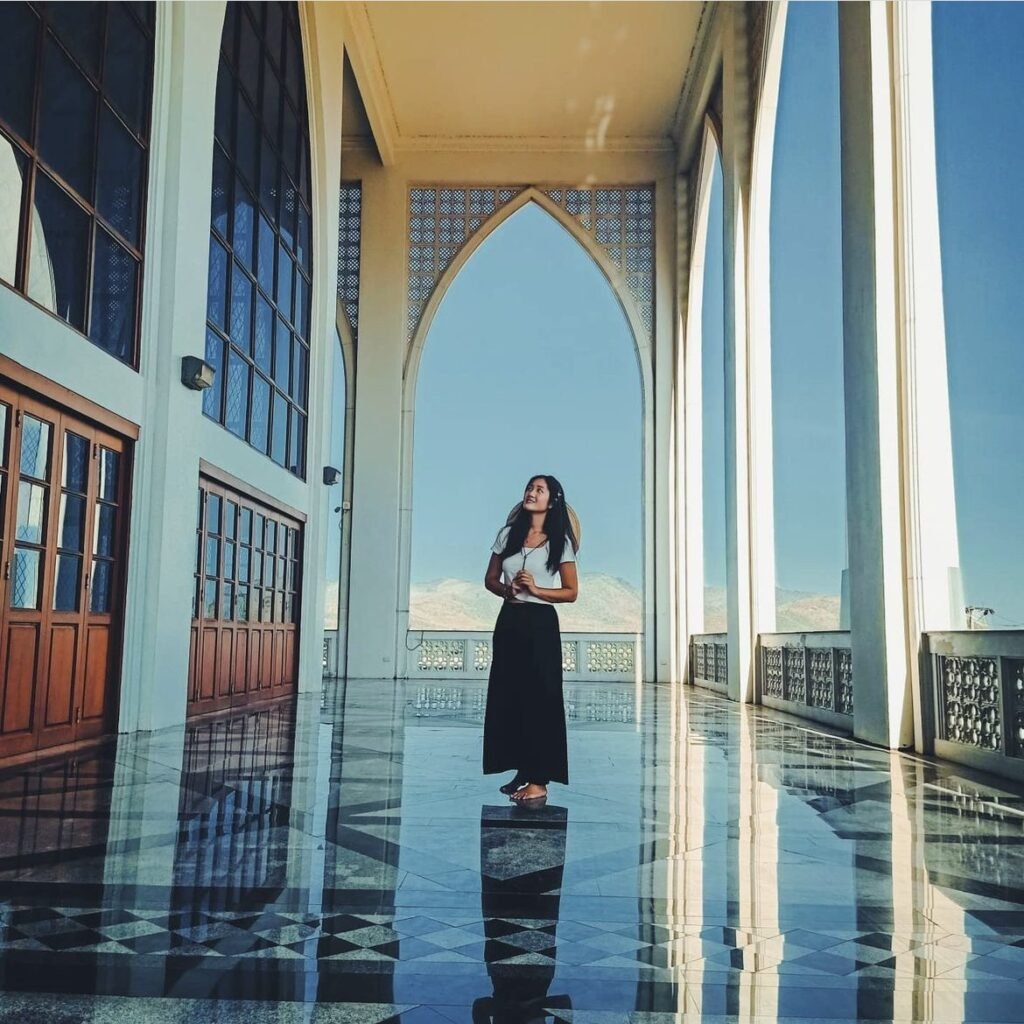
05Songkhla Central Mosque
A white building with a golden central dome, four slender minarets and a long reflecting pool, often compared with the Taj Mahal and one of the most photographed buildings in the south. It was completed around 2001 on Lopburi Ramesuan Road in Hat Yai.
Timing is everything: it’s closed to visitors on Fridays and during prayers, so come early or late on another day, when the light is soft and the pool is still. Cover shoulders and knees, and women should bring a headscarf for the prayer hall. Remove shoes on carpeted areas, keep your voice down, don’t photograph people praying, and ask before flying a drone.
- Attraction Type
- Mosque
- Location
- Open in Google Maps
- Cost
- Free
- Opening Hours
- Saturday to Thursday, 08:30 to 15:30; closed to visitors on Fridays and during prayers
- Best Time To Visit
- Early morning or late afternoon, outside prayer times; avoid Friday midday
- How To Get There
- A short Grab or tuk-tuk ride (about 15-20 minutes) from central Hat Yai, near Khlong Hae Floating Market.
- What to Pack
- Long trousers or long skirt, headscarf, socks


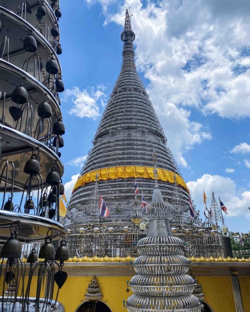
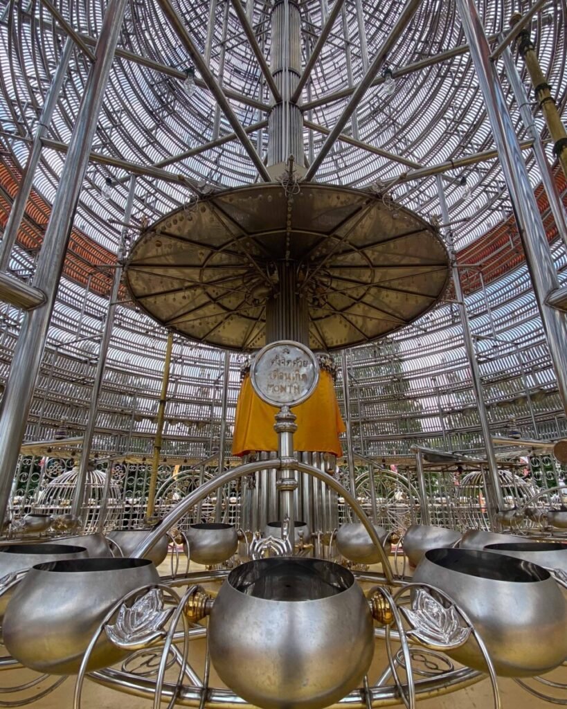
06Phra Maha Chedi Tripob Trimongkol
This hilltop chedi on Khao Kho Hong, on the eastern side of Hat Yai, is clad in stainless steel rather than the usual gold leaf or plaster, and is often described as the first of its kind in Thailand. Rows of small bells hang from the structure and ring in the wind. Circular rooms at the base represent the days of the week, and a spiral staircase leads to an upper level with wide views over the city. Shrines to Guanyin and Luang Pho To sit on the approach.
Come in the late afternoon for softer light on the steel, but leave before dark as the hill road is unlit. Midday from March to May is very hot underfoot. Allow 45 minutes to an hour. Entry is free. Cover shoulders and knees and take shoes off where asked. There is no bus, so use Grab, a taxi or a tuk-tuk and agree a waiting fee with the driver.
- Attraction Type
- Temple and viewpoint
- Location
- Open in Google Maps
- Cost
- Free (donations welcome)
- Opening Hours
- Daylight hours, no fixed closing time posted (check before you go)
- Best Time To Visit
- Late afternoon, about an hour before sunset; weekdays are quieter than weekends and Buddhist holy days
- How To Get There
- About 15 to 20 minutes by car, Grab or tuk-tuk from central Hat Yai; no public bus


07Hat Yai Municipal Park and Khao Kho Hong
Hat Yai’s municipal park covers the slopes and summit of Khao Kho Hong on the eastern side of the city, with lakes and lawns below and shrines on the hilltop. The 19.9-metre standing Buddha, Phra Phuttha Mongkol Maharaj, was put up in 1999 for King Bhumibol’s 72nd birthday and looks out over Hat Yai. Nearby are a large Guanyin statue in a Chinese shrine and a Brahma statue. The 525-metre cable car, billed as Thailand’s first, links the Buddha with the Brahma station.
Go early morning or late afternoon, when the hill is cooler and locals are out exercising. Allow two to three hours for the hilltop and the lower park. The cable car has had long maintenance closures in recent years, so confirm at the park before planning around it. A 20-baht tram also runs from the visitor centre to the summit; keep your ticket for the ride down. Dress modestly at the shrines.
- Attraction Type
- Park, viewpoint and religious statues
- Location
- Open in Google Maps
- Cost
- Park free. Cable car 200 baht foreign adults, 100 baht Thai adults, 100/50 baht children (check before you go). Tram 20 baht. Observatory 20 baht
- Opening Hours
- Park 06:00 to 20:00. Cable car Monday to Thursday 09:00 to 16:30, Friday to Sunday and public holidays 09:00 to 17:30 (check before you go)
- Best Time To Visit
- Early morning or late afternoon; December to April for the driest weather
- How To Get There
- About 15 minutes by Grab, taxi or songthaew from central Hat Yai; a shuttle songthaew runs within the park
Around the Province
Beyond the two cities, Songkhla has limestone hills, forest waterfalls and the rice country of Ranot near Thale Noi. You need your own transport for all of these. Liwong is in Chana district, which is covered by the travel advice in that entry.


08Khao Khuha
Khao Khuha is a former limestone quarry concession in Khuha Tai subdistrict, Rattaphum, where years of blasting left jagged grey pinnacles and sheer cut faces. It has since become a hiking and photo spot promoted by the Tourism Authority of Thailand. A path climbs from the foot of the hill to a summit viewpoint over the pinnacles and the surrounding plantations, and early in the morning low mist often fills the ground below.
Start before dawn if you want sunrise at the top. Bring a head torch, water and shoes with good grip, as the trail is steep and slippery in places, especially after rain. Facilities are minimal, so carry what you need and take rubbish home. Avoid hiking alone and tell someone your plans. Allow two to three hours including time on the summit. You need your own transport or a hired car from Hat Yai, roughly 30 km to the north-west.
- Attraction Type
- Viewpoint and hiking trail
- Location
- Open in Google Maps
- Cost
- No fee found in sources (check before you go)
- Opening Hours
- No posted hours (check before you go)
- Best Time To Visit
- Early morning for sunrise and mist; drier months for safer footing
- How To Get There
- Private car, motorbike or hired vehicle from Hat Yai; no public transport to the trailhead


09Ton Plio Waterfall
Ton Plio is a multi-tier waterfall in Kamphaeng Phet subdistrict, Rattaphum, inside the Ton Nga Chang Wildlife Sanctuary on the Banthat range. Its tiers fall about 50 metres in total through dense forest. The first tier is the easiest to reach and has a wide pool and a Buddha image; the second, Ton Sai Rung, is about 300 metres further up a steep trail. It is smaller and quieter than the better-known Ton Nga Chang Waterfall nearby.
Flow is strongest in the wetter months, but stay out of the water after heavy rain, when levels can rise fast. Rocks are slippery, there are no lifeguards and few facilities, so bring water, food and shoes with grip. The upper tiers are on rough, overgrown paths for confident hikers only. Allow two to three hours. From Hat Yai, take Highway 4 towards Rattaphum, pass the Ton Nga Chang turn-off, continue about 8.4 km, turn right at the plant research centre and follow the local road for about 7 km.
- Attraction Type
- Waterfall
- Location
- Open in Google Maps
- Cost
- No fee found in sources (check before you go)
- Opening Hours
- 07:00 to 18:00 (check before you go)
- Best Time To Visit
- Morning; wetter months for stronger flow, avoiding days after heavy storms
- How To Get There
- Own car or hired vehicle from Hat Yai via Highway 4 towards Rattaphum (about 45 minutes); last 7 km on a narrow rural road
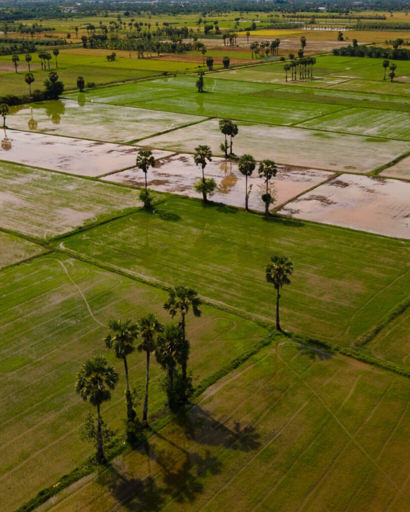

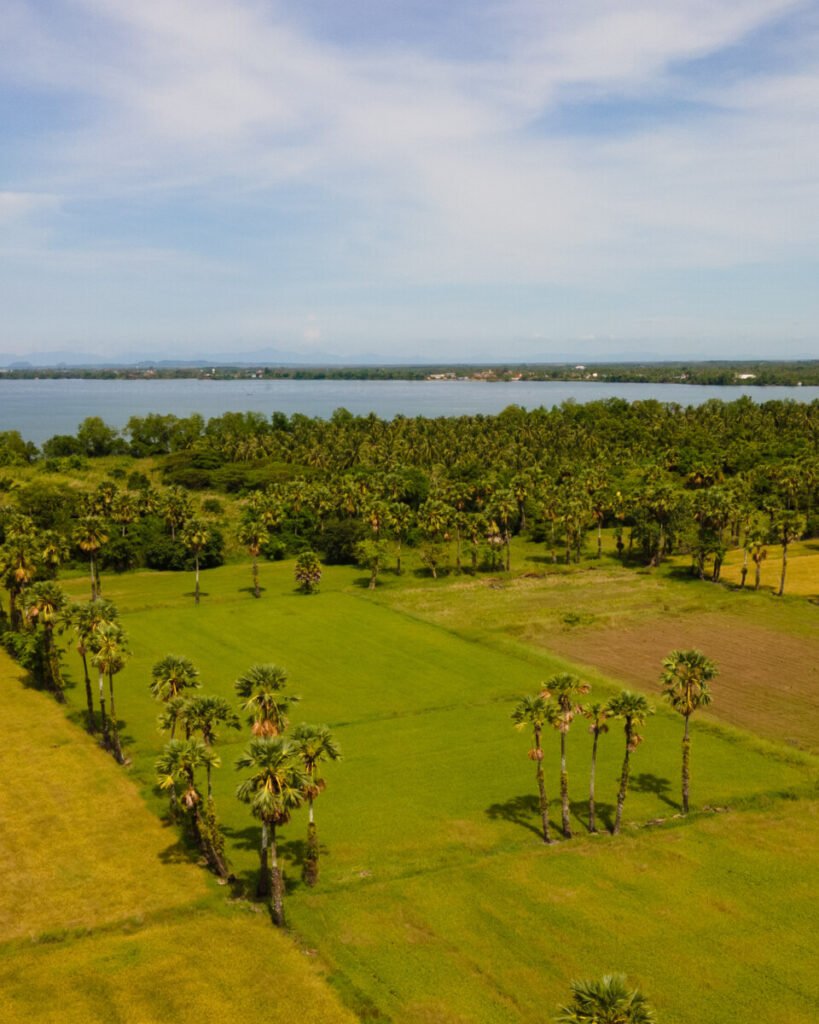
10Ranot Rice Fields and Sugar Palms
Ranot, Songkhla’s northernmost district, is a flat plain of paddy fields between the northern end of the Songkhla Lake basin and the Gulf of Thailand. The fields are dotted with tall sugar palms (tanot), which farmers still climb to tap sap for palm sugar, a local speciality. From the air, the dykes, water channels and lines of palms form strong patterns, and the fields turn from bright green after planting to gold before harvest.
Go at sunrise or late afternoon, when the palms throw long shadows. There is no single ticketed viewpoint, so drive the minor roads west of Ranot town towards the lake and stop where it is safe. Stay on public roads and dyke tracks, and ask before walking into fields or flying a drone near homes. Community groups run palm sugar and cooking activities, and the Ranot canal floating market opens in the evening. Combine with the 5.5 km bridge across to Thale Noi.
- Attraction Type
- Rural landscape
- Location
- Open in Google Maps
- Cost
- Free
- Opening Hours
- Open access
- Best Time To Visit
- Sunrise or late afternoon; field colour depends on the planting cycle (check locally)
- How To Get There
- Own transport; about 2 hours north of Hat Yai by car, or 30 minutes from Thale Noi over the Chaloem Phrakiat bridge (check before you go)


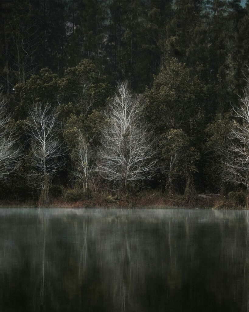

11Liwong Tin Mine Lake
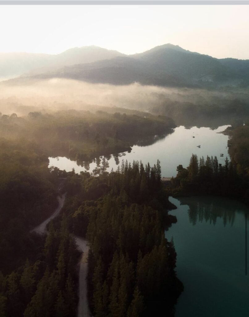
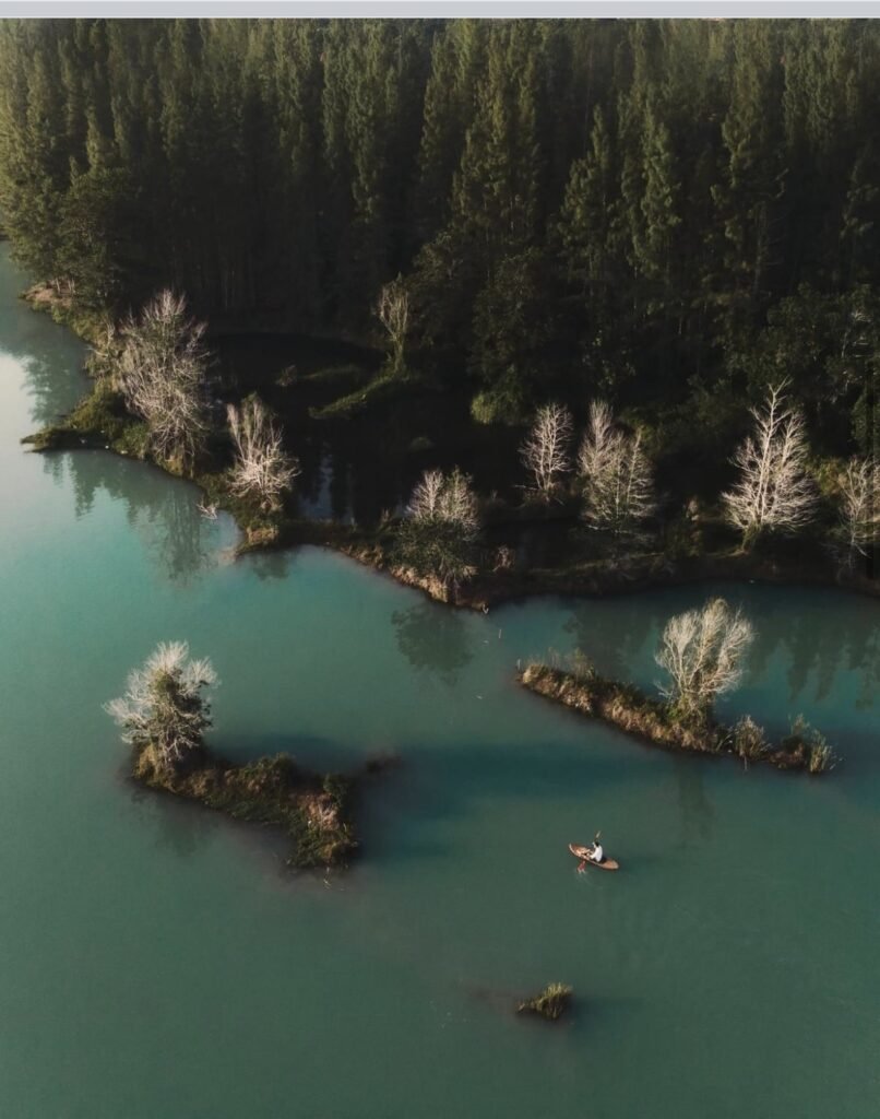
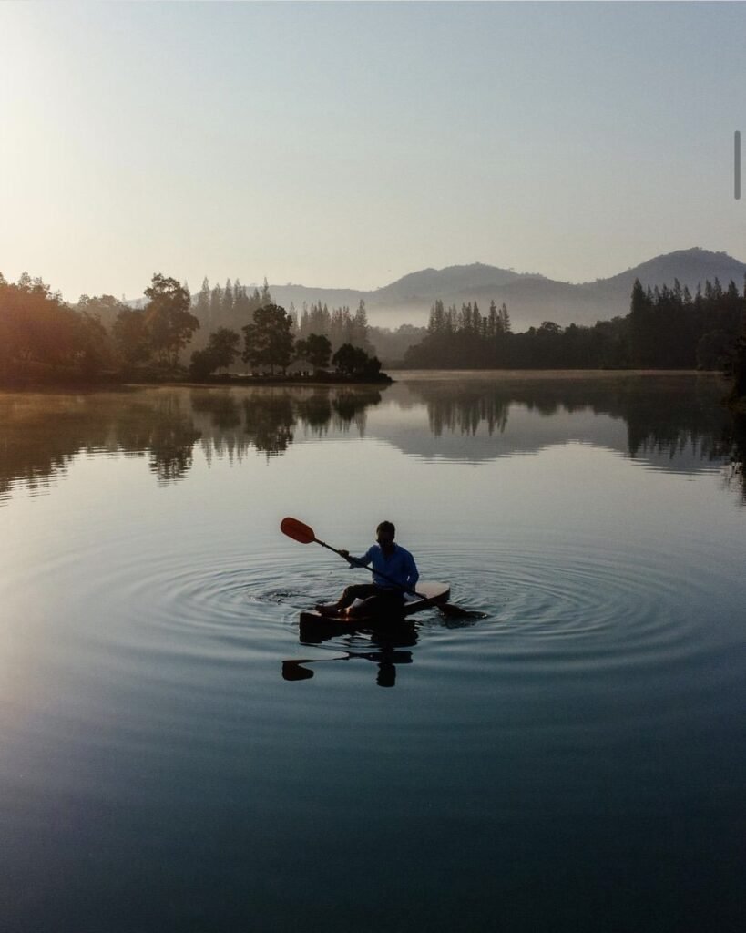
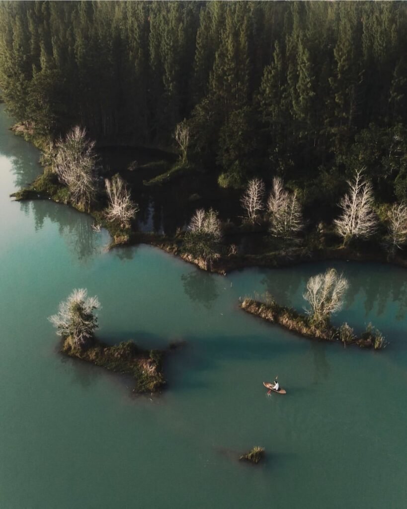
Liwong (also spelt Livong) is a tin mine more than a century old at Ban Liwong, Tha Mo Sai, in Chana district. The flooded pit is now a still lake ringed by pines and grassy banks, with dead trunks standing in the water and green hills behind, a scene locals call the Switzerland of Chana.
Chana is one of the four Songkhla districts under UK advice against all but essential travel, so check your government’s guidance and your insurance first.
If you do go, timing matters. Mist lies on the water between 06:30 and 08:30, though the listed opening time is 07:00, so ask locally about early access; otherwise come after 16:00 for warm side light. Facilities are basic, just a small coffee stall. Hire a car with a driver from Hat Yai.
- Attraction Type
- Former tin mine lake, viewpoint
- Location
- Open in Google Maps
- Cost
- Adults 50 THB, children 20 THB (community fee; check before you go)
- Opening Hours
- 07:00-19:00 (check before you go)
- Best Time To Visit
- Early morning for mist (06:30 to 08:30; ask about access before the 07:00 opening); late afternoon to sunset
- How To Get There
- About 15 minutes by road from Chana town, via the Chana-Na Thawi road or the road behind Chana railway station. Chana is roughly 40 km east of Hat Yai; hire a car with driver.
- What to Pack
- Tripod, insect repellent