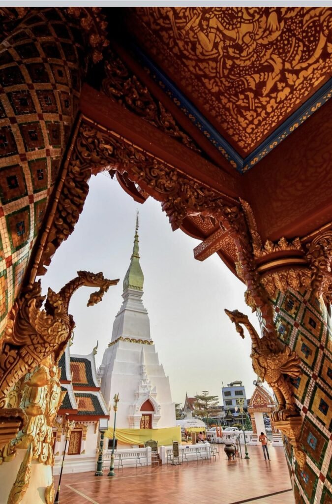
Thailand's viewpoints change character from region to region. In the north you look over ridge after forested ridge towards Laos or Myanmar, and the best of it often means a night at the top. Closer to Bangkok and along the east coast the views are of reservoirs, coast roads and the capital itself. Isaan's sandstone ridges look out over forest, reservoirs and the Mekong, and in the south short, steep climbs lead to views over turquoise bays, sandbars and limestone towers. For first and last light, see our Sunrises and Sunsets guides too.
Choose by effort. Some you can drive straight to: Noen Nang Phaya's coast road, the Sky Road in Nan, the 1715 viewpoint at Doi Phu Kha and Pattaya Viewpoint. At Mahanakhon, the Twin Pagodas, Lam Takhong, the Chiang Khan Skywalk and Doi Pha Phueng, a lift, shuttle or pickup does the climbing. Short, steep climbs of an hour or less take you up John-Suwan, Chado Cliff on Koh Adang, Black Rock and Khao Daeng, and short but steep stairs lead to the top of Pha Daeng in Lom Sak. Monlong, Dragon Crest and Khao Laem on Koh Chang are hikes of several hours, and Phu Kradueng and Doi Mon Jong are overnight expeditions. Doi Sa Ngo, Doi Chang, Doi Kham Fah, Ban Mae Tho and the Buak Chan fire tower also reward a night nearby, while a few work only in a short window: Khao Lom Muak, which opens only on selected long holiday weekends, Phu Lom Lo's cherry blossom, Doi Phu Kha's pink blossom from February to mid-March, and the Pa Sak Jolasid floating train from about November to February.
The cool season from November to February brings the clearest skies in the north and the morning mist that fills valleys there and in Isaan. From February to April, smoke from crop burning can leave the northern views hazy. In the south, the best visibility comes between December and April. Several mountain parks close in the rains: Doi Phu Kha and Phu Kradueng from 1 June to 30 September, and the Kew Mae Pan trail on Doi Inthanon from 1 June to 31 October. Doi Mon Jong's treks run only from roughly November to mid-February, and the road to Doi Kham Fah shuts in rain. Many viewpoints sit inside national parks, which charge an entry fee, and some private viewpoints charge a small fee or ask you to buy a drink. Drones are banned in national parks without a permit. Carry water, wear proper shoes on trails, and start hikes early to avoid the midday heat.
How we chose these spots. We only include viewpoints our creators have photographed, so this isn't every high place in Thailand. Each one links to its full province guide, where fees, hours and directions live. Closed spots are kept and marked: Mae Wong National Park has been shut since October 2026, and Hollow Mountain is now listed as permanently closed. The Aiyoeweng Skywalk near Betong is in Yala, which is covered by UK advice against all but essential travel.
Good to know
- Tourist Police: 1155
- Emergency (ambulance): 1669
Northern Thailand
The north’s viewpoints look out over ridge after forested ridge, often towards Laos or Myanmar, and several, including Doi Sa Ngo, Doi Chang and Phu Kradueng, are best with a night at the top. Come between November and February: Doi Phu Kha, Phu Kradueng and the Kew Mae Pan trail close for the rains, and Mae Wong is closed until further notice.


01Doi Sa Ngo
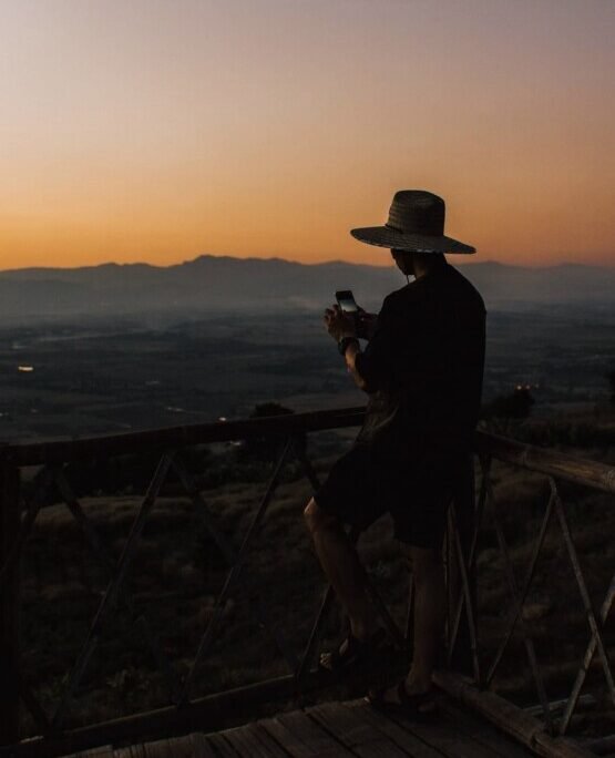
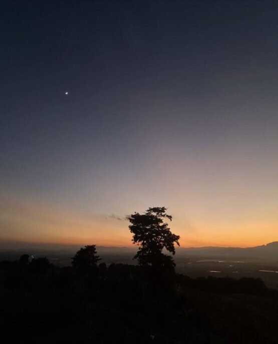
Sunrise and sunset both play out over this Chiang Rai ridge, so it rewards a night at the top more than a quick visit, in simple huts, bungalows or tents. A long bamboo walkway looks out over Myanmar and Laos. The road up is steep and rough in places, and not one to attempt in the rain.
More in our Chiang Rai guide.
- Attraction Type
- Viewpoint
- Location
- Open in Google Maps
- Cost
- Varies
- Best Time To Visit
- Sunrise



02Doi Chang Mub
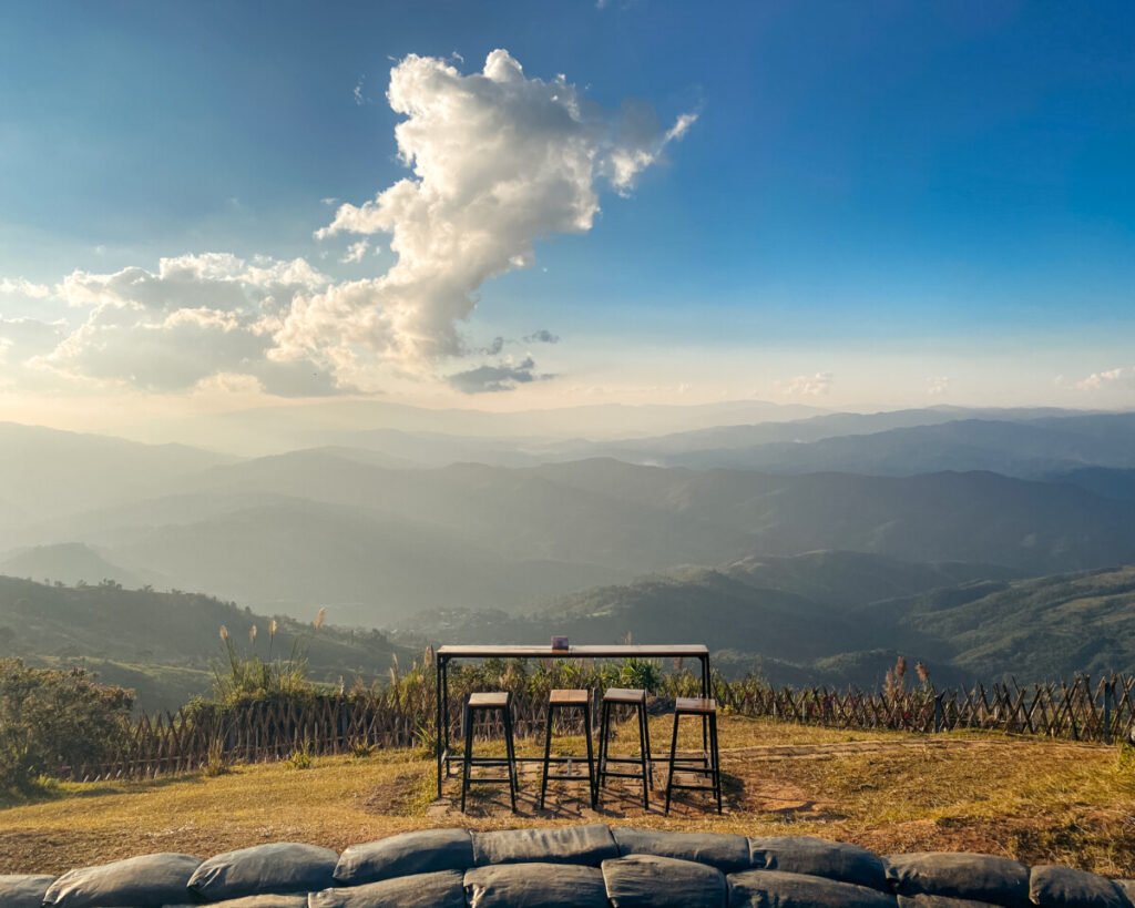
This one doubles as a military outpost on the Myanmar border, and visitors are welcome to come in, take photos and have a coffee over the valley. Aim for sunset, when the sun drops behind the Myanmar hills, but watch the clock: it closes at 6pm.
More in our Chiang Rai guide.
- Attraction Type
- Viewpoint
- Location
- Open in Google Maps
- Cost
- Free
- Best Time To Visit
- Sunset
- Opening Hours
- 6am – 6pm



03Road 3 and the Sky Road
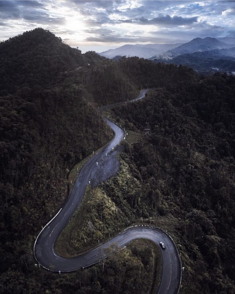
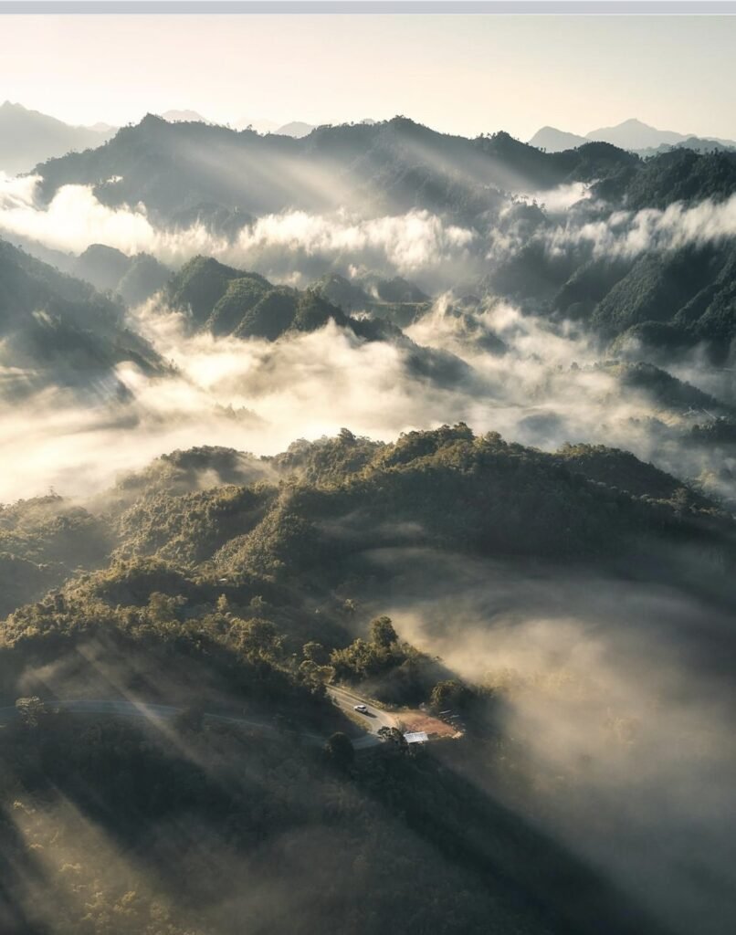
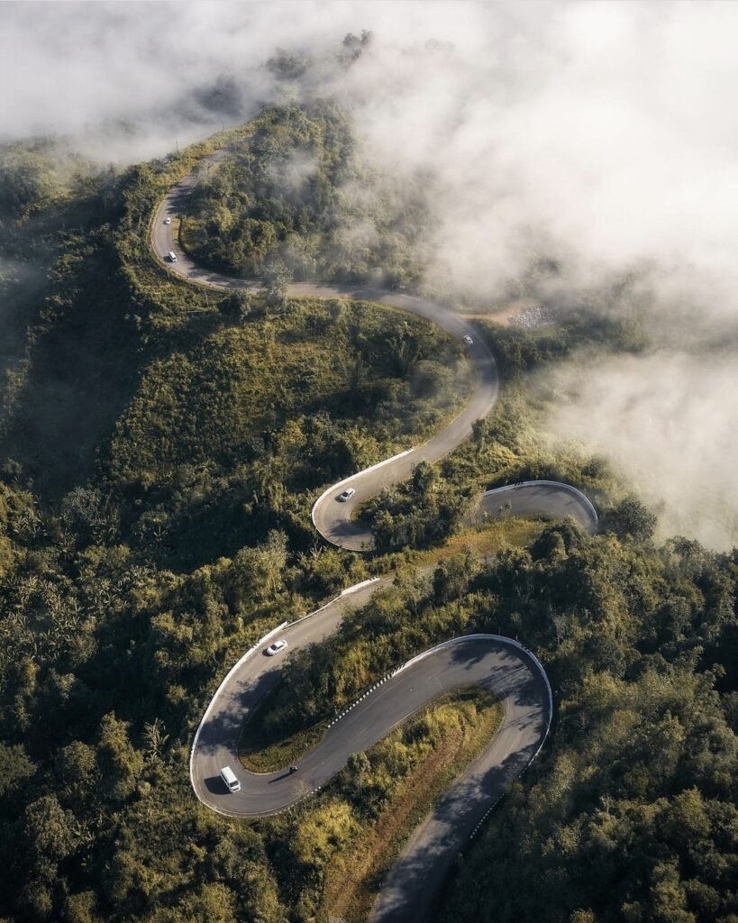
Here the viewpoint is the drive. Highway 1081 between Santi Suk and Bo Kluea follows the ridges, often above the clouds, and photographers gather at sunrise above the hairpins that trace a number 3. The road is steep, narrow and relentlessly winding, so stop only at the designated parking areas, and check conditions first: some sections have been on temporary repairs since the August 2026 floods.
More in our Nan guide.
- Attraction Type
- Scenic Road / Viewpoint
- Location
- Open in Google Maps
- Cost
- Free
- Best Time To Visit
- Sunrise, November – February
- How To Get There
- Highway 1081 from Santi Suk towards Bo Kluea
- What to Pack
- Motion sickness tablets / Jacket
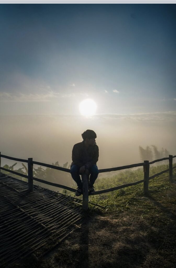

04Yun Lai Viewpoint
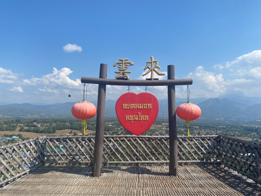
A low-effort option around Pai: easy to reach, close to Santichon Village, and with a café at the top so you can wait with a drink. It works at either end of the day, sunrise for mist in the valley and sunset for the light.
More in our Mae Hong Son guide.
- Attraction Type
- Viewpoint
- Location
- Open in Google Maps
- Cost
- 20 THB per person
- Best Time To Visit
- Sunrise or sunset
- Number
- +66 81 024 3982
- Opening Hours
- Daily, 05:00 to 20:00
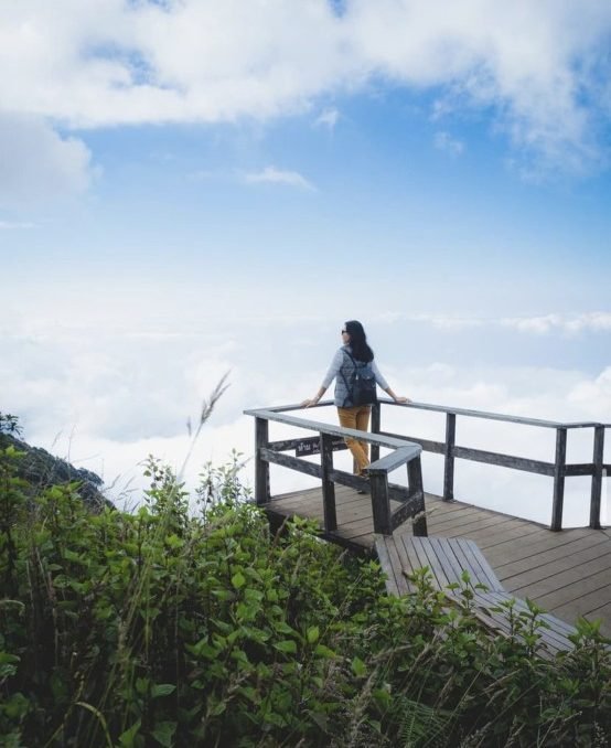


05Kew Mae Pan
For a view on Doi Inthanon that you walk to rather than drive to, this is the trail. It is relatively easy, two to three hours through forest and past Mae Pan waterfall to an observation deck, with the Twin Pagodas in sight along the way. A local guide is compulsory, and the trail is only open from 1 November to 31 May, so plan it for the dry season.
More in our Chiang Mai guide.
- Attraction Type
- Trail / Viewpoint
- Location
- Open in Google Maps
- Cost
- 300 THB for foreign adults (national park), plus about 200 to 220 THB per group for the compulsory guide
- Best Time To Visit
- Morning / Sunrise
- Opening Hours
- 6am – 4pm (Dry Season)
- Number
- +66 53 286 728
- How To Get There
- Drive / Tour
- Area
- Doi Inthanon National Park
- What To Pack
- Hiking shoes, warm layers, snacks
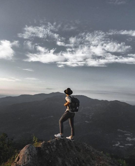
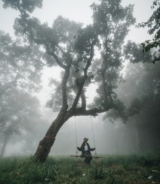
06Monlong Peak
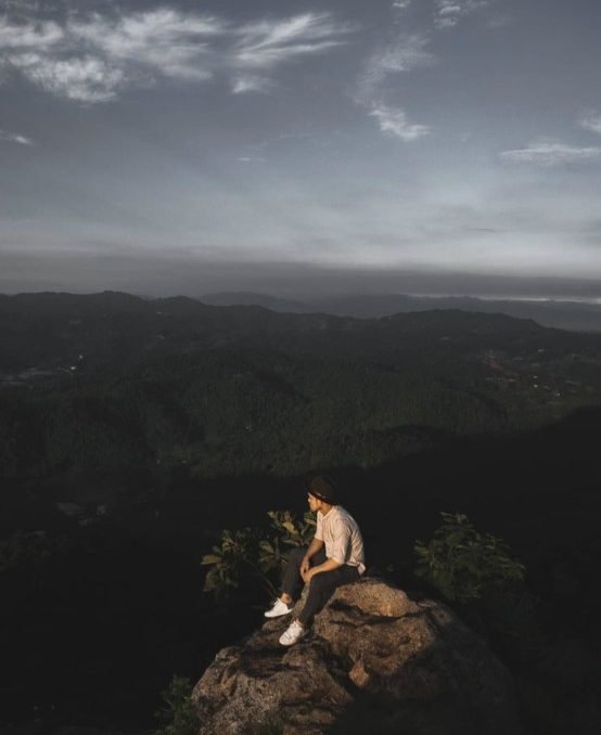
Choose Monlong for the climb as much as the view. The 6 km uphill trail can take even fit walkers 3 to 4.5 hours, signposts are few, and the rainy season makes it harder still. If you can, camp at the top and stay for sunrise.
More in our Chiang Mai guide.
- Attraction Type
- Hike / Viewpoint
- Location
- Open in Google Maps
- Cost
- Free
- Best Time To Visit
- Morning / Camping
- Number
- +66 53 892 745
- Website
- Website
- How To Get There
- Drive / Taxi
- What To Pack
- Hiking Shoes / Food / Water


07The Twin Pagodas, Doi Inthanon
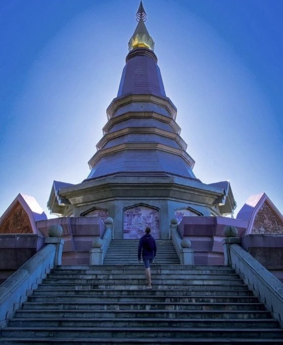
No hiking needed: a shuttle runs up from the ticket gate and escalators help with the climb, though not every section is always running. The pagodas, built for the late King and Queen’s 60th birthdays, stand among landscaped gardens. The weather decides this one. On a clear day the mountain views carry it; on a cloudy one you mainly get the gardens.
More in our Chiang Mai guide.
- Attraction Type
- Pagodas / Viewpoint
- Location
- Open in Google Maps
- Cost
- 300 (National Park) + 100 (Entrance Fee) + 10/20 (Parking)
- Best Time To Visit
- Morning / Afternoon
- Opening Hours
- Daily, 08:00 to 17:00
- Number
- +66 80 924 5459
- How To Get There
- Drive / Tour / Taxi
- Area
- Doi Inthanon National Park


08Pha Singh Leaw
If Pha Chor’s eroded rock formations appeal but the crowds don’t, this is the bigger, free version. The catch is distance: it’s in Hot district, 2 hours south of Chiang Mai, so it suits people already heading to Op Luang National Park. Once you’re there, a narrow lane runs almost to the viewpoints and there is very little walking.
More in our Chiang Mai guide.
- Attraction Type
- Viewpoint / Trail
- Location
- Open in Google Maps
- Cost
- Free
- Best Time To Visit
- Morning / Afternoon
- How To Get There
- Drive / Taxi



09Phu Kradueng
An overnight expedition rather than a viewpoint stop. A steep 5.5 km hike leads up to the flat top, then 3.6 km across pine forest and meadows to the cliff edges, and staying over gets you sunset at Pha Lom Sak and sunrise at Pha Nok Aen. Go between November and February, with red maple leaves from late November to early December. The park closes from 1 June to 30 September, and facilities on top are basic.
More in our Loei guide.
- Attraction Type
- National park and hike
- Location
- Open in Google Maps
- Cost
- 200 THB for foreign adults, 40 THB for Thai adults; porters charged per kilo
- Best Time To Visit
- November to February; red maple leaves late November to early December
- Opening Hours
- 1 October to 31 May; ascents daily, 06:00 to 12:00, descents must start by 13:00
- Number
- 042 810 833
- How To Get There
- Bus from Bangkok towards Loei to Pha Nok Khao, then a songthaew to the park
- What to Pack
- Warm layers, a head torch and light luggage



10Doi Chang Viewpoint
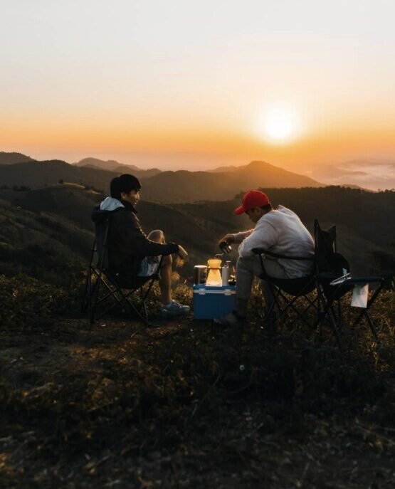
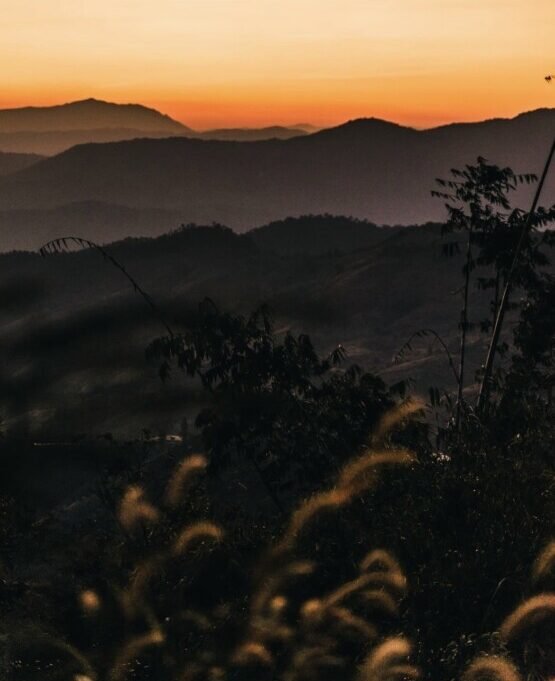
Easy to reach by car or motorbike, Doi Chang is about sunsets over hills and coffee plantations that run as far as you can see. With glamping, camping and cafés at the top, it is better as a night for the stars than a sunset-and-back trip. November to February brings mild weather and clear skies; bring warm clothes.
More in our Chiang Rai guide.
- Attraction Type
- Viewpoint
- Location
- Open in Google Maps
- Cost
- Free
- Best Time To Visit
- Sunset
- What to Pack
- Warm clothes


11Doi Bo Viewpoint
There is a place to pitch a tent at the top, which is how you see the mist rise from the valley at sunrise. Getting up is the hard part. The last stretch is badly eroded and steep: a 4-wheel drive or hiking up are the safe options, only confident riders should try it on a scooter or motorbike, and nobody should after rain.
More in our Chiang Rai guide.
- Attraction Type
- Viewpoint
- Location
- Open in Google Maps
- Cost
- Free
- Best Time To Visit
- Morning
- What to Pack
- Water


12Khun Nan National Park
From the Huai Ti ranger station, the view runs over ridge after forested ridge towards Laos and down into the Sapan valley. Expect some effort to get there: the track of about 2 km to the viewpoint is rough, can be muddy, and low cars struggle. Aim for sunrise between November and February.
More in our Nan guide.
- Attraction Type
- National Park / Viewpoint
- Location
- Open in Google Maps
- Cost
- ฿20 Thai / ฿100 foreign adults
- Best Time To Visit
- Sunrise, November – February
- Opening Hours
- Daily, 08:30 to 16:30
- How To Get There
- Near Bo Kluea, via Highway 1081 or 1256



13Doi Phu Kha National Park
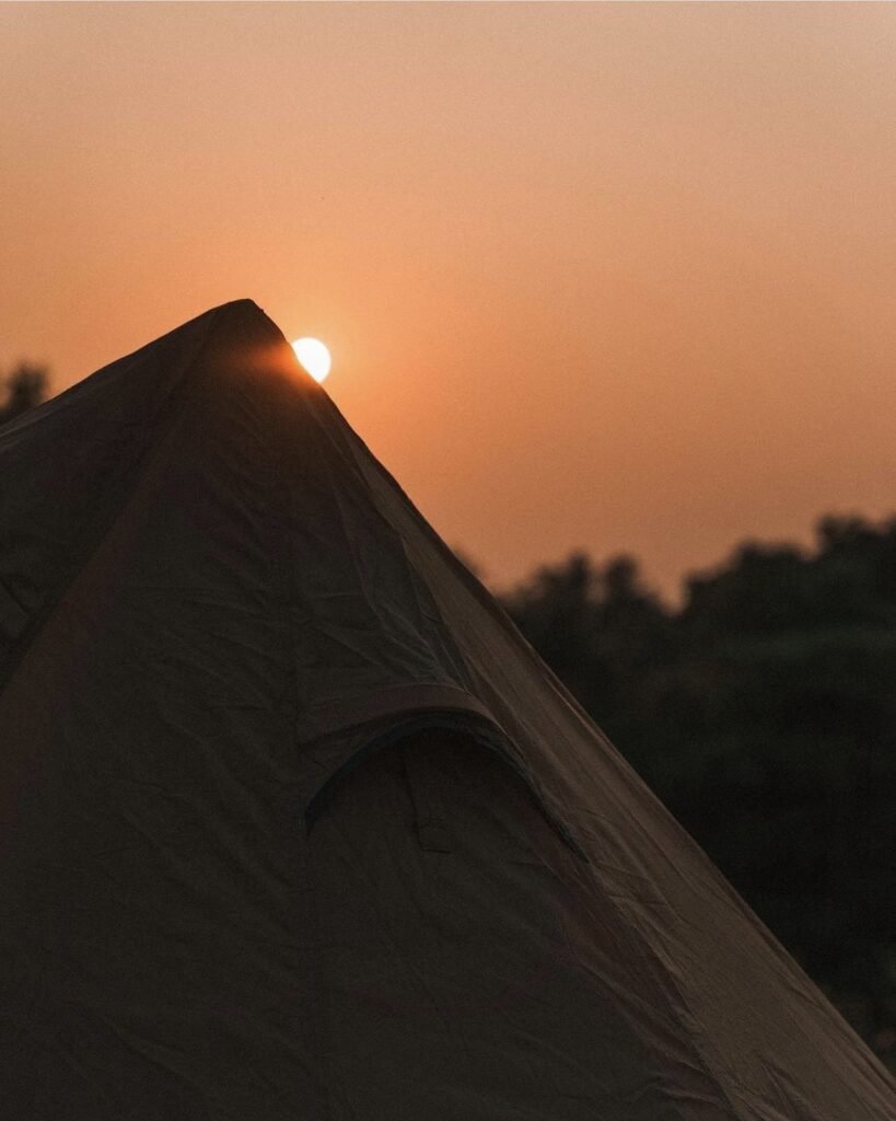
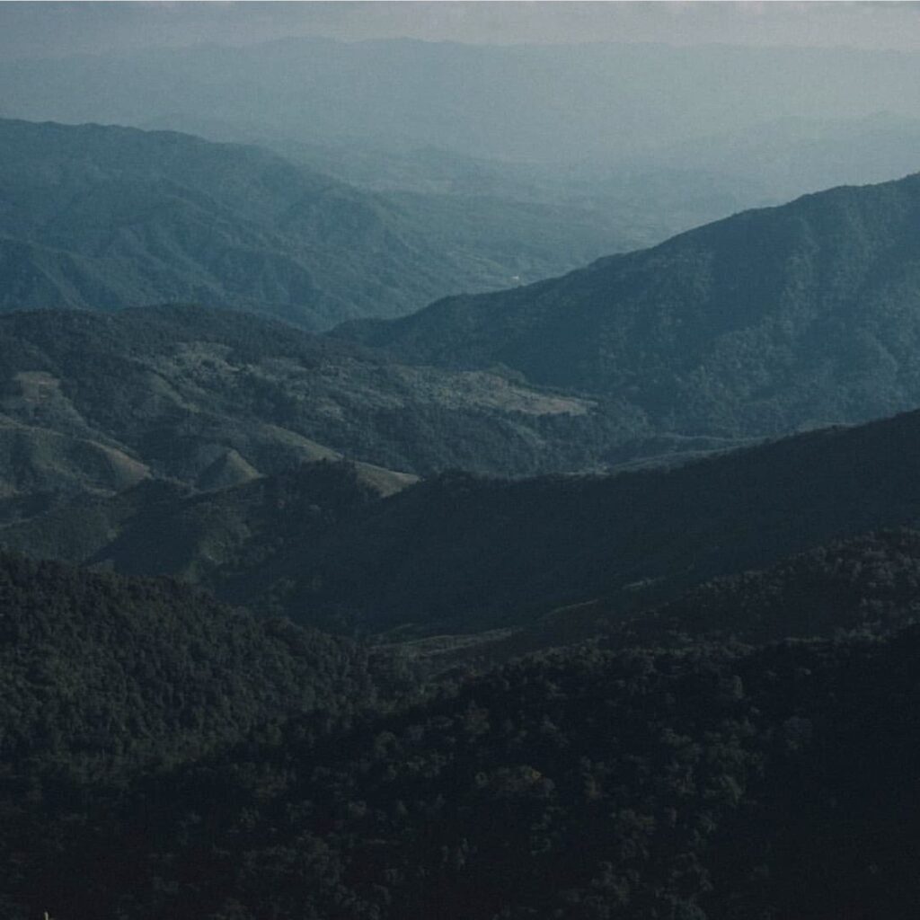
A roadside view: the 1715 viewpoint is the highest point of Highway 1256 as it crosses the park, used for sunrise or sunset, with a short trail on to a campsite. From February to mid-March, look out for the pink blossom of the rare Chomphu Phu Kha tree. The park shuts every year from 1 June to 30 September.
More in our Nan guide.
- Attraction Type
- National Park / Viewpoint
- Location
- Open in Google Maps
- Cost
- ฿40 Thai / ฿200 foreign adults, plus vehicle fee
- Best Time To Visit
- October – February; February – March for the blossom
- Opening Hours
- Visitor centre daily, 08:00 to 16:30; closed 1 June to 30 September
- Number
- 082 194 1349
- How To Get There
- About 24 km from Pua on Highway 1256
- What to Pack
- Warm layers / Tent if camping
14Phu Lom Lo
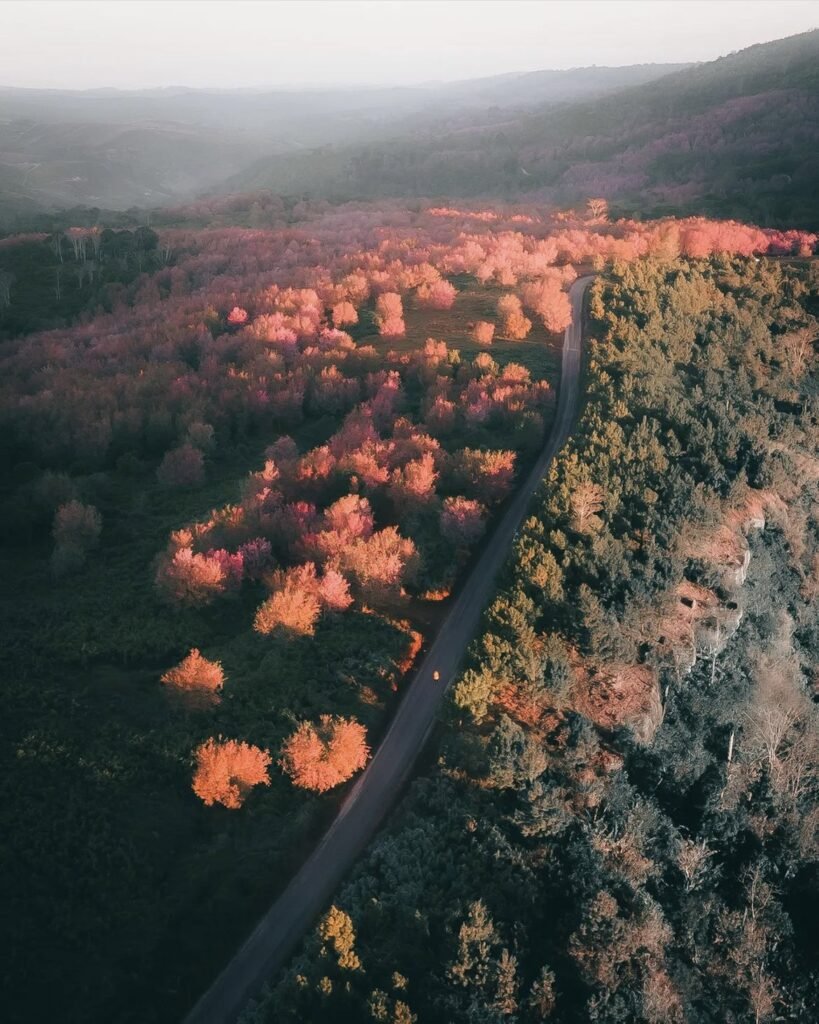
Timing is everything here. Usually from late December into January the hills turn pink with wild Himalayan cherry, but the full bloom lasts only a week or so, so check conditions before you travel. Private cars are banned during the bloom, the community truck ride up is very rough, and there is nothing to buy at the top.
More in our Loei guide.
- Attraction Type
- Cherry blossom viewpoint
- Location
- Open in Google Maps
- Cost
- 200 THB for foreign adults, 40 THB for Thai adults (Phu Hin Rong Kla National Park), plus about 1,500 THB per shared truck (check before you go)
- Best Time To Visit
- Late December to January
- Opening Hours
- Trucks daily, about 05:00 to 16:00 during the season
- Number
- 081 596 5977
- How To Get There
- Community trucks from Kok Sathon (Dan Sai) or Ban Rong Kla
- What to Pack
- Warm clothes, water and snacks



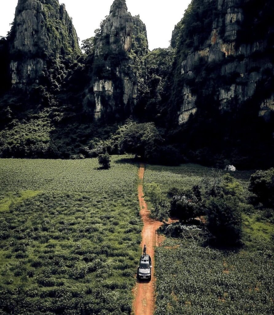
15Ban Mung Limestone Hills
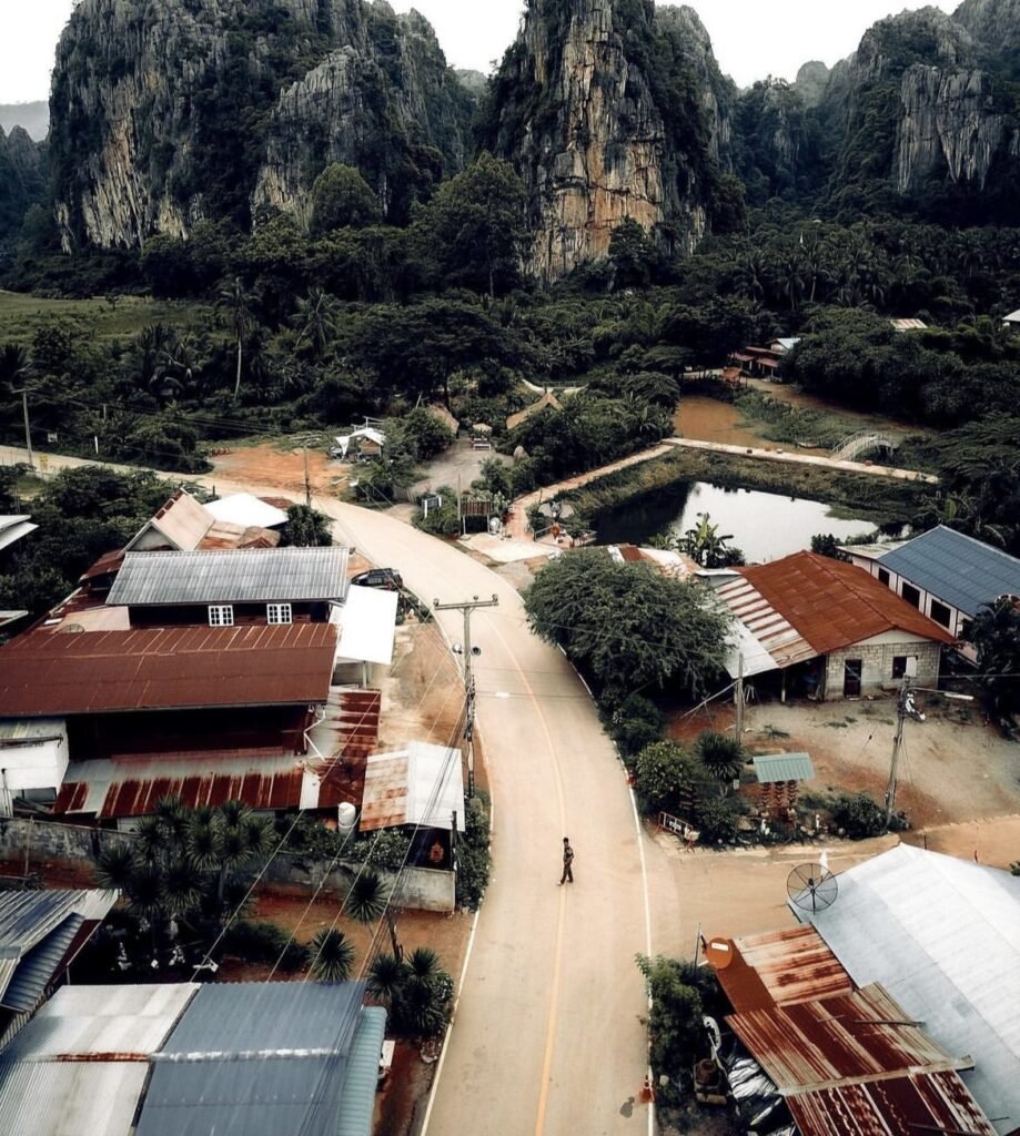
Plan for both ends of the day. At dawn the mist lifts off the rice fields around the limestone hills and local guides lead scrambles up the karst peaks for the view; at dusk, huge numbers of bats stream out of the caves near the village. The climbs need a guide and grippy shoes.
More in our Phitsanulok guide.
- Attraction Type
- Limestone hills and viewpoints
- Location
- Open in Google Maps
- Cost
- Free
- Best Time To Visit
- November to February, at sunrise
- How To Get There
- Drive from Phitsanulok to Noen Maprang district
- What to Pack
- Grippy shoes and a local guide for the climbs
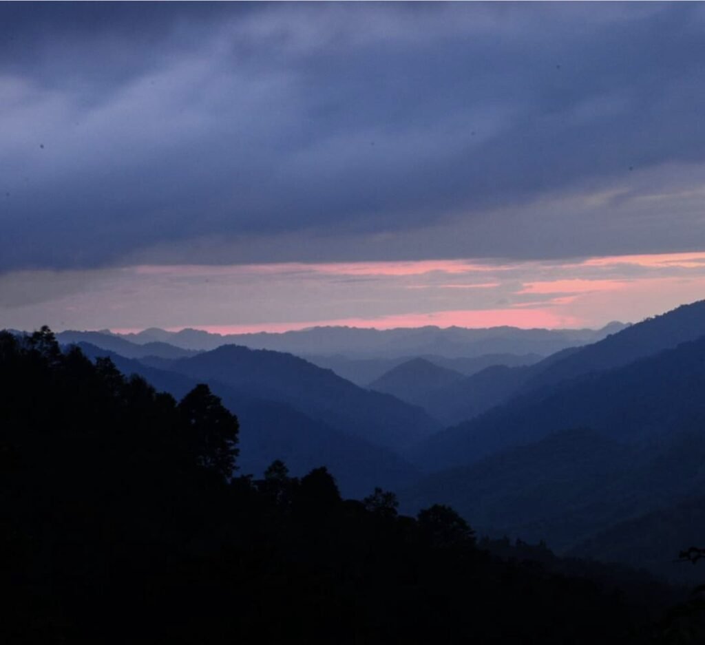

16Mae Wong National Park
Closed: the park shut on 2 October 2026 after flash floods and landslides damaged roads and accommodation, and no reopening date has been announced. Don’t plan a visit until it reopens. Its draw is Chong Yen, at about 1,420 metres the highest point you can drive to, where a viewpoint looks out over layer after layer of misty ridges.
More in our Lower North guide.
- Attraction Type
- National park, mountain viewpoint
- Location
- Open in Google Maps
- Cost
- Foreigners 200 THB, Thais 40 THB (national park fee)
- Opening Hours
- Closed until further notice since 2 October 2026; normally open daily, with seasonal closures in the rains
- Best Time To Visit
- November-February, sunrise for mist
- How To Get There
- About 70 km from Kamphaeng Phet town to park headquarters via Khlong Lan; Chong Yen is a further 27.5 km on the steep park road. No public transport into the park
- What to Pack
- Warm jacket, head torch, camping gear if staying overnight, a telephoto for layered ridges


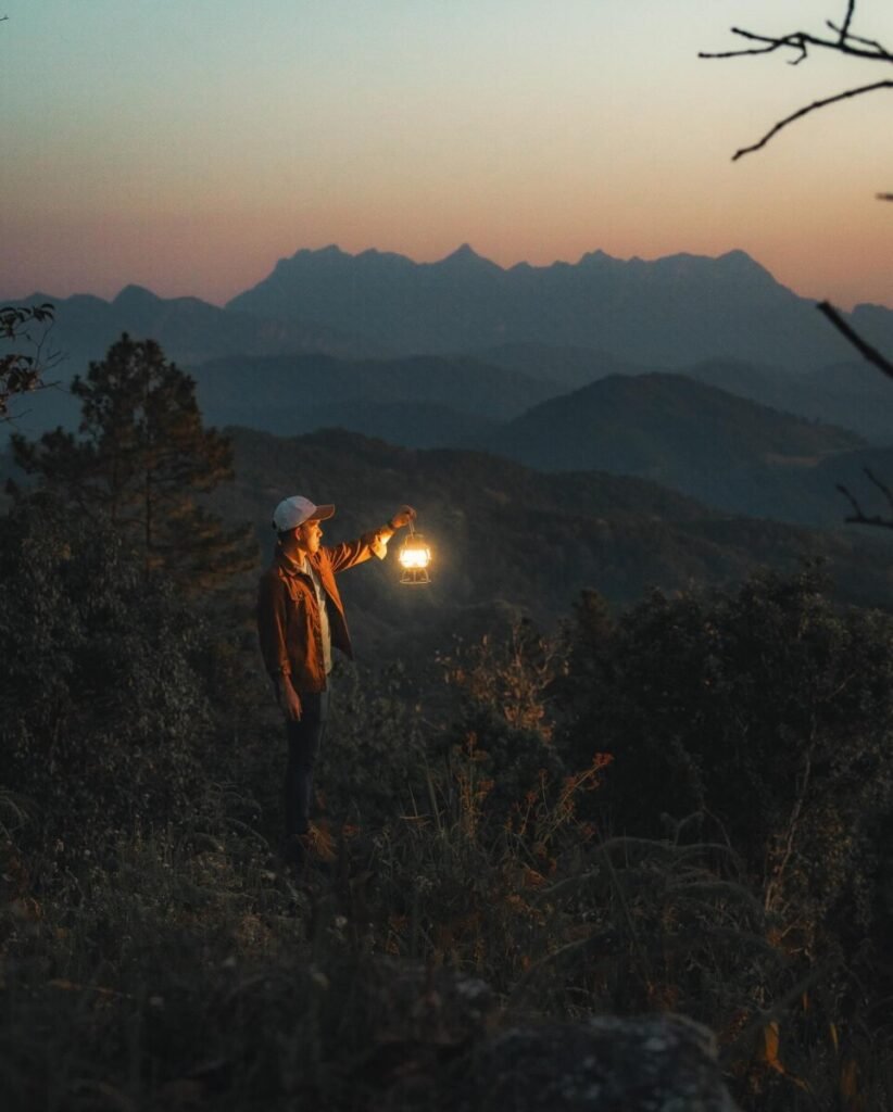
17Doi Kham Fah
At 1,834 metres, Doi Kham Fah looks across layered ridges towards Doi Luang Chiang Dao, with a sunset viewpoint on the way up and a sea of mist on many mornings. It suits people prepared to plan: access is controlled, the final 8 km is by 4×4 and the hike needs a park guide, so contact the Mae Ngai watershed unit before every visit. Treat it as a dry-season trip, as the road shuts in rain, and come in mid-January for the wild Himalayan cherry in flower.
More in our Chiang Mai guide.
- Attraction Type
- Viewpoint and mountain camping
- Location
- Open in Google Maps
- Cost
- 4×4 transfer about 1,200 THB per vehicle, guide 600 THB, camping 200 THB per person (2023 figures, check before you go)
- Opening Hours
- Listed 07:00 to 18:00; advance permission required for every visit (check before you go)
- Best Time To Visit
- November to February in dry weather; mid-January for cherry blossom
- How To Get There
- From Chiang Dao take the road towards Wiang Haeng (Route 1322) about 30 km to the signed turn near the Huai Nam Kat bridge (around km 26 to 27), then about 8 km by 4×4 to the top. Call ahead: 081 992 7346 or 053 046 370.


18Ban Mae Tho
Here the view is a whole landscape rather than one platform: open ridge country around Hmong and Karen villages, with big lone trees and viewpoints such as Doi Mae Tho and Pha Bo Lek over layered mountains. It is not a day trip, and the last stretch on Route 1270 is partly gravel that gets hard going in the rains, so a 4×4 or local pickup makes sense. Come in the cool, dry months for morning mist, and ask villagers before photographing them or their ceremonies.
More in our Chiang Mai guide.
- Attraction Type
- Village and mountain viewpoints
- Location
- Open in Google Maps
- Cost
- No entry fee listed; Royal Project guesthouse, camping and meals extra (check before you go)
- Opening Hours
- Royal Project centre about 08:30 to 16:30; arrange visits in advance (check before you go)
- Best Time To Visit
- November to February for cool weather and morning mist; January for Hmong New Year
- How To Get There
- From Chiang Mai take Route 108 to Hot (about 89 km), continue on Route 108 towards Mae Sariang for about 55 km to the Ban Kong Loi junction, then turn right onto Route 1270 for about 16 km. The final stretch is partly unpaved; use a 4×4 or local pickup in the wet season.
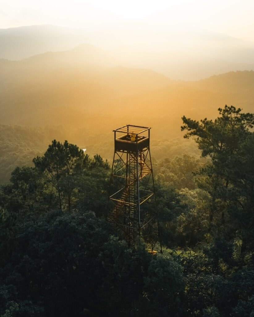


19Buak Chan Fire Lookout Tower
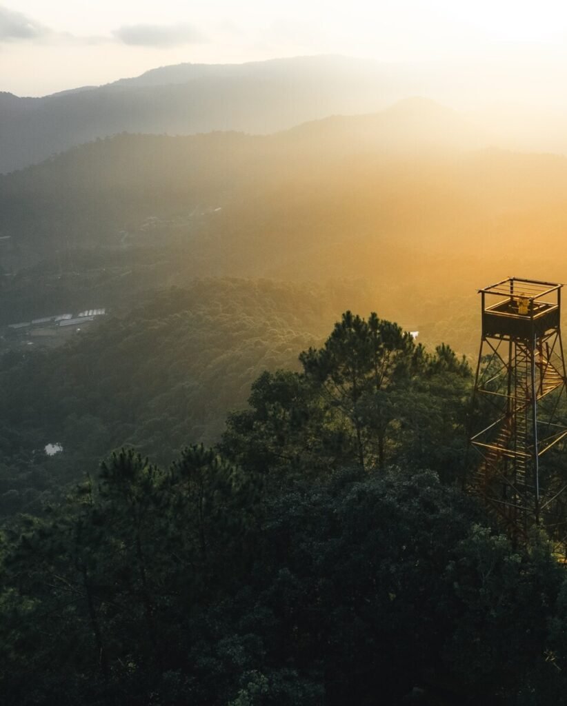
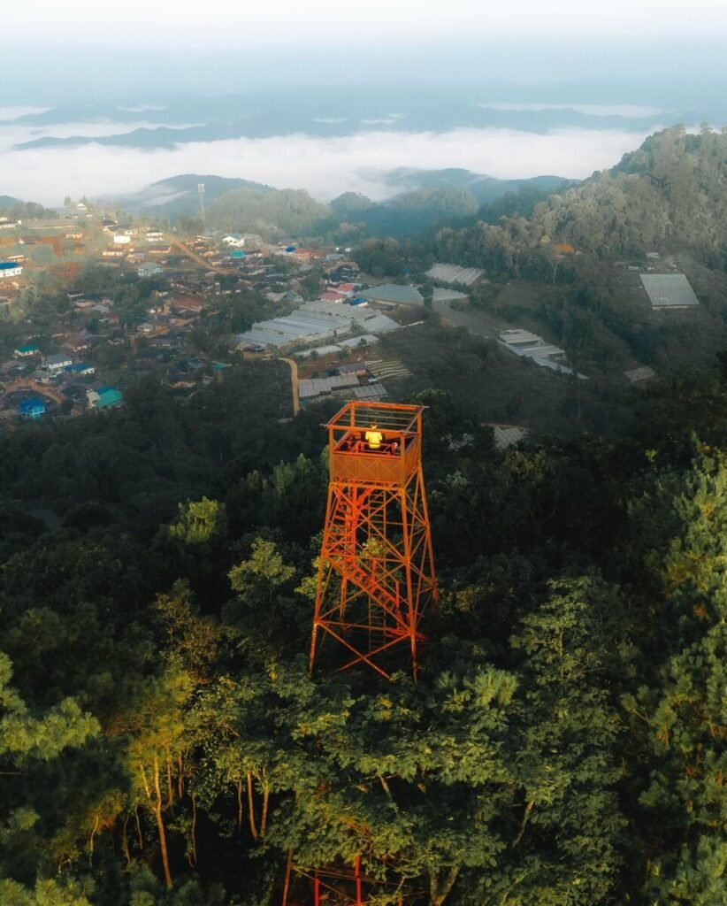
A working forest fire lookout rather than a managed attraction: climb the tower, more than 30 metres tall, and on a clear day the view reaches over 100 km, with a Hmong village below and mist in the valleys at dawn. Ask in the village if you may go up, and do not try it in wind or storms. Stay the night in one of the village homestays to be there for sunrise, and avoid the spring burning season, when smoke hides the view.
More in our Chiang Mai guide.
- Attraction Type
- Viewpoint
- Location
- Open in Google Maps
- Cost
- Not confirmed (check before you go)
- Opening Hours
- Not confirmed; best at sunrise (check before you go)
- Best Time To Visit
- November to February for sea-of-mist mornings
- How To Get There
- From Chiang Mai head to Mae Rim and take the Mae Rim to Samoeng road (Route 1096) for about 17 km, turn left onto the Ban Buak Chan road and drive about 3 km to the village. Own car or motorbike needed.

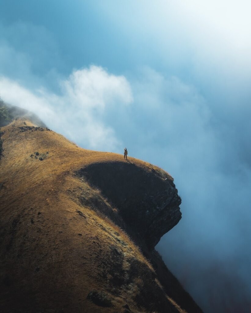


20Doi Mon Jong and Pha Hua Sing
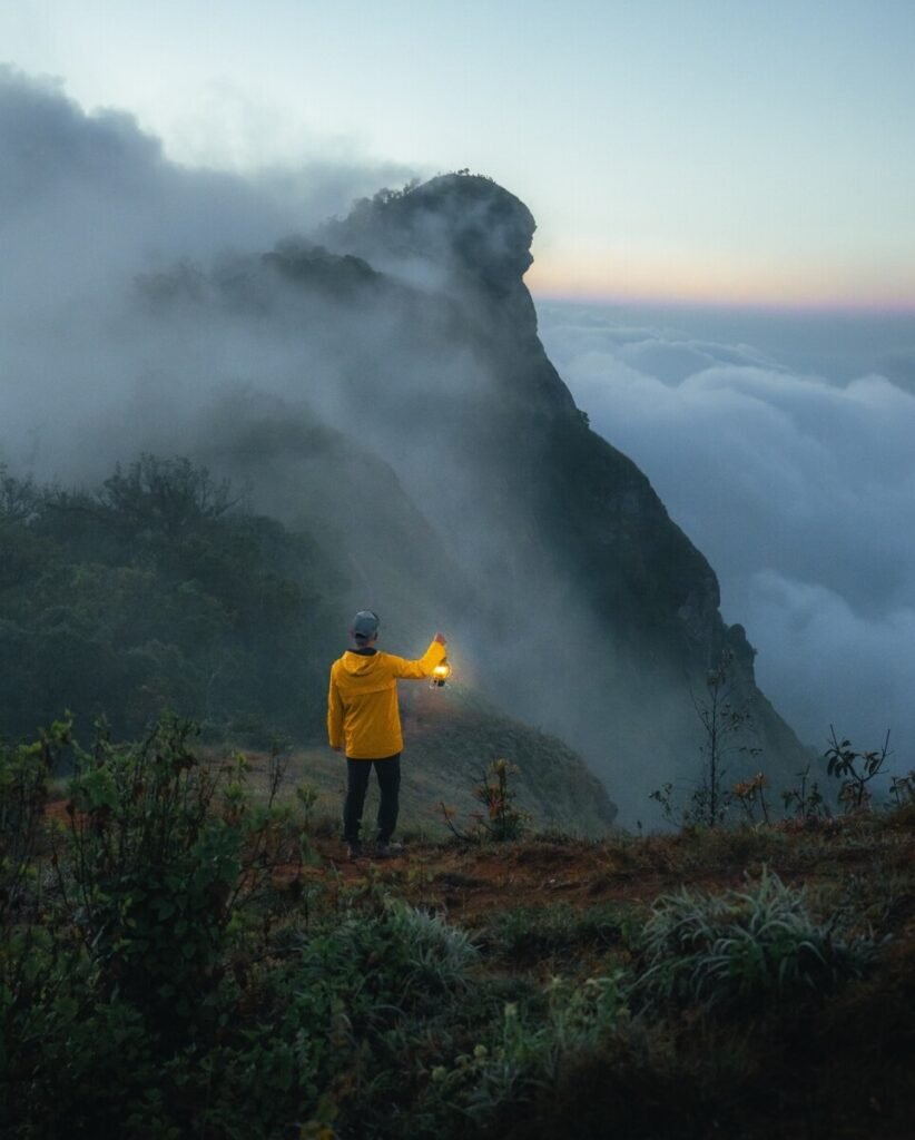
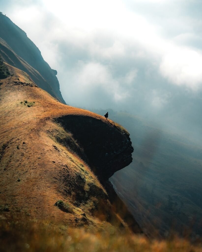
For a view you earn, Doi Mon Jong is the highest peak in Omkoi Wildlife Sanctuary, a ridge of golden grassland where the lion’s-head cliff of Pha Hua Sing juts out over a sea of cloud at sunrise. Getting there means a trek of 3 to 4 hours with some very steep stretches, a night in your own tent, and a booking on the sanctuary website at least three days ahead. Treks run only from roughly November to mid-February; come in December or January for rhododendrons.
More in our Chiang Mai guide.
- Attraction Type
- Mountain trek and camping / wildlife sanctuary
- Location
- Open in Google Maps
- Cost
- Sanctuary fees paid at check-in, amount unconfirmed; guided packages with 4×4, guide and permit about 3,000 to 4,000 THB per person (check before you go)
- Opening Hours
- Seasonal, roughly November to mid-February; closed Wednesdays in 2024-25; day visitors check in by 09:00 and out by 17:00 (check before you go)
- Best Time To Visit
- December to January for rhododendrons and clear sunrises; closed outside the November to February season
- How To Get There
- From Chiang Mai take Route 108 to Hot, then Route 1099 towards Omkoi (about 3 hours) and on to the Ban Musoe unit or Ban Huai Pu Ling checkpoint. The last stretch is rough and needs a 4×4 transfer. Minivans run from Chiang Mai to Omkoi.


21Chiang Khan Skywalk
The glass floor is the point here: a walkway more than 100 metres long, about 80 metres above the Mekong, with Laos on the far bank and the Huang River meeting the Mekong below, the two often running different colours. It takes little effort, as a shuttle runs from the car park up the hill. It is about 20 km from Chiang Khan town, so plan it separately from the walking street, and for late light arrive early, as the site closes at 18:00.
More in our Loei guide.
- Attraction Type
- Viewpoint / skywalk
- Location
- Open in Google Maps
- Cost
- 60 THB per person, including shuttle and overshoes
- Opening Hours
- Daily 07:00 to 18:00
- Best Time To Visit
- November to February; sunrise for Mekong mist, or late afternoon before closing
- How To Get There
- About 20 km east of Chiang Khan town via Route 2195; turn at Ban Tha Di Mi and continue about 2 km to the lower car park, then take the shuttle

22Doi Pha Phueng
Four low summits on a grassy limestone ridge near the Lao border make up Doi Pha Phueng, looking across the Doi Phu Wae ridge, Doi Cho and Bo Kluea district at sunrise or sunset. The climb to Ban Manee Phruek is steep and partly unsealed, then a village pickup and a short walk do the rest. Camping on the peak is not allowed, so plan a night in a village homestay and come between November and February for clear, cold mornings.
More in our Nan guide.
- Attraction Type
- Viewpoint / mountain peak
- Location
- Open in Google Maps
- Cost
- Community pickup about 700 THB per vehicle return from the village; any national park fee unconfirmed (check before you go)
- Opening Hours
- Daylight hours; go up for sunrise or sunset with a village driver
- Best Time To Visit
- November to February for mist and clear views
- How To Get There
- From Nan take Highway 1080 north; at around km 77 to 78 near Ban Na Nun turn right for Ban Manee Phruek (about 100 km from Nan in total; sources give 2 to 5 hours). 4×4 recommended. From the village, hire a local pickup (about 20 minutes) then walk a short way to the summits.


23Ban Mani Phruek
Rather than a single viewpoint, this Hmong and Lua coffee-growing village is a base for several, with the Phu Hua Lan viewpoint and Doi Pha Phueng peak both close by. Mornings are cold, and the cool season adds mist and wild Himalayan cherry blossom. The steep, part-dirt road up takes about two hours from Highway 1080 and a 4×4 is advised, so stay a night in a homestay rather than rushing it.
More in our Nan guide.
- Attraction Type
- Village, viewpoints and waterfall
- Location
- Open in Google Maps
- Cost
- Village free; Nam Poen waterfall tractor and guide about 1,500 THB per group; homestays from about 1,300 THB per person with meals (check before you go)
- Opening Hours
- Development project 08:00 to 17:00; waterfall trips by arrangement with the village tourism group
- Best Time To Visit
- Cool season for cold mornings, mist and cherry blossom; July to September for Nam Poen waterfall
- How To Get There
- From Thung Chang, about 40 to 47 km: Highway 1080 to Ban Na Nun (km 77 to 78), then turn off on a steep mountain road; about 2 hours, 4×4 recommended. Roughly 2 hours from Nan airport

24Pha Daeng Cliff, Lom Sak
Seen from Highway 12, Pha Daeng is a red sandstone cliff; the view itself is from its flat rock top, out over the forest of Phu Pha Daeng Wildlife Sanctuary, the highway twisting through it and, on clear days, Khao Kho. Effort is modest: short but steep stairs from the shrine, or a drive round to the sanctuary office. The edge is a sheer drop, so keep well back. Cool-season mornings from November to February often bring mist.
More in our Phetchabun guide.
- Attraction Type
- Viewpoint / cliff
- Location
- Open in Google Maps
- Cost
- No fee found in sources (check before you go)
- Opening Hours
- Not published; daylight hours advised (check before you go)
- Best Time To Visit
- November to February for cool air and mist; late afternoon for sunset
- How To Get There
- From Lom Sak take Highway 12 towards Nam Nao and Chum Phae to about km 18.5, at the Pho Khun Pha Mueang bridge. Climb the stairs from the Pha Daeng shrine, or cross the bridge, continue about 4 km, turn left and drive about 3 km to the Phu Pha Daeng Wildlife Sanctuary office. Own car or motorbike needed.
Central and Eastern Thailand
Closer to Bangkok, viewpoints look over reservoirs, coastlines and the capital itself. Most are drive-up or short-walk stops, such as the Noen Nang Phaya coast road and the reservoirs at Pa Sak Jolasid, Lam Takhong and Muak Lek; Khao Daeng’s rocky scramble, the fixed ropes on Khao Lom Muak and the jungle trek up Khao Laem on Koh Chang take more effort.



25King Power Mahanakhon
Bangkok’s entry, and a paid one. At 314m Mahanakhon can be seen free from all over the city, so buy a ticket only if you want the view from the top and the glass skywalk, which is a real test if you’re nervous of heights. Go for sunset and stay as the city lights come on.
More in our Bangkok guide.
- Attraction Type
- Sky Walk / Viewpoint
- Location
- Open in Google Maps
- Cost
- Free to view from outside; SkyWalk 1,000 THB for adults (10:00 to 15:30) or 1,200 THB (15:30 to 19:00); 500 THB or 600 THB for children aged 8 to 12 and over-60s
- Best Time To Visit
- Morning / Sunset
- Opening Hours
- Daily, 10:00 to 24:00 (last entry 23:00)
- Number
- +66 26 778 721
- Website
- Website
- How To Get There
- Taxi / BTS / MRT / Bus
- Area
- Bangkok


26Phra Nakhon Khiri (Khao Wang)
History comes with this view. King Mongkut’s summer palace spreads across the three peaks of a hill in the middle of Phetchaburi, its Thai, Chinese and European buildings looking out over the town and the plains, best in the late afternoon. Ride up and walk down, bring a hat and water for the exposed, very hot hilltop, and keep a firm grip on food around the macaques.
More in our Phetchaburi guide.
- Attraction Type
- Historic palace and viewpoint
- Location
- Open in Google Maps
- Cost
- 200 THB for foreign adults, 20 THB for Thais; cable car about 50 THB return (check before you go)
- Opening Hours
- Daily, 08:30 to 16:30
- Best Time To Visit
- Late afternoon, for views over the town
- How To Get There
- In Phetchaburi town, a short tuk-tuk ride from the station
- What to Pack
- A hat, water and a bag that zips shut


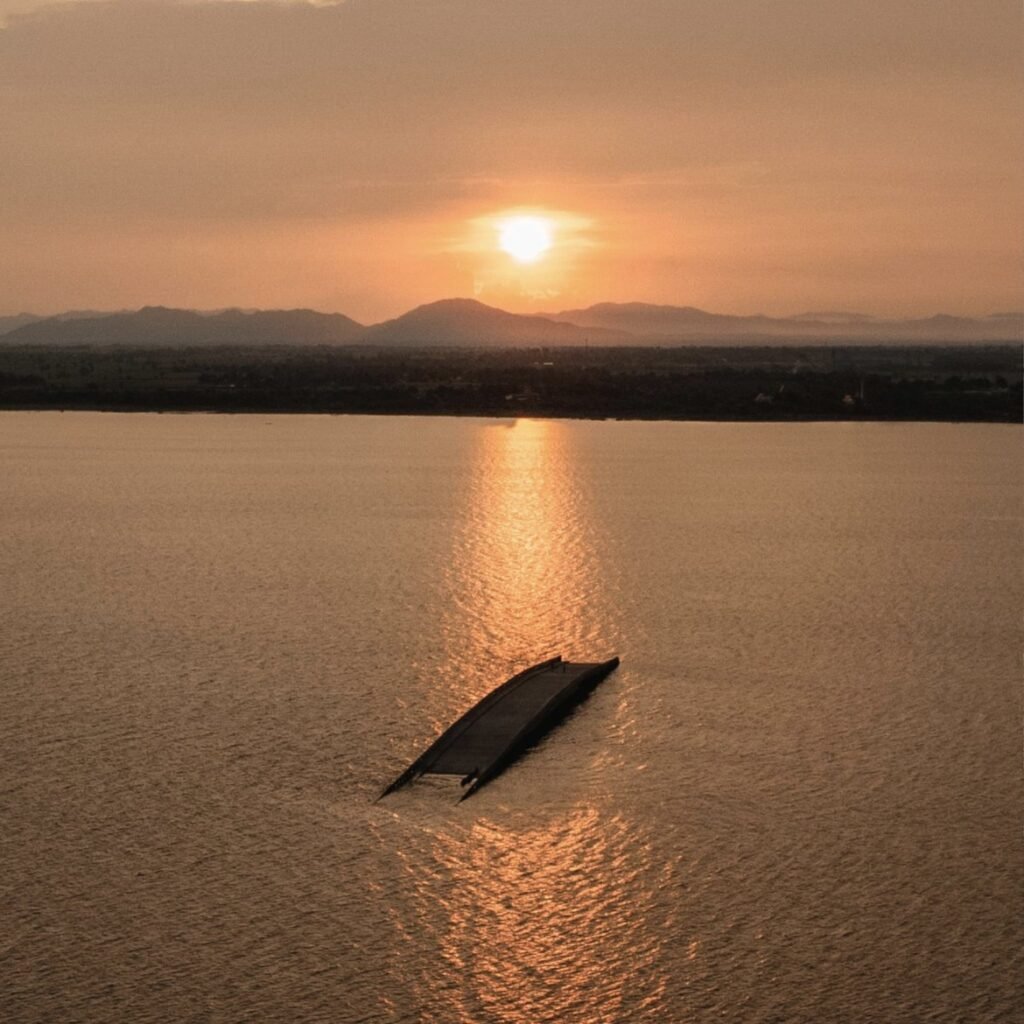

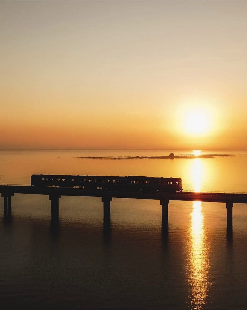
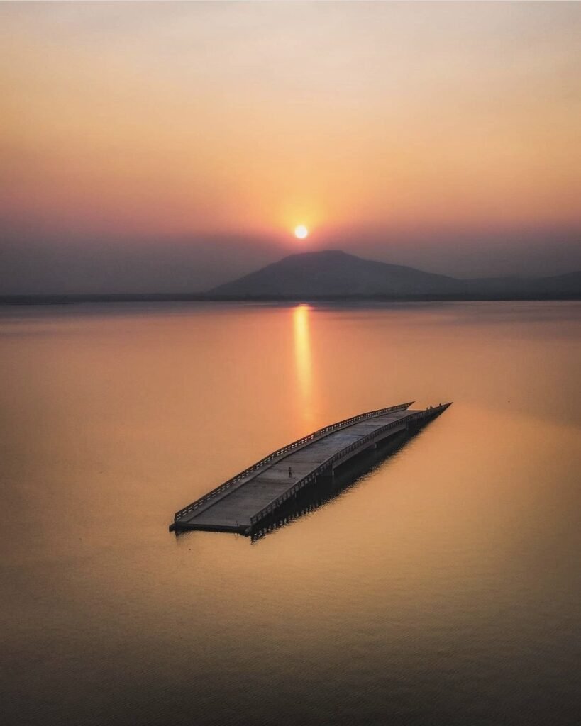
27Pa Sak Jolasid Dam
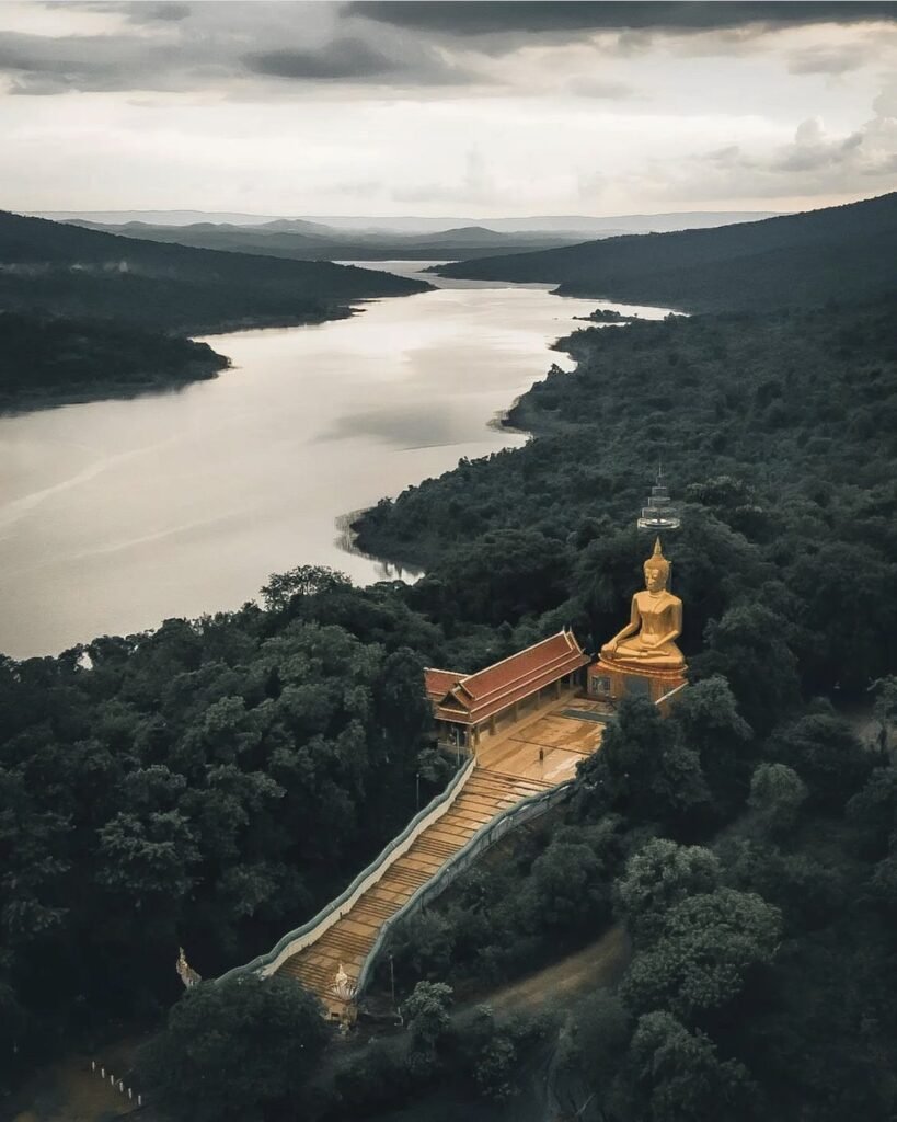
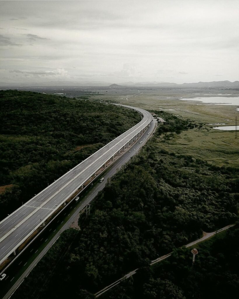
Come for the trains rather than the height. The railway crosses this huge reservoir on a long, low viaduct, so trains seem to glide over the water past small tree-covered islands. From about November to February a weekend floating train day trip from Bangkok stops on the viaduct; outside the season, watch a train cross from the shore at sunset.
More in our Lopburi guide.
- Attraction Type
- Reservoir and viewpoint
- Location
- Open in Google Maps
- Cost
- Free. The floating train from Bangkok has recently cost about 330 to 560 THB
- Opening Hours
- Daily, 06:00 to 18:00
- Best Time To Visit
- Sunset, November to February
- How To Get There
- About 40 km (45 minutes by car) east of Lopburi town, or the seasonal floating train from Bangkok



28Lam Takhong and Khao Yai Thiang
A cool-season sunrise spot that needs no hiking: drive to the base and take a shared pickup up the Khao Yai Thiang ridge, lined with 14 wind turbines. From the Pha Yai Thiang viewpoint you look down over the Lam Takhong reservoir as mist fills the valley below. Bikes can be rented at the top.
More in our Nakhon Ratchasima guide.
- Attraction Type
- Reservoir and viewpoint
- Location
- Open in Google Maps
- Cost
- Free; shared pickup up the ridge around 30 THB, bike rental around 40 THB
- Best Time To Visit
- November to February, at sunrise
- Opening Hours
- Daily, 06:00 to 18:00
- How To Get There
- Drive along Highway 2 (Mittraphap Road) towards Sikhio, then take the shared pickup up the ridge
- What to Pack
- A warm layer for early mornings

29Khao Daeng
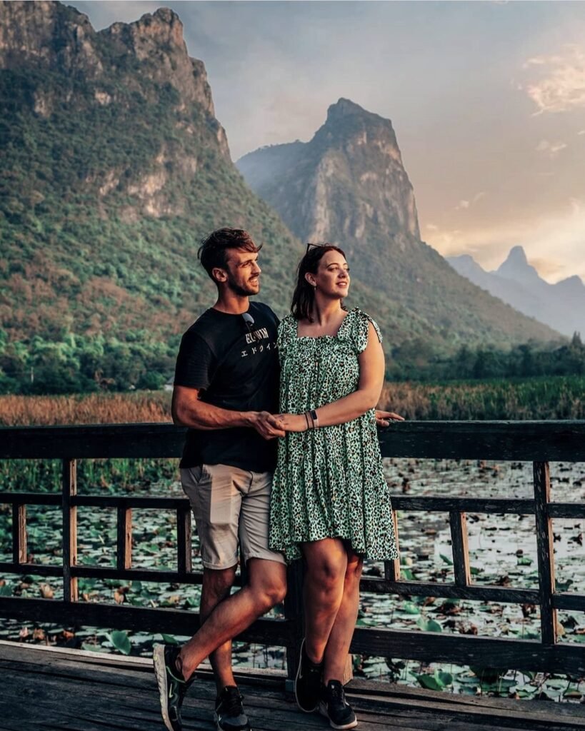
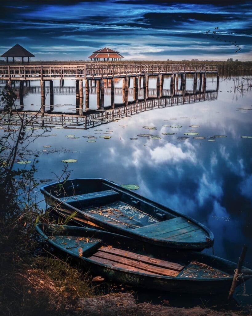
Short but genuinely rough: a steep, rocky 157 metre scramble near park headquarters gets you a 360-degree view over limestone peaks, marshes and the sea. The sharp rocks are harder going down than up, so allow about an hour. Sunrise is the classic time, but the trail’s listed opening is 08:00, so confirm locally before planning a dawn climb, and save the late afternoon for a longtail along the Khao Daeng canal.
More in our Prachuap Khiri Khan guide.
- Attraction Type
- Viewpoint and boat trip
- Location
- Open in Google Maps
- Cost
- 200 THB for foreign adults, 40 THB for Thai adults (national park fee); canal boats around 500 THB per boat
- Best Time To Visit
- Early morning for the viewpoint (sunrise only if early access is allowed), late afternoon for the canal
- How To Get There
- The trailhead is about 700 m from park headquarters
- Opening Hours
- Viewpoint trail daily, 08:00 to 15:30 (check before you go)
- What to Pack
- Sturdy shoes, water; a headlamp if climbing for sunrise



30Pattaya Viewpoint
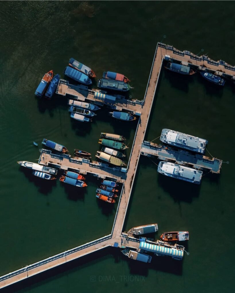
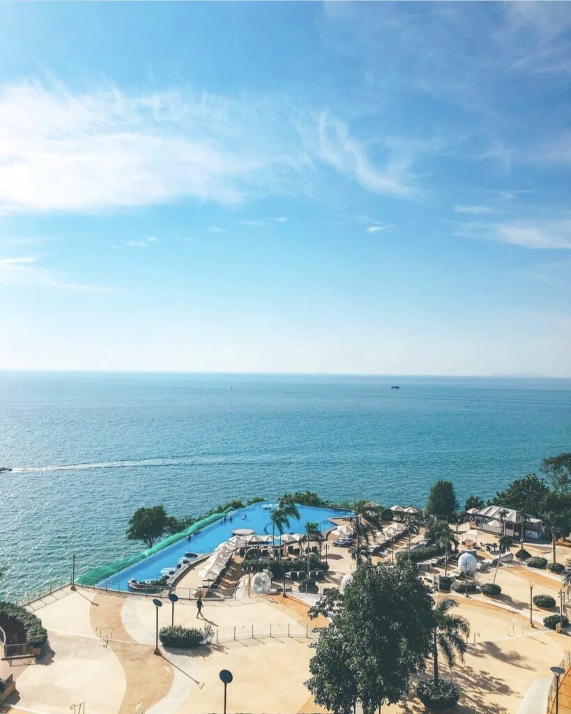
The classic view of Pattaya Bay, with the whole curve of beach and skyline in one frame from Pratumnak Hill. It costs nothing and has a café, so it fills up at sunset; you can also walk up from Bali Hai Pier, where the boats crowded around the Koh Larn ferries make a photo of their own.
More in our Chonburi guide.
- Attraction Type
- Viewpoint and city
- Location
- Open in Google Maps
- Cost
- Free
- Best Time To Visit
- Sunset
- Opening Hours
- Viewpoint daily, 07:00 to 22:00
- How To Get There
- Songthaew or Grab to Pratumnak Hill; you can also walk up from Bali Hai Pier


31Chonburi Grand Canyon
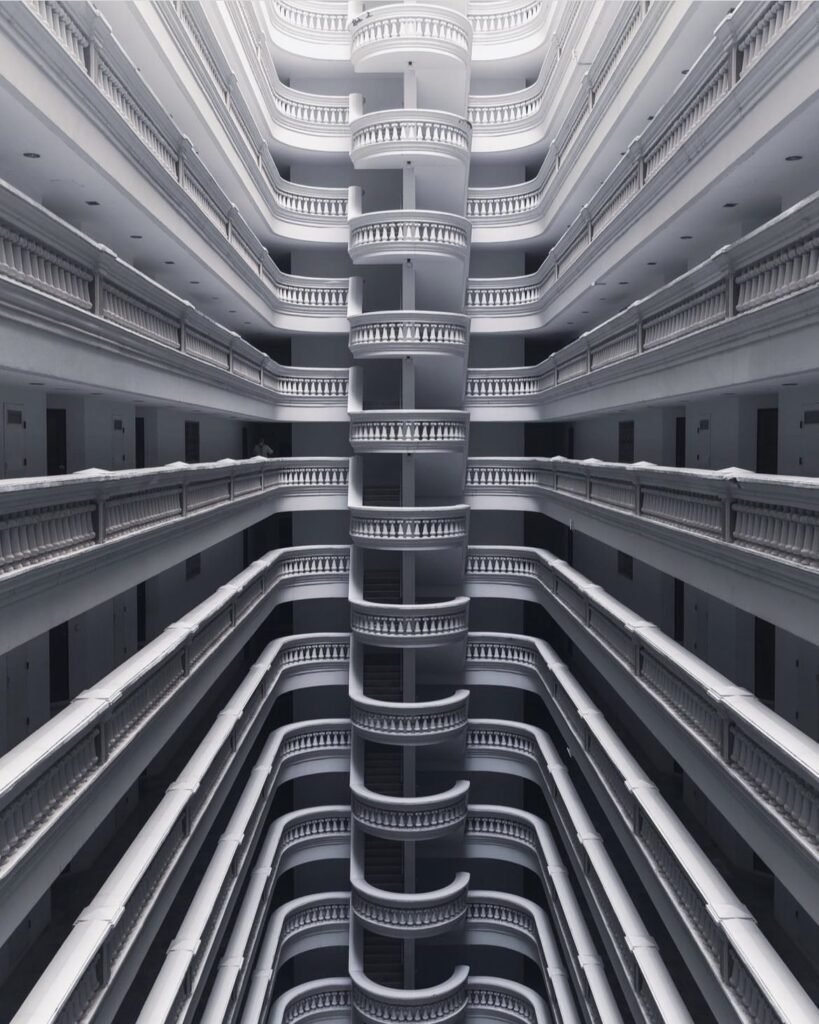
Here you look down rather than out: a flooded former quarry, emerald water about 30 metres deep, ringed by pale cliffs. Walk the rim in the late afternoon and treat it as a photo stop, since the walls are too steep for swimming. It is much closer to Bang Saen than to Pattaya.
More in our Chonburi guide.
- Attraction Type
- Flooded quarry and viewpoint
- Location
- Open in Google Maps
- Cost
- About 20 THB per person at the gate
- Best Time To Visit
- Late afternoon
- How To Get There
- Drive or Grab; about an hour from Pattaya, or 20 minutes from Bang Saen
- What to Pack
- Good shoes for the rocky edges

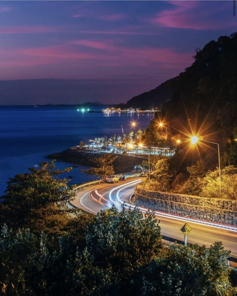
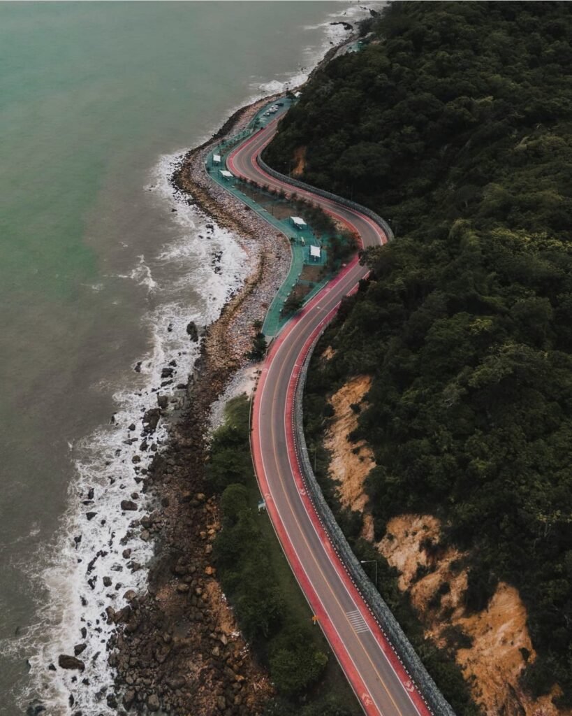
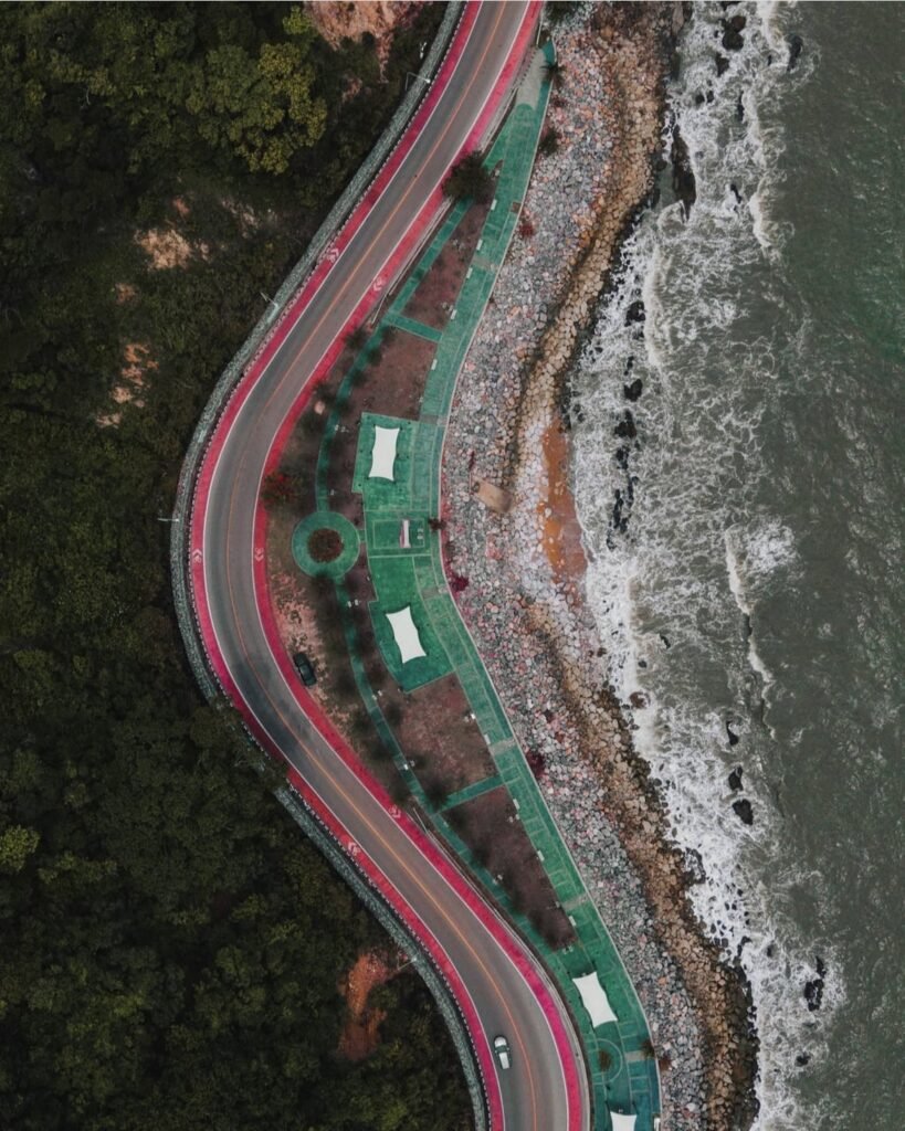
32Noen Nang Phaya Viewpoint
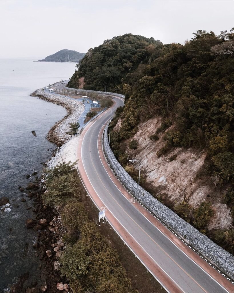
A drive-up view with no effort at all: an S-shaped bend in the coast road curling along the cliffs above Kung Wiman bay, Chanthaburi’s most photographed spot. It sits on a scenic coast road with plenty of places to pull over, so fold it into a road trip. Come early in the morning or in the half hour before sunset.
More in our Chanthaburi guide.
- Attraction Type
- Viewpoint and coastal drive
- Location
- Open in Google Maps
- Cost
- Free
- Best Time To Visit
- Early morning or the half hour before sunset
- Opening Hours
- 24 hours
- How To Get There
- Own car or motorbike along the coast road in Na Yai Am district
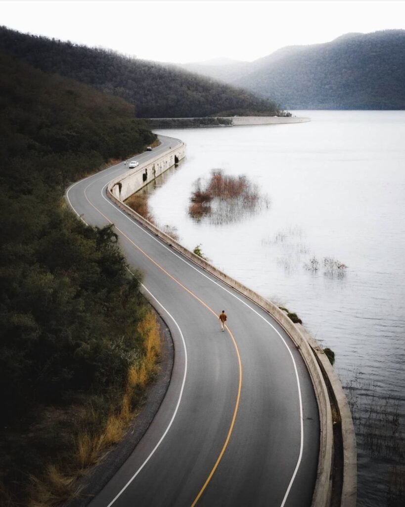
33Muak Lek Reservoir
A dawn spot, and a strict one: mist often sits on the water among forested hills, but on weekdays the morning window runs only from 06:00 to 08:00. Weekends are more relaxed, and evenings suit a slow drive round the shore at sunset. November to February gives the best chance of mist.
More in our Saraburi guide.
- Attraction Type
- Reservoir, viewpoint
- Location
- Open in Google Maps
- Cost
- Free; Chet Sao Noi National Park foreigners 100 THB, Thais 20 THB, plus 30 THB per car
- Opening Hours
- Reservoir Monday to Friday 06:00 to 08:00 and 16:00 to 18:00, Saturday and Sunday 06:00 to 18:00; Chet Sao Noi daily, 08:00 to 17:00
- Best Time To Visit
- November to February, early morning for mist
- How To Get There
- About 2 hours from Bangkok by car via Highway 1 to Saraburi, then north-east into Wang Muang district. No public transport to the reservoir; use a car or ask a taxi driver for อ่างเก็บน้ำมวกเหล็ก.
- What to Pack
- Light jacket for early mornings



34Koh Perid
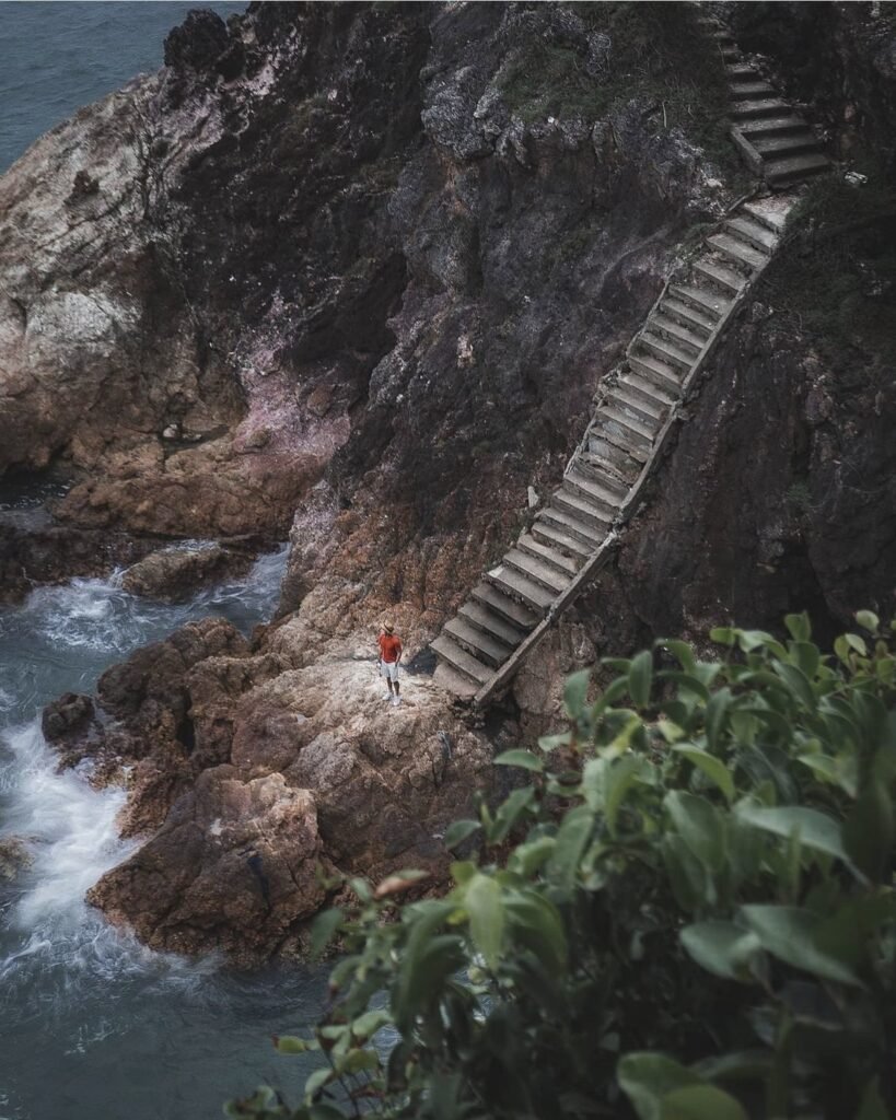
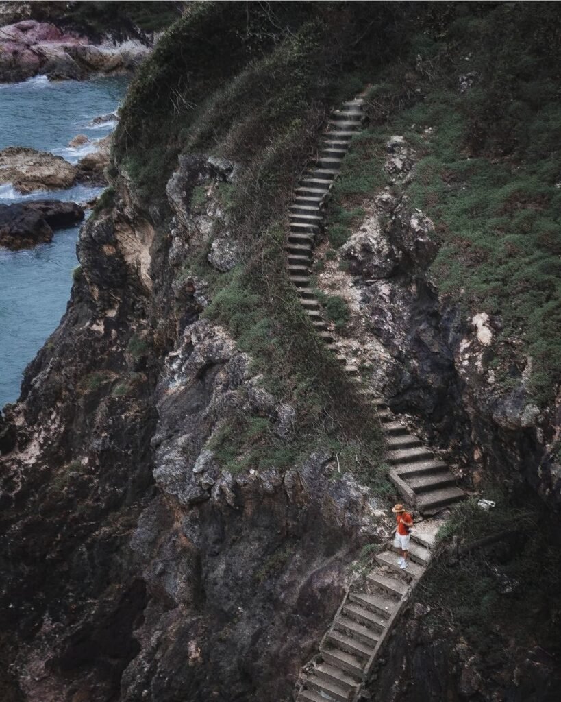
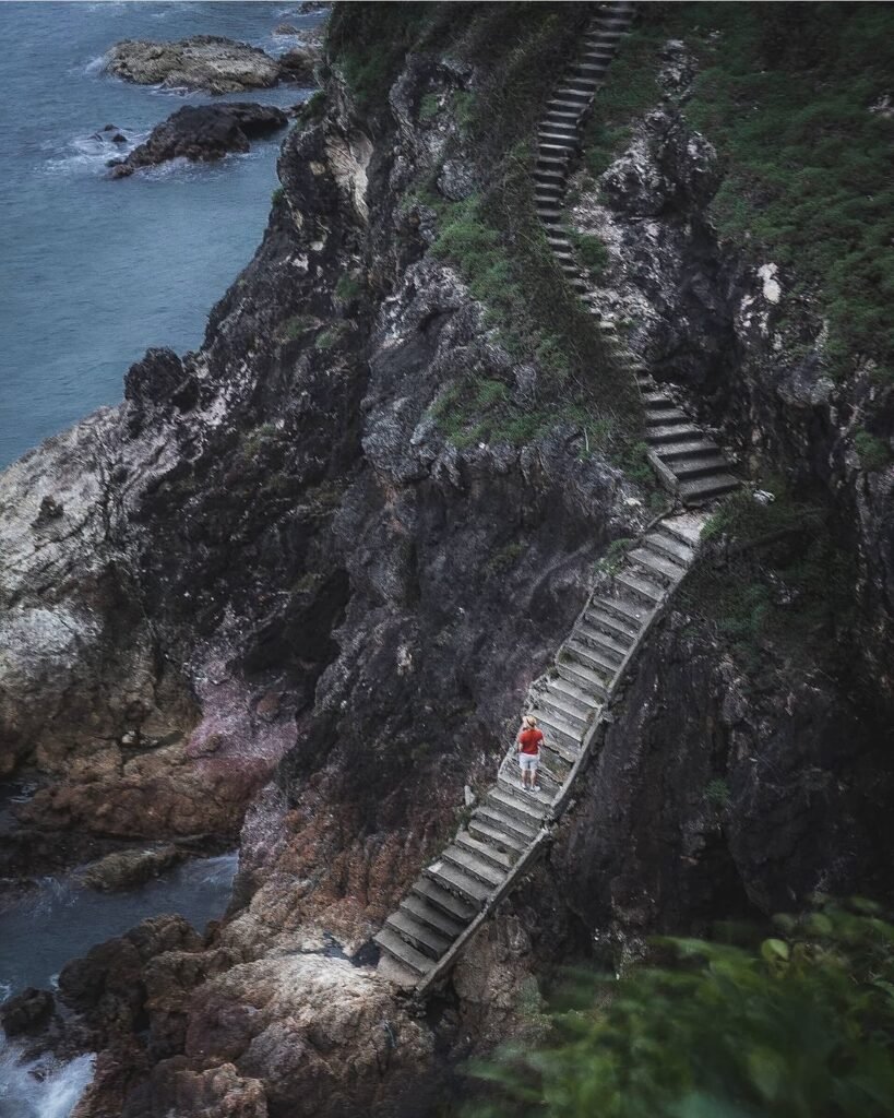
Not an island, despite the name, but a rocky headland where steep cliff stairs built by Vietnamese refugees lead down to small, clear-water coves. Short climbs reach the Sunshine and Pha Suk Niran viewpoints, so expect some legwork and wear shoes with good grip. The temple at the car park looks after the site and asks for donations.
More in our Chanthaburi guide.
- Attraction Type
- Headland and viewpoints
- Location
- Open in Google Maps
- Cost
- Free
- Best Time To Visit
- November to February
- How To Get There
- Drive along the Chalerm Burapha Chonlathit coast road
- What to Pack
- Shoes with good grip for the cliff stairs



35Koh Samet Rocky Coast
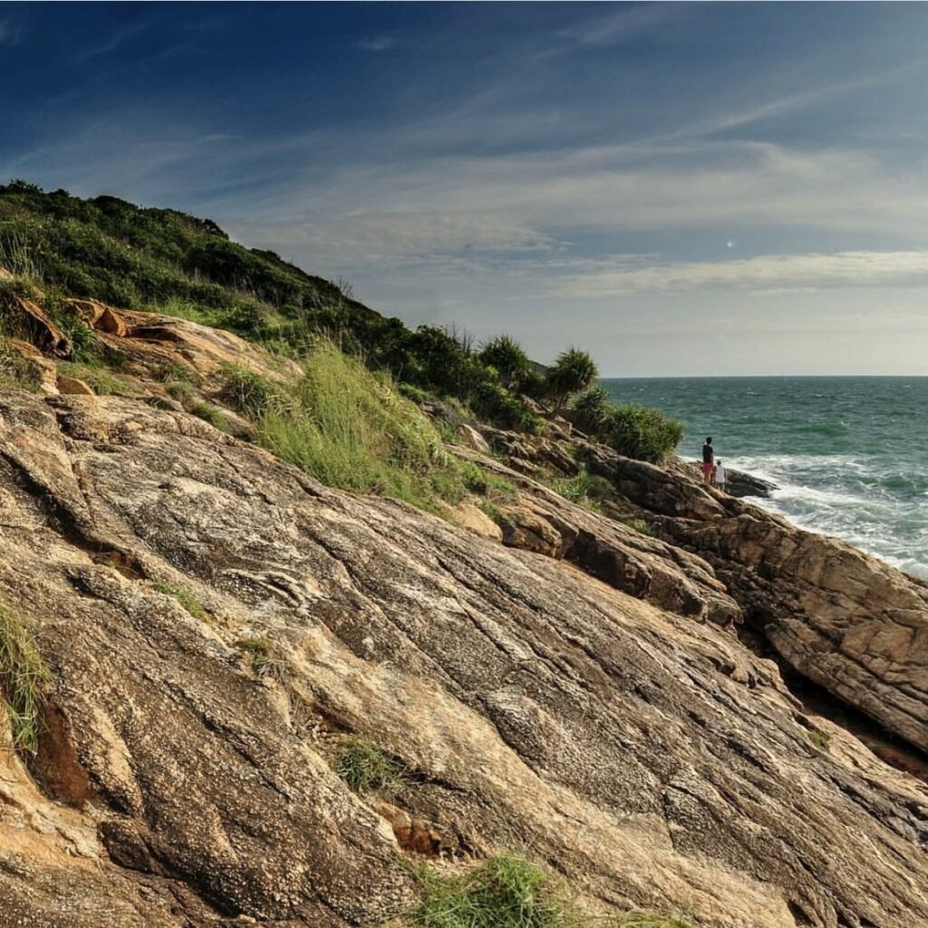
An island sunset with a bit of scrambling. At Samet’s southern tip, short rocky trails lead from the end of the road to viewpoints over the sea among granite boulders; the western one faces the sunset. Wear proper shoes and bring a torch for the walk back in the dark.
More in our Rayong guide.
- Attraction Type
- Viewpoint and coastal walk
- Location
- Open in Google Maps
- Cost
- Included in the park fee
- Best Time To Visit
- Late afternoon into sunset
- How To Get There
- Scooter or charter songthaew to the southern end of the island
- What to Pack
- Grippy shoes and a torch

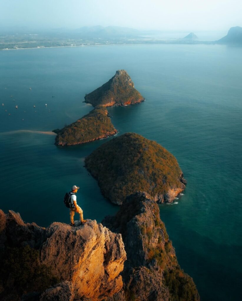
36Khao Lom Muak
Timing is the challenge at Khao Lom Muak: the climb inside the Wing 5 air force base opens only on selected long holiday weekends, with registration from 06:00 and everyone down by noon. The reward is a narrow summit looking straight down over Prachuap Bay, Ao Manao and a scatter of small islands, but it is a real scramble, with 496 steps, then rough rock and fixed ropes, and no barriers at the top. Wear proper shoes and bring gloves and water.
More in our Prachuap Khiri Khan guide.
- Attraction Type
- Hike and viewpoint
- Location
- Open in Google Maps
- Cost
- Sources disagree: free, or 40 THB per person (check before you go)
- Opening Hours
- Only on selected long holiday weekends; registration 06:00 to 10:00, everyone down by 12:00
- Best Time To Visit
- The listed holiday openings, starting at 06:00 before the heat. Cancelled in bad weather.
- How To Get There
- From Prachuap Khiri Khan Provincial Hall drive south on the beach road into Wing 5, swap your ID for a pass at the gate, continue about 500 m and turn left to the Chao Pho Khao Lom Muak shrine, about 1 km further. Registration is by the shrine.


37Khao Laem Viewpoint, Koh Chang
Koh Chang’s best spot for sunrise is also a proper jungle trek: about 3.8 km with roughly 600 m of climbing to a bare rocky outcrop looking south over Bang Bao, Salak Phet and the southern islands. Go with a guide unless you are an experienced jungle hiker, as the trail is easy to lose, and allow about three hours up. For sunrise you need to start in the dark or camp, and camping needs national park permission. December to March brings the clearest skies.
More in our Trat guide.
- Attraction Type
- Viewpoint / hike
- Location
- Open in Google Maps
- Cost
- National park fee (200 THB quoted by one operator); guided treks about 1,850 to 2,150 THB per person (check before you go)
- Opening Hours
- Daylight hiking; overnight camping only with park permission
- Best Time To Visit
- December to March for clear sunrise views; avoid the rainy season when cloud often hides the view
- How To Get There
- Drive or ride to Salak Phet in south-east Koh Chang and follow the old road to Khiriphet Waterfall; the trail starts from the small car park. Guides can arrange transfers.


38Huai Tha Khoei Reservoir
Thai travellers compare this reservoir near the Myanmar border to a lake under Mount Fuji, for the line of forested mountains reflected in still water. It is an easy, low-key stop with no formal visitor centre, best in the evening for sunset and clearest when there is no wind. Pair it with a night in Suan Phueng, about 40 km away.
More in our Ratchaburi guide.
- Attraction Type
- Reservoir / viewpoint
- Location
- Open in Google Maps
- Cost
- No fee reported (check before you go)
- Opening Hours
- Open daily (no set hours)
- Best Time To Visit
- Late afternoon for sunset; calm early mornings for reflections; November to February for cooler weather
- How To Get There
- About 40 km from Suan Phueng by road into Ban Kha district towards Ban Phu Nam Ron, Ban Bueng subdistrict. Own car or motorbike needed.
Isaan
The northeast’s sandstone ridges look out over forests, reservoirs and the Mekong. Most are best on cool-season mornings, when mist often hangs below Hin Sam Wan and Wat Pha Tak Suea and Sut Phaendin can sit above a sea of cloud.
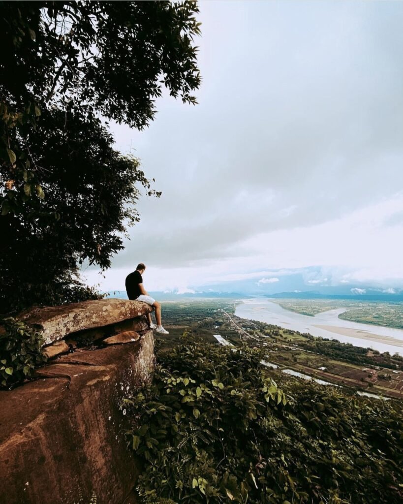
39Wat Pha Tak Suea Skywalk
Come for the view, not the glass. The horseshoe-shaped skywalk hangs out over a wide bend of the Mekong with the hills of Laos beyond, but its floor is now scratched and cloudy. Only about 20 people are allowed on at a time, so queues build: a weekday before 9am, ideally on a misty winter morning between November and February, is the time. It is a border area, so keep any drone over the Thai side.
More in our Isaan guide.
- Attraction Type
- Temple / viewpoint
- Location
- Open in Google Maps
- Cost
- Free
- Opening Hours
- About 08:00 to 17:00 daily
- Best Time To Visit
- Weekday early mornings, November to February for mist
- How To Get There
- About 1.5 hours by car or motorbike from Nong Khai town along Highway 211 towards Sangkhom; no regular public transport to the top


40Hin Sam Wan (Three Whale Rock)
The appeal is standing on the view itself: you walk out onto the backs of three huge boulders, which from the air look like a family of whales, with forest and the Mekong beyond. Get here for sunrise, when mist often hangs over the trees, between November and February. A shared truck does most of the climbing, and drones need a permit, though a paid drone service at the top gets you the aerial shot.
More in our Bueng Kan guide.
- Attraction Type
- Rock formation and viewpoint
- Location
- Open in Google Maps
- Cost
- 100 THB per person. Truck about 500 THB per vehicle, shared between up to 6 people. Drones need a permit
- Opening Hours
- Daily, 05:00 to 16:30
- Best Time To Visit
- Sunrise, November to February
- How To Get There
- By car, about 1 hour from Bueng Kan town, then the park truck (or a 3.2 km walk)
41Lan Hin Ngam and Sut Phaendin
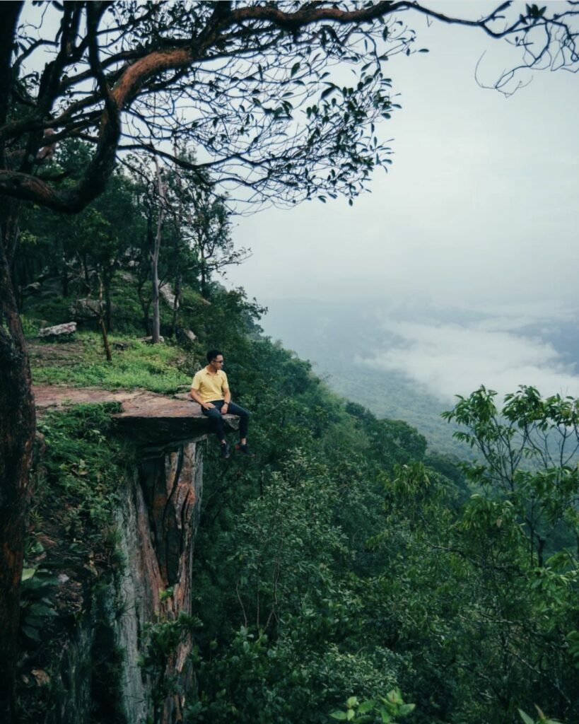
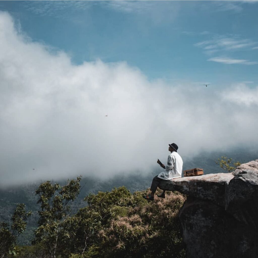
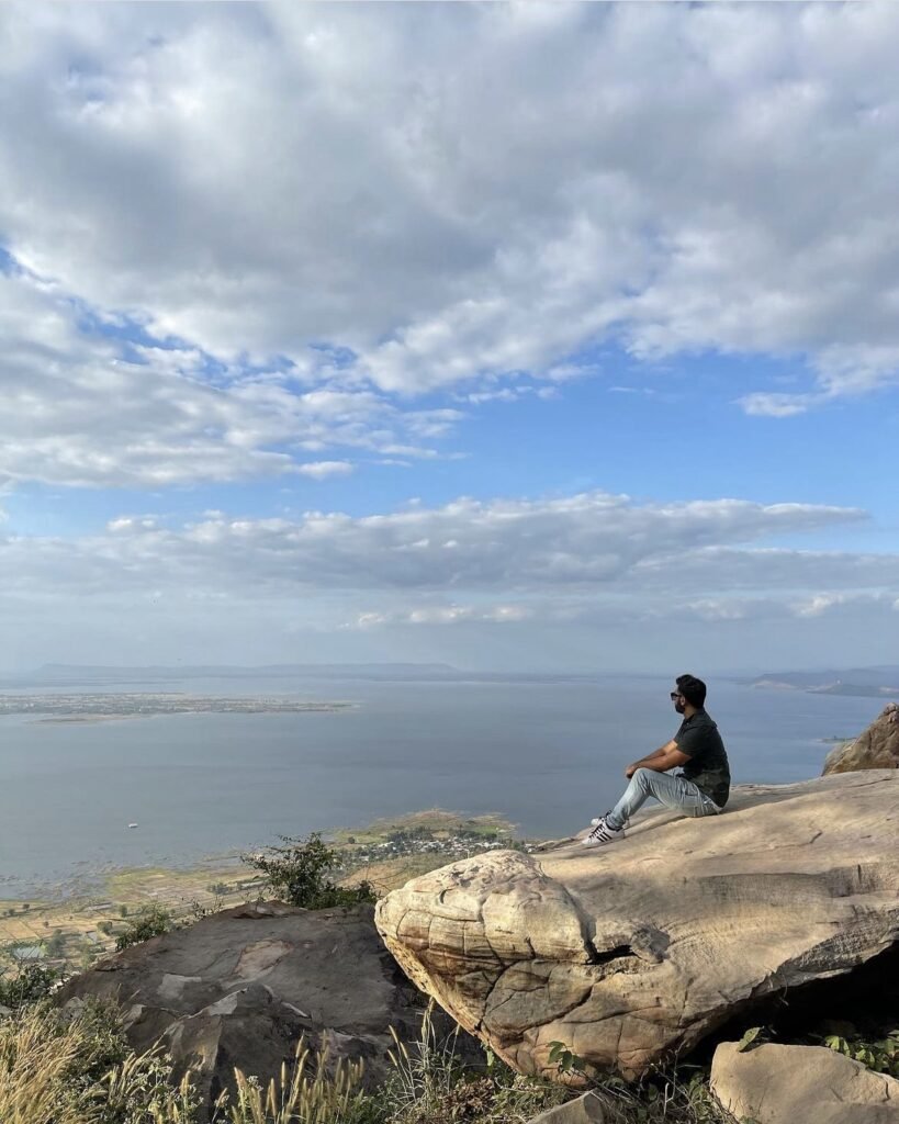
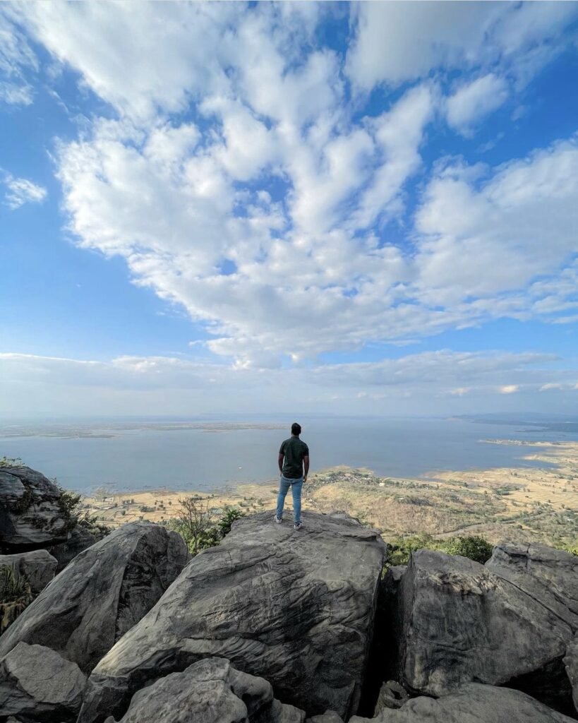
A gamble on the weather. At dawn in the cool season, the Sut Phaendin cliff, at about 846 metres on the watershed between the Chao Phraya and Mekong basins, can sit above a sea of cloud, but fog can just as easily hide everything, with sunset as the fallback. There are no railings on the ledge. The wind-cut sandstone pillars of Lan Hin Ngam nearby add something to see in any weather.
More in our Chaiyaphum guide.
- Attraction Type
- National park viewpoint and rock formations
- Location
- Open in Google Maps
- Cost
- Included in the Pa Hin Ngam fee: foreigners 200 THB, Thais 40 THB; tram about 30 THB
- Opening Hours
- Park about 06:00 to 18:00
- Best Time To Visit
- Sunrise, November to February for a sea of cloud; also sunset
- How To Get There
- Inside Pa Hin Ngam National Park, about 2 km from the park office by road or park tram
- What to Pack
- Warm layer for dawn, torch


42Hin Chang Si Viewpoint
Sandstone outcrops said to look like elephants frame the view over forest to the Ubol Ratana reservoir, and prehistoric rock paintings nearby give you something more to look at. It is about an hour from Khon Kaen. Come early, as the haze lifts off the water, or in the late afternoon, not at midday in the hot season, and bear in mind the full national park fee applies even if you only want the viewpoint.
More in our Isaan guide.
- Attraction Type
- Viewpoint (national park)
- Location
- Open in Google Maps
- Cost
- Foreigners 100 THB, Thais 20 THB (national park fee), plus vehicle fee
- Opening Hours
- Daily, 08:00 to 17:00
- Best Time To Visit
- Early morning or late afternoon, November to February
- How To Get There
- About 50 km (1 hour) west of Khon Kaen by car or motorbike towards Ubol Ratana dam; no public transport to the viewpoint



43Thung Kamang Lone Tree, Phu Khiao Wildlife Sanctuary
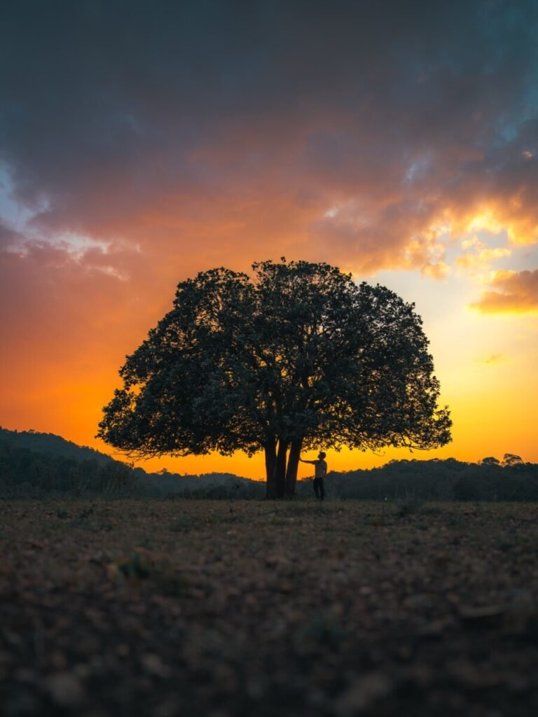
Instead of a cliff edge, Thung Kamang offers open grassland at around 900 metres, with a single mueat tree at the end of a long dirt path, sambar deer on most mornings and evenings, and dark skies for stargazing. Access is controlled: ask permission at the Pang Muang checkpoint for a day visit, or send a written request in advance to stay overnight. The last 24 km is slow forest road, and for stars, plan your night near the new moon.
More in our Chaiyaphum guide.
- Attraction Type
- Grassland and viewpoint / wildlife sanctuary
- Location
- Open in Google Maps
- Cost
- Foreigners 200 THB, Thais 20 THB; car 30 THB, motorbike 20 THB (check before you go)
- Opening Hours
- Daily 08:00 to 16:00 for day visits; overnight stays by advance written request only
- Best Time To Visit
- Around the new moon for stargazing; early morning or dusk for deer. The rainy season is green but the road is harder.
- How To Get There
- From Khon San take Highway 2055 towards Chulabhorn Dam. About 3 km before the dam turn left at Pang Muang checkpoint, then drive about 24 km of winding forest road to the sanctuary office and grassland. Own vehicle needed.
Southern Thailand
On the islands and the Andaman coast, short hikes lead to views over turquoise bays, sandbars and limestone towers, and several, such as Koh Nang Yuan, Hong Island and Koh Adang, are reached by boat. Dragon Crest is the long hike here. Betong, in Yala, is covered by UK advice against all but essential travel.


44Betong and the Aiyoeweng Skywalk
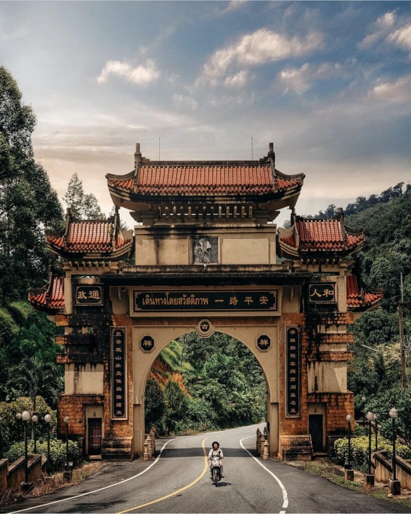
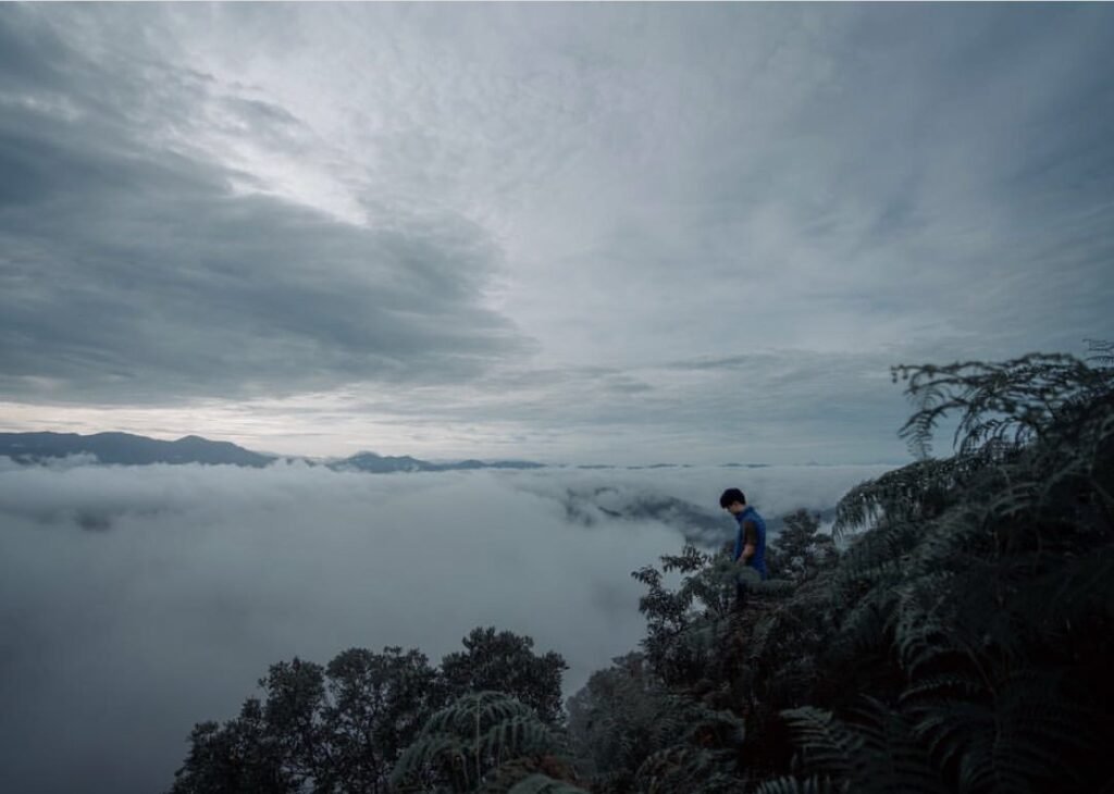
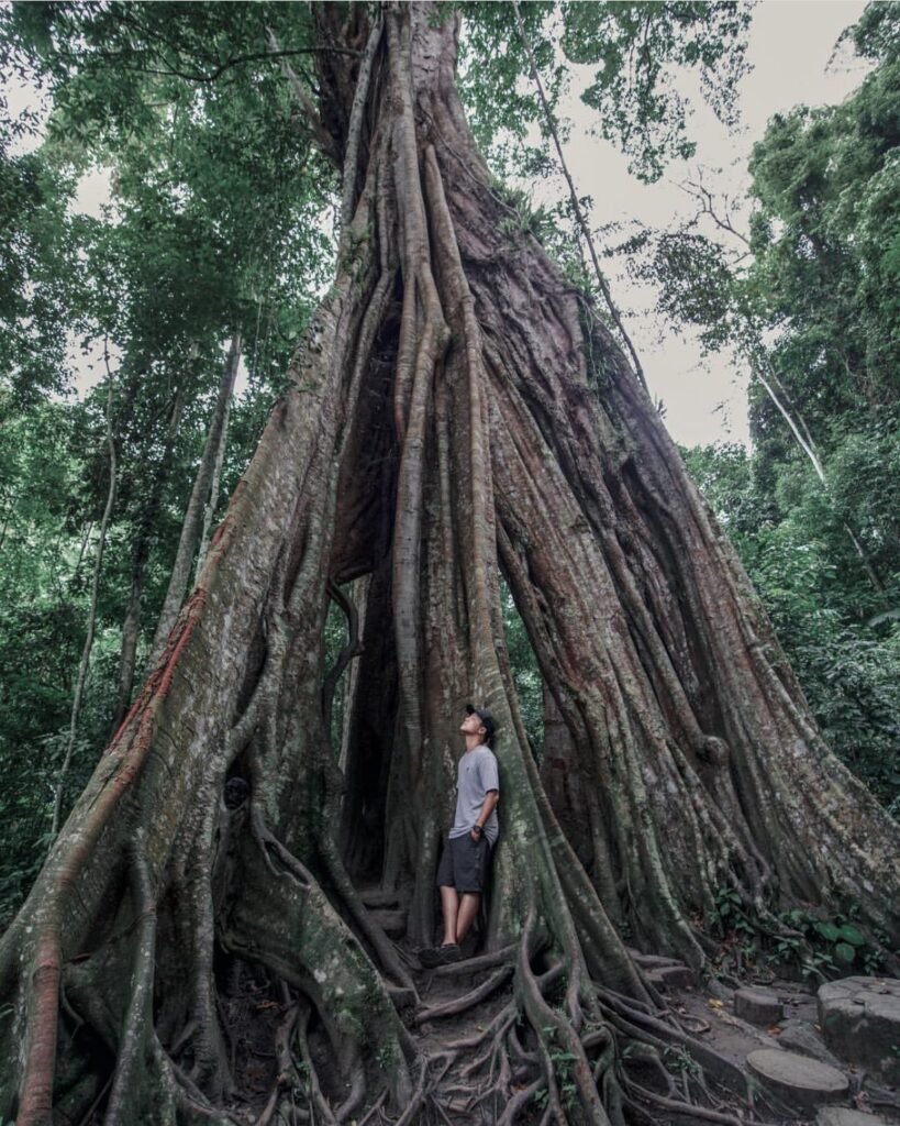
Betong is in Yala, and the UK advice against all but essential travel covers all of Yala, including Betong. Most visitors are Thai and Malaysian; if you do go, base yourself in Betong town and use a driver for the dawn start. The skywalk is a glass-floored walkway of about 61 m on a steel tower on Khao Microwave, at about 621 m, and on cool mornings the border hills rise out of cloud-filled valleys. Arrive by 06:00, as the mist usually thins by mid-morning.
More in our Deep South guide.
- Attraction Type
- Viewpoint and glass skywalk
- Location
- Open in Google Maps
- Cost
- Foreigners 200 THB, Thais 40 THB; foot covers about 30 THB; shuttle from car park 20 to 50 THB; parking 20 to 40 THB (check before you go)
- Opening Hours
- Daily from 05:30; closing time reported between 15:00 and 16:30 (check before you go)
- Best Time To Visit
- Sunrise, about 05:30 to 07:00; mist can form all year but varies day to day
- How To Get There
- About 25 to 30 km north of Betong via Highway 410 and the Aiyoeweng road; self-drive, motorbike or hired driver; 500 m steep path or shuttle from the car park
- What to Pack
- Warm jacket, torch for the pre-dawn walk, cash for fees and shuttle



45John-Suwan Viewpoint
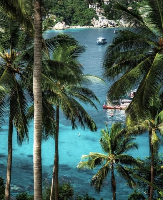
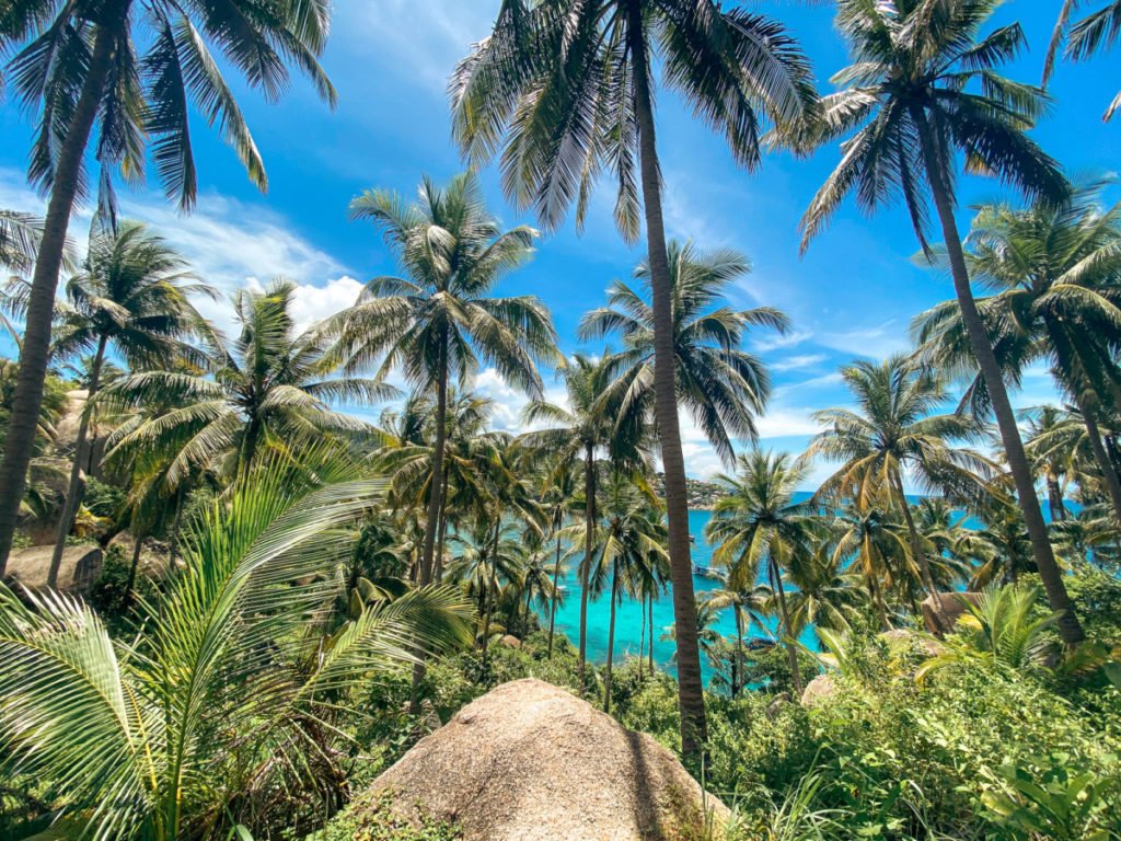
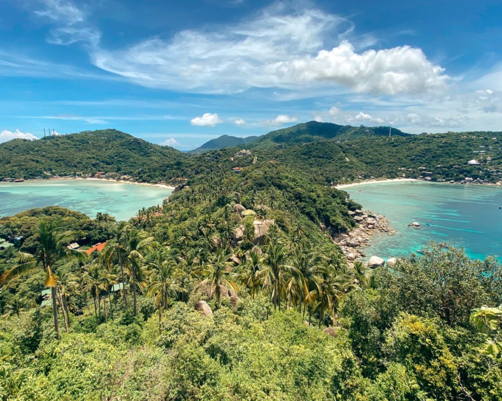
Koh Tao’s two-bay view: from the top you look down on both Shark Bay and Chalok Baan Kao Bay. The climb is short, 15 to 20 minutes, but steep over sand and gravel, so flip-flops won’t do. Go in the morning, and use the same ticket for a swim at Freedom Beach afterwards.
More in our Koh Tao guide.
- Attraction Type
- Viewpoint
- Location
- Open in Google Maps
- Cost
- ฿50
- Best Time To Visit
- Morning
- How To Get There
- Drive + Hike
- Area
- Koh Tao
- What To Pack
- Proper shoes



46Koh Nang Yuan
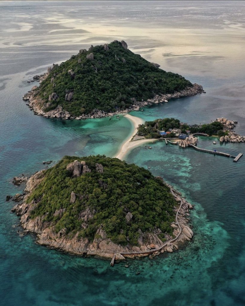
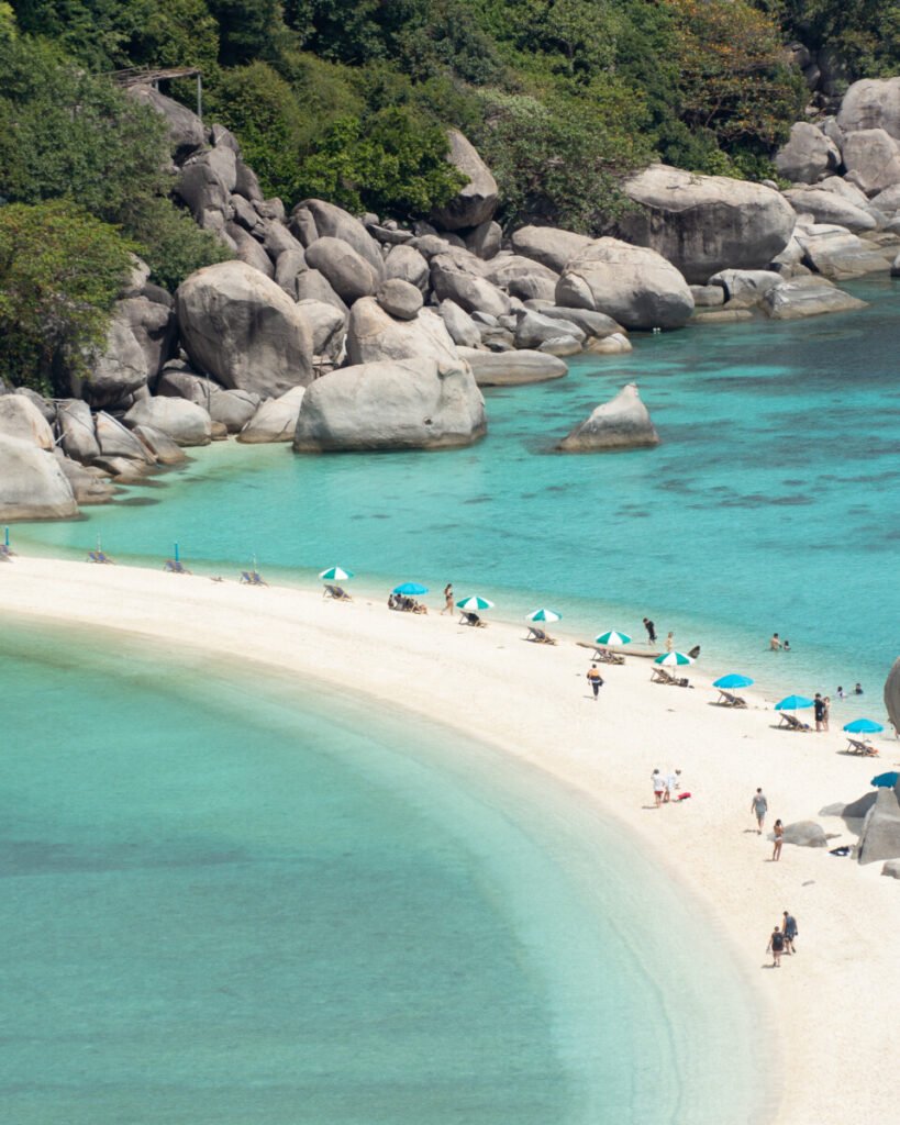
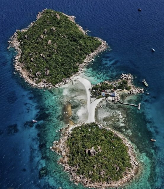
Three islands joined by a white sandbar make the classic Koh Tao view, and the viewpoint on the island is where you see it. The catch is the crowds: it gets very busy from late morning, with a queue for the viewpoint at peak times, so take an early boat. Pack a snorkel, as the snorkelling off the beaches is very good too.
More in our Koh Tao guide.
- Attraction Type
- Island / Viewpoint
- Location
- Open in Google Maps
- Cost
- ฿250 (Entrance Fee)
- Best Time To Visit
- Morning
- Opening Hours
- Daily, 10:00 to 15:00 for day visitors (check before you go)
- How To Get There
- Boat / Tour
- Area
- Koh Tao
- What To Pack
- Snorkel, swimwear, snacks, mosquito repellent


47Overlap Stone
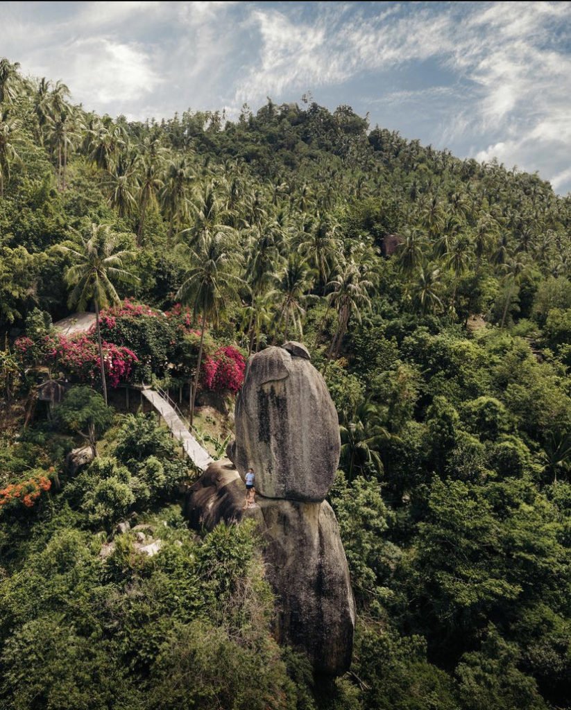
A boulder balanced on a Samui hilltop, on private land where the owners charge entry with a soft drink included. The road up is very steep, and it’s 200m on foot from the top to the stone. It opens at 08:00, so sunrise visits are no longer possible; come in the morning instead.
Don’t confuse it with Overlap Stone 2, further up the same road: forestry officials seized that site in July 2026 and it has been closed since.
More in our Koh Samui guide.
- Attraction Type
- Viewpoint
- Location
- Open in Google Maps
- Cost
- 300 THB per person, includes a soft drink (check before you go)
- Best Time To Visit
- Morning
- Opening Hours
- Daily, 08:00 to 18:00
- How To Get There
- Drive + Walk
- Area
- Koh Samui
48Dragon Crest Mountain
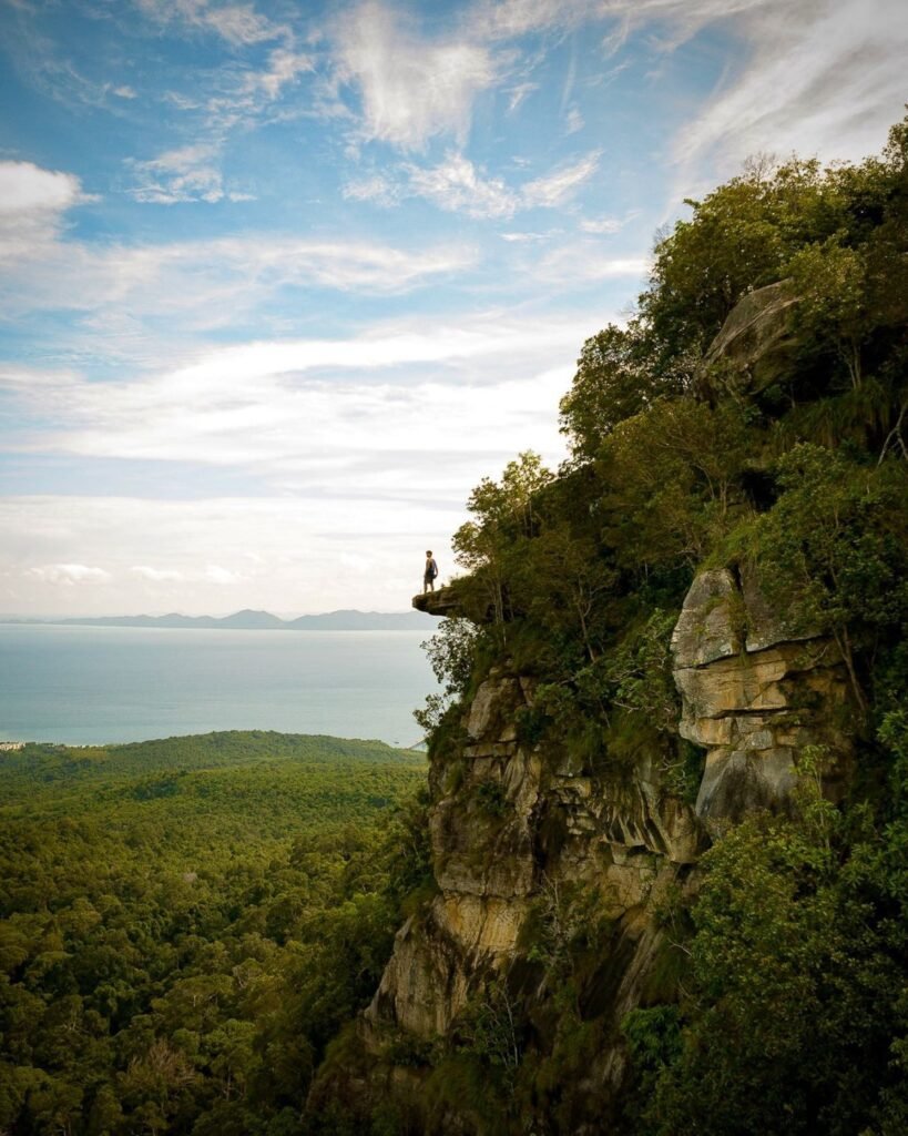
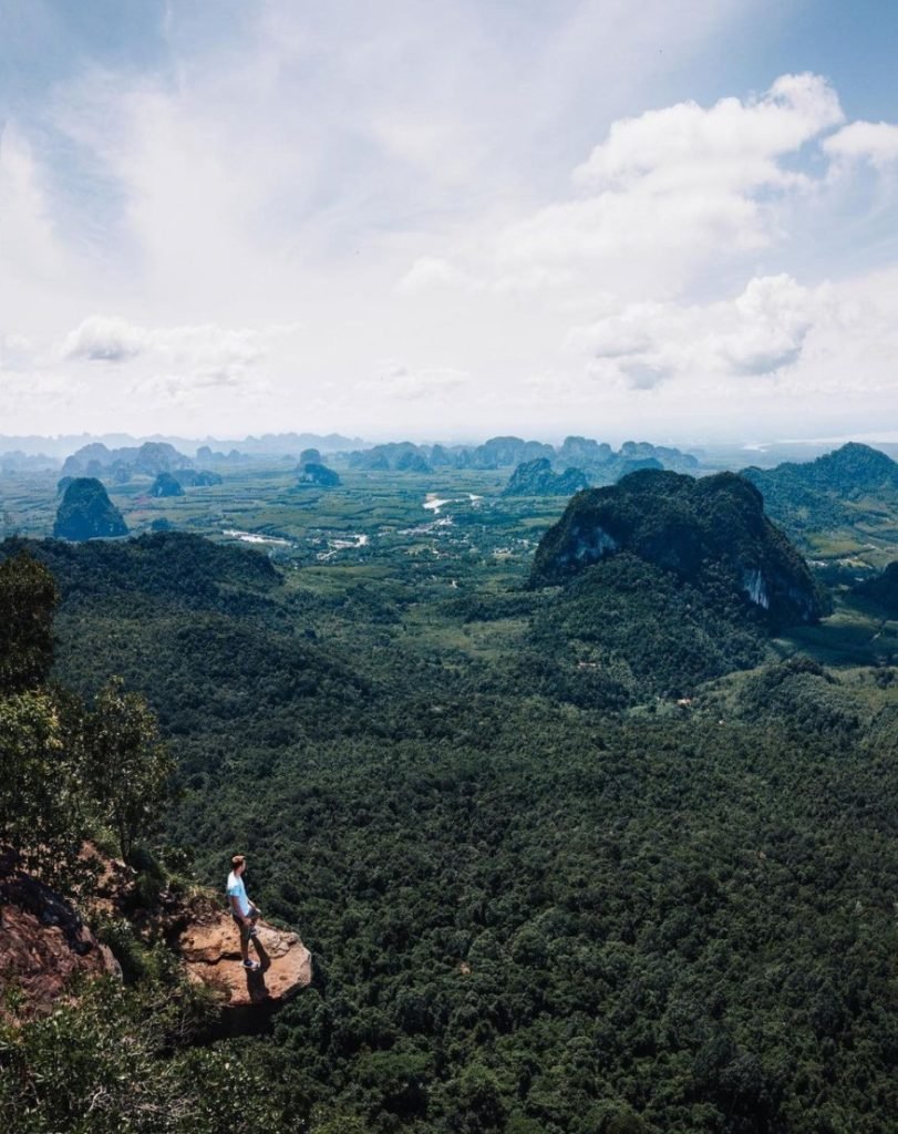
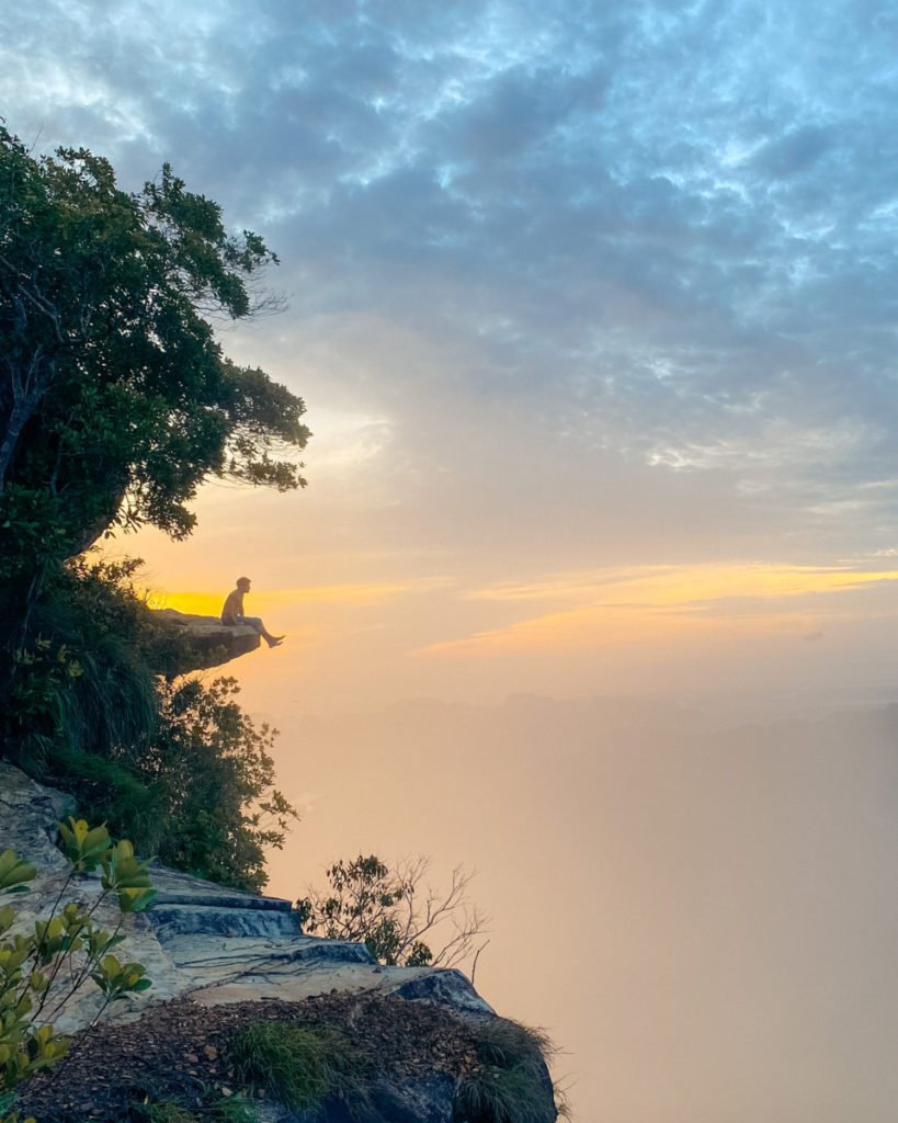
A proper hike, with a view right across Krabi as the reward. The 3.7km trail to the rock ledge of Khao Ngon Nak is uphill nearly all the way, rough with loose rocks and roots, and very humid, taking roughly 2 to 3 hours up and 1 to 2 down. Carry at least 2 litres of water and start as early as the trail opens.
More in our Krabi guide.
- Attraction Type
- Viewpoint / Hike
- Location
- Open in Google Maps
- Cost
- 200 THB for foreign adults
- Best Time To Visit
- Early morning, starting as soon as the trail opens, before the heat
- Opening Hours
- Daily, from about 06:00 (some listings say 08:00); last entry to the trail 14:00
- Number
- + 66 62 257 9456
- How To Get There
- Taxi / Drive + Hike
- Area
- Khlong Mueng
- What To Pack
- Plenty of water, snacks, hiking shoes


49Hong Island 360° Viewpoint
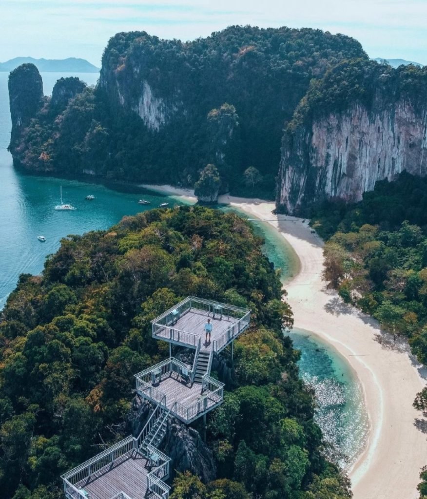
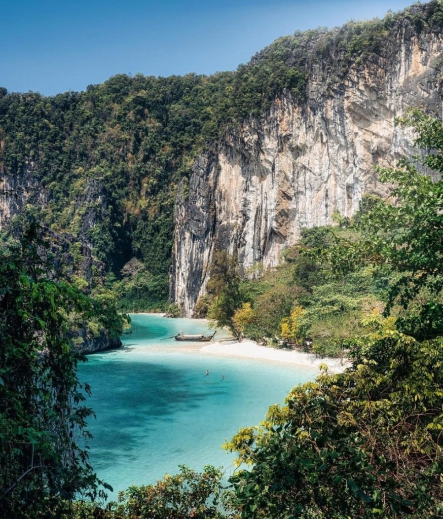
A recent addition to a Koh Hong boat trip: around 400 steep, see-through metal steps, 15 to 20 minutes with rest stops, lead to a view over all the neighbouring islands. Go in the morning, as the midday sun drives people down early. The open steps may put off anyone who dislikes heights.
More in our Krabi guide.
- Attraction Type
- Viewpoint
- Location
- Open in Google Maps
- Cost
- 300 THB for foreign adults, 150 THB for children (National Park)
- Best Time To Visit
- Morning
- Opening Hours
- Daily, 08:00 to 16:30
- How To Get There
- Boat
- Area
- Koh Hong
- What To Pack
- Water, shoes with grip


50Black Rock Viewpoint
One of Phuket’s lesser-known viewpoints, free and looking out over Promthep Cape and Nai Harn Beach from a huge black granite boulder. Getting there is half the outing: the access road is steep, rough and dusty, so many people take a 4WD or ATV taxi, then it’s a 15 to 20-minute steep climb through the forest. Go for sunrise or sunset.
More in our Phuket guide.
- Attraction Type
- Viewpoint / Hike
- Location
- Open in Google Maps
- Cost
- Free
- Best Time To Visit
- Sunrise / Sunset
- Opening Hours
- 24 Hours
- How To Get There
- Drive + Walk
- Area
- Karon
51Phu Khao Ya (Grass Hill)
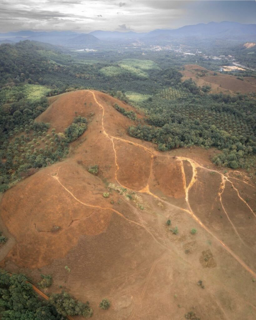
You choose the colour here: the bare, grass-covered hills are bright green in the rainy season, May to October, and gold from November to April. A short trail from beside the highway climbs to the ridge. Go late in the day, when locals come to picnic and fly kites, as there is no shade or water on the hill.
More in our Ranong guide.
- Attraction Type
- Viewpoint and hills
- Location
- Open in Google Maps
- Cost
- Free
- Opening Hours
- Daily, 08:00 to 18:00
- Best Time To Visit
- May to October for green grass; November to April for gold
- How To Get There
- About 12 to 14 km south of Ranong town on Highway 4

52Khao Chom Pa
Short but adventurous: the trail up this 84-metre limestone hill rising out of the mangroves is only about 400 metres, but steep and rocky, with fixed ropes and a squeeze through a rock gap. The 360-degree view takes in the forest and its winding canals. It is an add-on to a Ban Nam Rap boat trip for the reasonably fit; aim for late afternoon in the dry season, in closed-toe shoes.
More in our Trang guide.
- Attraction Type
- Viewpoint and hike
- Location
- Open in Google Maps
- Cost
- Included in community boat trips (check locally)
- Best Time To Visit
- Late afternoon in the dry season
- How To Get There
- By community raft or longtail from Ban Nam Rap
- What to Pack
- Closed-toe shoes, gloves and water



53Koh Adang (Chado Cliff)
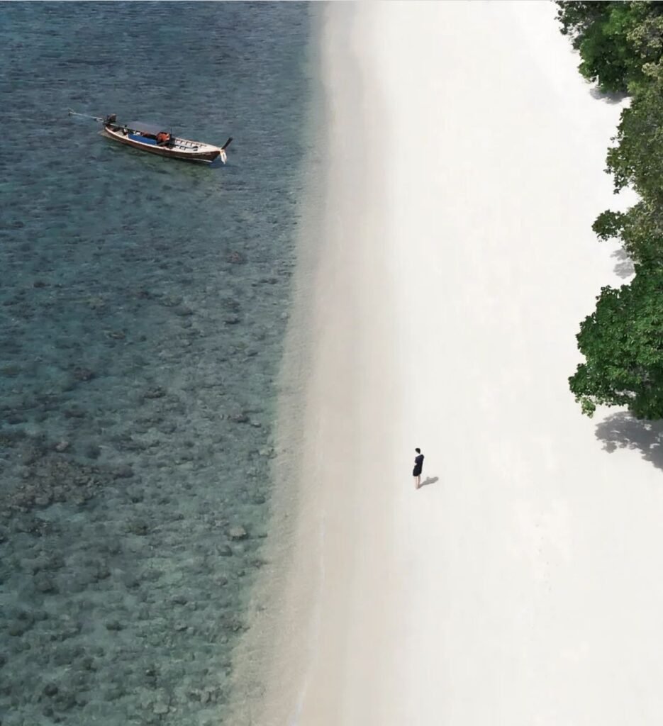
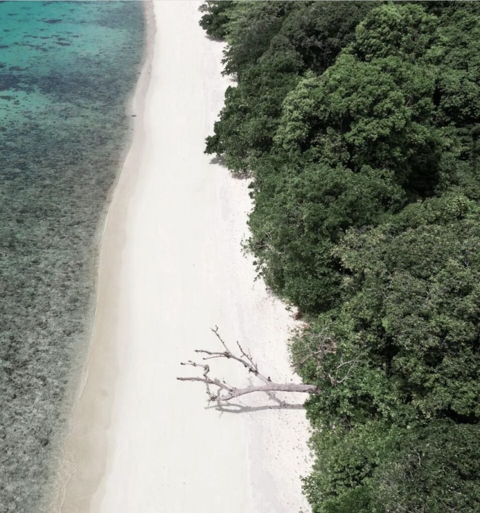
The view over Koh Lipe rather than from it. A steep, rocky trail of 30 to 45 minutes climbs from the ranger station on rainforest-covered Koh Adang to Chado Cliff, looking down on Lipe and its reefs. Go early in the morning between November and April, as the Adang sites normally close for the monsoon from 16 May to 14 October, and agree a pick-up time before your longtail leaves.
More in our Satun guide.
- Attraction Type
- Island, viewpoint and hike
- Location
- Open in Google Maps
- Cost
- Covered by the 200 THB Tarutao National Park ticket
- Best Time To Visit
- Early morning for the climb, November to April. Adang–Rawi sites close for the monsoon, normally 16 May to 14 October; Koh Lipe itself stays open
- How To Get There
- Longtail boat from Koh Lipe (about 10 minutes)
- What to Pack
- Proper shoes, plenty of water and insect repellent
- Good to Know
- Return taxi longtails from Sunrise Beach cost about 200 THB per person


54Ratchaprapha Dam Viewpoint
A quick drive up if you’re staying near the pier before a Cheow Larn Lake boat trip, for a view over the reservoir and its limestone peaks. Sunset is the obvious time, but the listed hours end at 17:00, so check you can get in that late.
More in our Surat Thani guide.
- Attraction Type
- Viewpoint
- Location
- Open in Google Maps
- Cost
- Free
- Best Time To Visit
- Late afternoon (closes at 17:00)
- Opening Hours
- Daily, 09:00 to 17:00
- How To Get There
- Drive
- Area
- Ban Ta Khun


55Bottle Beach Viewpoint
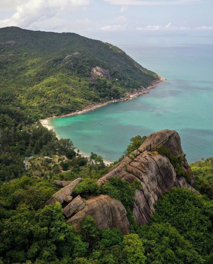
A giant rock high above Bottle Beach, reached by a relatively easy 20 to 30-minute trail from the north-east side, or in around 30 minutes up from the beach. The light rock scrambling at the top feels exposed, so it is not ideal if you dislike heights. Go in the morning and carry on down to the beach for a swim.
More in our Koh Phangan guide.
- Attraction Type
- Viewpoint
- Location
- Open in Google Maps
- Cost
- Free
- Best Time To Visit
- Morning
- How To Get There
- Boat / Drive + Walk
- Area
- Koh Phangan
- What To Pack
- Good shoes

56Lamai Viewpoint
A low-effort view on Samui: a hillside deck above Lamai with food and drinks at the top. Walk up in 5 to 10 minutes on a short, steep path, or ride the cable car, which is part of the fun. There is a 440m zip line too, though it’s expensive for what it is.
More in our Koh Samui guide.
- Attraction Type
- Viewpoint
- Location
- Open in Google Maps
- Cost
- 100 THB entry (walking up)
- Best Time To Visit
- Morning
- Opening Hours
- Daily, 09:00 to 19:00
- Number
- +66 80 890 9755
- How To Get There
- Drive / Taxi
- Area
- Koh Samui
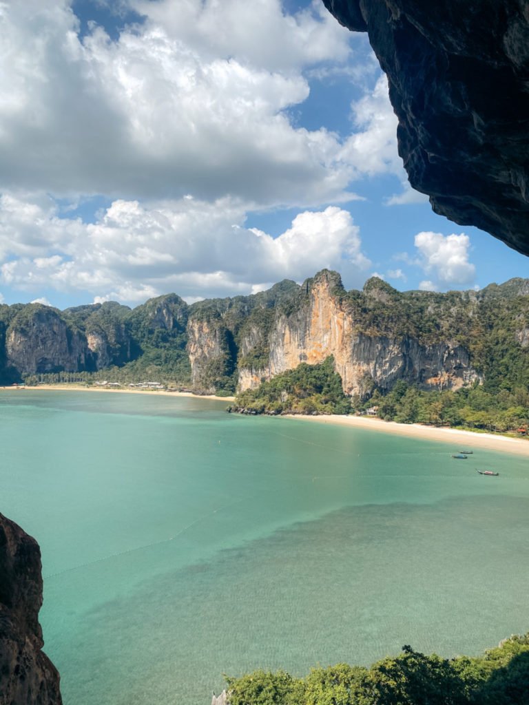
57Railay Viewpoint West
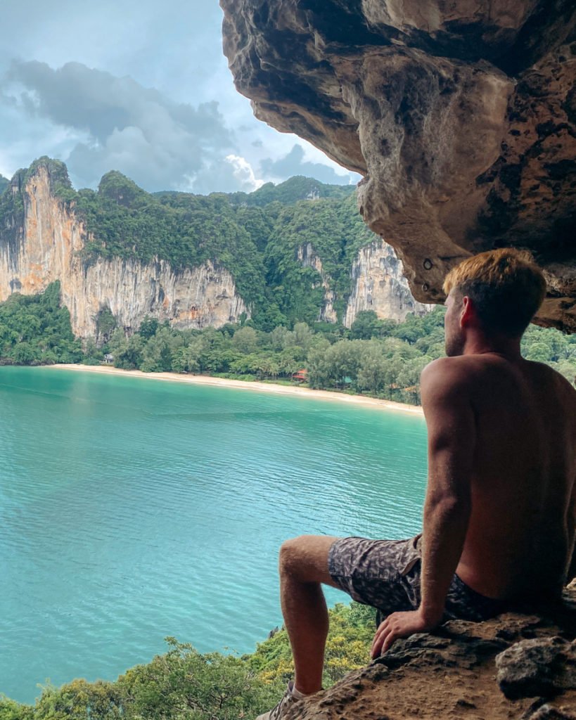
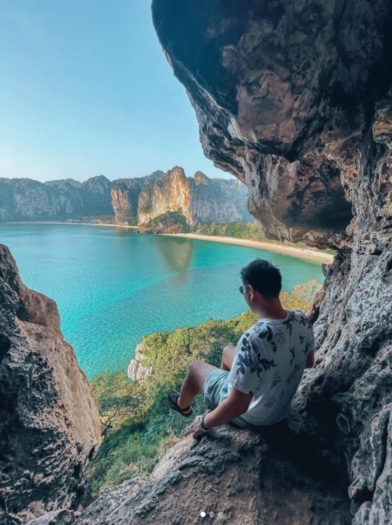
Getting up is half the point: through Bat Cave, then up the bamboo ladders inside to the top. A head torch leaves your hands free for the ladders. If caves don’t appeal, many of Railay’s climbing companies can take you up the rock instead.
More in our Railay guide.
- Attraction Type
- Viewpoint
- Location
- Open in Google Maps
- Cost
- Free
- Best Time To Visit
- Daytime
- What to Pack
- Torch
58<span class="spot__status">Permanently closed</span>Hollow Mountain
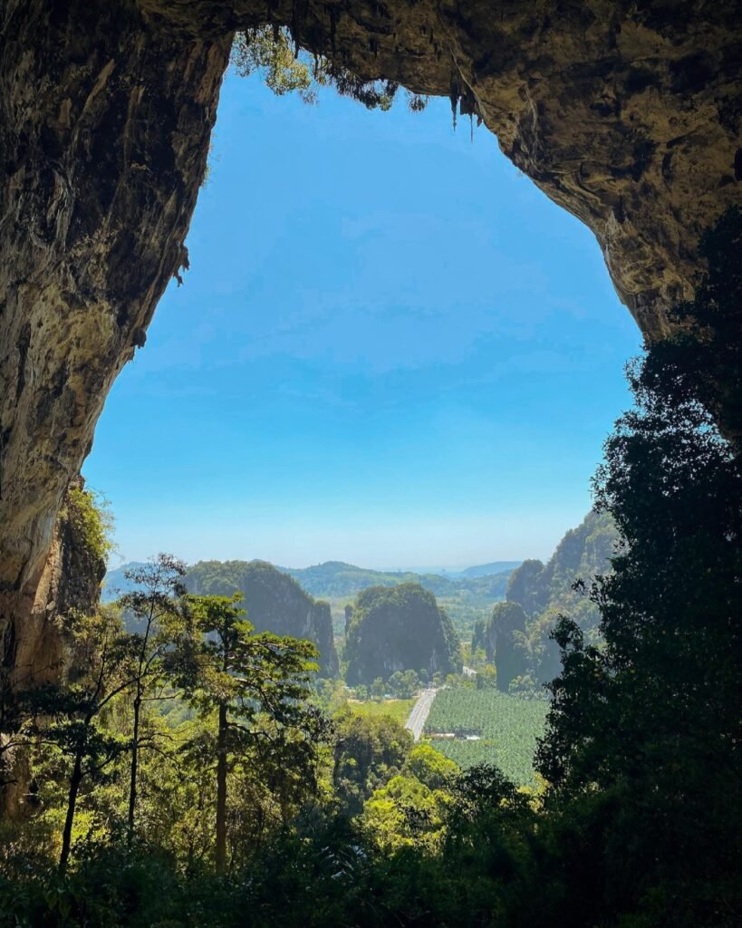
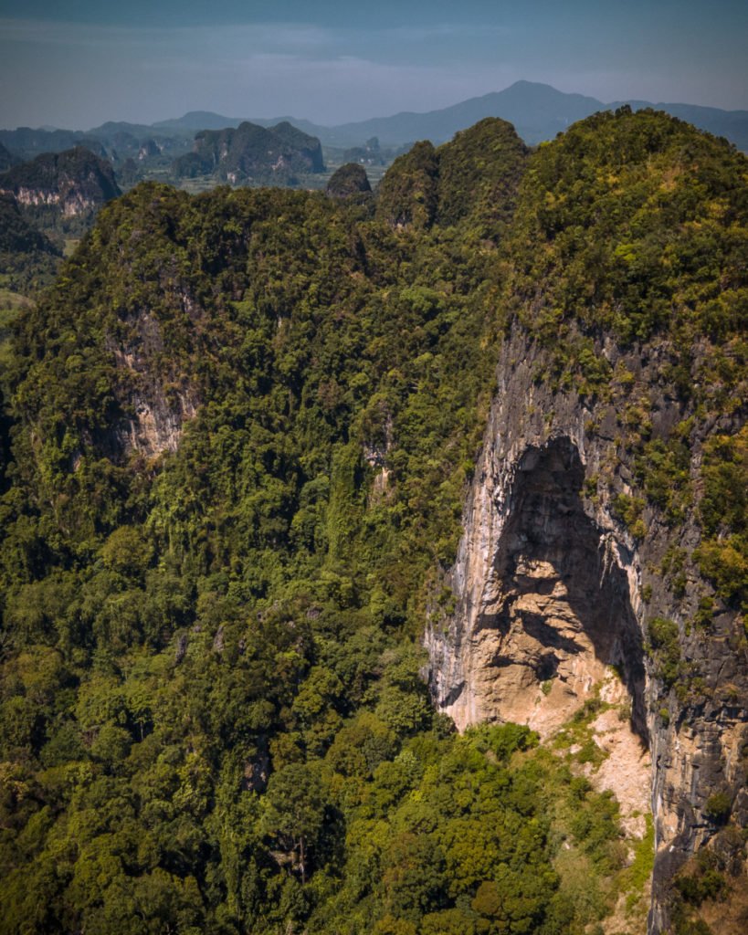
Permanently closed. Google Maps now lists Hollow Mountain as permanently closed, so don’t plan a trip around it. It was a former adventure park near Ao Nang that had become an overgrown trail of 35 to 45 minutes, with ropes and ladders and a final section that was a real climb.
More in our Krabi guide.
- Status
- Permanently closed on Google Maps (checked October 2026)
- Attraction Type
- Viewpoint / Hike
- Location
- Open in Google Maps
- Cost
- Free
- Best Time To Visit
- Morning
- Opening Hours
- 24 Hours
- How To Get There
- Drive / Taxi + Hike
- Area
- Sai Thai

59Suan Phrueksa Sawan
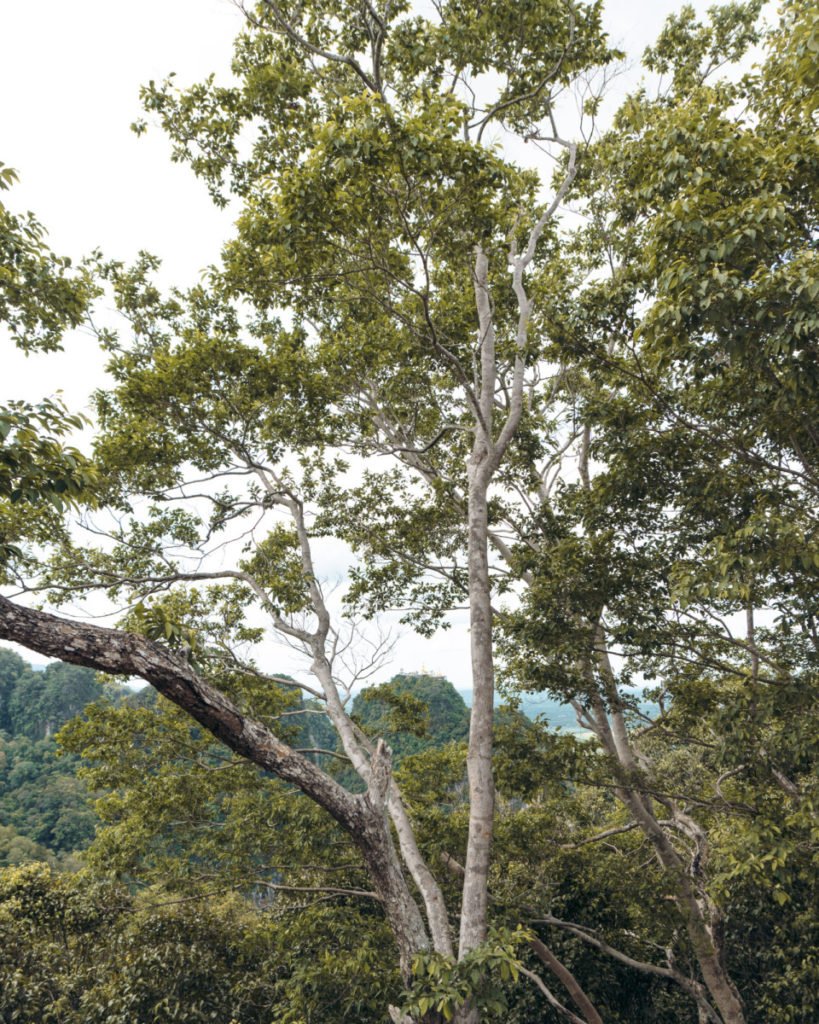
A local viewpoint in Krabi town that looks across at Tiger Cave Temple. The view from the temple itself is better, but this one takes far less effort: ride or drive most of the way, then a short flight of rocky steps to the viewing tower, 10 to 15 minutes in all. Bring mosquito repellent.
More in our Krabi guide.
- Attraction Type
- Viewpoint / Hike
- Location
- Open in Google Maps
- Cost
- Free
- Best Time To Visit
- Morning / Evening
- Opening Hours
- Daily, 06:00 to 19:00
- How To Get There
- Drive + Walk
- Area
- Krabi Town
- What To Pack
- Mosquito repellent


60Khao Khuha, Songkhla
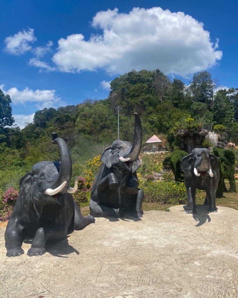
Old quarrying at Khao Khuha in Rattaphum left a cluster of sheer limestone pinnacles, and a steep path climbs to a summit viewpoint above them. At dawn, mist often lies over the plantations below. Start in the dark with a head torch and shoes with grip, as the trail is slippery after rain.
More in our Songkhla guide.
- Attraction Type
- Viewpoint and hiking trail
- Location
- Open in Google Maps
- Cost
- No fee found in sources (check before you go)
- Opening Hours
- No posted hours (check before you go)
- Best Time To Visit
- Early morning for sunrise and mist; drier months for safer footing
- How To Get There
- Private car, motorbike or hired vehicle from Hat Yai; no public transport to the trailhead


61Wang Pha Mek, Trang
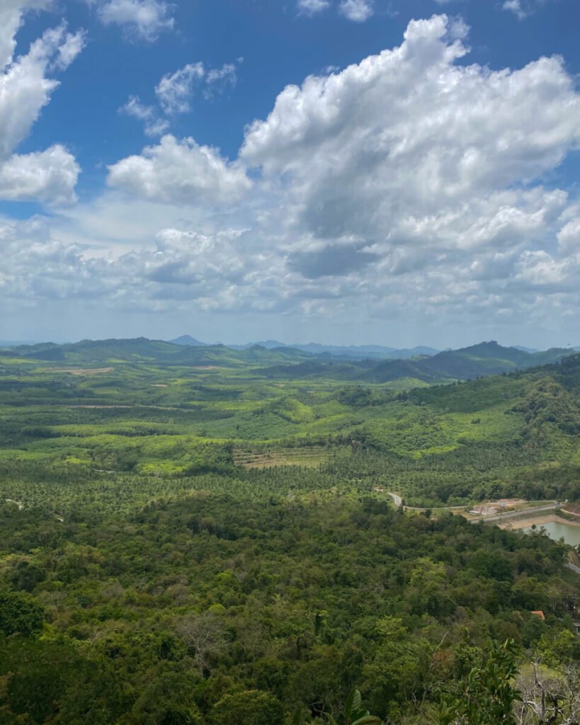
A community-run viewpoint in the hills of Wang Wiset, reached by a steep climb of about an hour. On misty mornings the valleys fill with cloud; on clear ones you can see west to the Andaman. Guided sunrise climbs start around 4.30am, and there is a dinosaur sculpture park at the foot of the hill.
More in our Trang guide.
- Attraction Type
- Mountain viewpoint and dinosaur sculpture park
- Location
- Open in Google Maps
- Cost
- No entrance fee; guide and site donations expected (check before you go)
- Opening Hours
- Daily about 8am to 5pm; sunrise climbs from 4.30am by arrangement (check before you go)
- Best Time To Visit
- Sunrise, after rain, in the rainy season and early cool season (roughly June to December) for mist
- How To Get There
- Drive about 40 km from Trang town to Ban Thung Luang, Wang Maprang subdistrict, then about 3 km further; search 'Wangpamek Adventure Dinosaur Park' in Google Maps. Own transport needed for the early start


62Khao Ok Thalu, Phatthalung
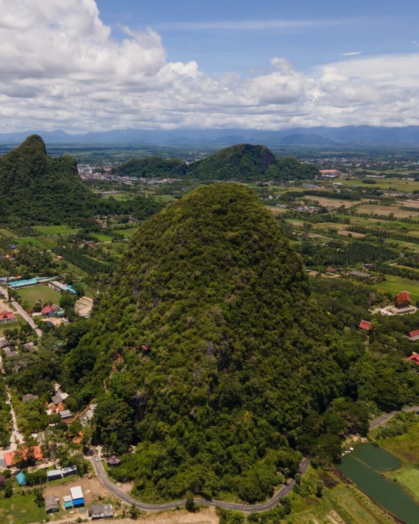
The limestone peak on Phatthalung’s provincial seal, with a hole right through the rock near the summit. About 1,000 steps climb to a rock platform and flag with views over the town and the rice plains. Go early or a couple of hours before sunset, and take plenty of water.
More in our Deep South guide.
- Attraction Type
- Mountain viewpoint and hike
- Location
- Open in Google Maps
- Cost
- Free
- Opening Hours
- 08:30 to 17:30 (check before you go)
- Best Time To Visit
- Early morning or late afternoon; February to August for drier weather
- How To Get There
- About 1 km east of Phatthalung railway station; walk, or take a motorbike taxi (about 80 baht return with waiting time, per Travelfish)


63Grand Canyon Khuan Noi
Not a mountain view but a patchwork of colour: flooded clay pits north-west of Phatthalung town whose ponds run from turquoise to emerald, divided by narrow earth ridges. Late afternoon puts warm light on the cut banks, and early morning can bring mist over the water. Swimming isn’t allowed, the banks crumble, and you’ll need your own transport.
More in our Deep South guide.
- Attraction Type
- Former quarry lakes and viewpoint
- Location
- Open in Google Maps
- Cost
- No fee found in sources (check before you go)
- Opening Hours
- Daily 08:30 to 17:30 (check before you go)
- Best Time To Visit
- Late afternoon to sunset, or early morning for mist
- How To Get There
- Own car or motorbike from Phatthalung town, about 20 minutes (check before you go)


64Hat Yai Municipal Park (Khao Kho Hong)
The city view of the south: Hat Yai spread out below a 19.9 m standing Buddha, with a Guanyin shrine and the steel-clad Phra Maha Chedi Tripob Trimongkol on the same hill. The park is free and a 20-baht tram saves the climb; the cable car has had long closures, so don’t plan around it. Go early or late, when the heat eases and locals are out exercising.
More in our Songkhla guide.
- Attraction Type
- Park, viewpoint and religious statues
- Location
- Open in Google Maps
- Cost
- Park free. Cable car 200 baht foreign adults, 100 baht Thai adults, 100/50 baht children (check before you go). Tram 20 baht. Observatory 20 baht
- Opening Hours
- Park 06:00 to 20:00. Cable car Monday to Thursday 09:00 to 16:30, Friday to Sunday and public holidays 09:00 to 17:30 (check before you go)
- Best Time To Visit
- Early morning or late afternoon; December to April for the driest weather
- How To Get There
- About 15 minutes by Grab, taxi or songthaew from central Hat Yai; a shuttle songthaew runs within the park


65Thung Khai Canopy Walkway
The only viewpoint here that puts you inside the forest rather than above it: Thailand’s first canopy walkway, about 175 m of suspended bridges up to 20 m high in the Peninsular Botanic Garden, 13 km from Trang town. You look straight into the crowns of tall dipterocarps, and birds are at eye level in the early morning. Allow about an hour and wear proper shoes, as the boards get slippery after rain.
More in our Trang guide.
- Attraction Type
- Botanic garden and canopy walkway
- Location
- Open in Google Maps
- Cost
- Free (check before you go)
- Opening Hours
- Daily 8.30am to 4.30pm (check before you go)
- Best Time To Visit
- Early morning; December to April for drier trails
- How To Get There
- Drive about 13 km from Trang town along Highway 404 towards Palian; the entrance is near kilometre 11. No regular public transport, so take a tuk-tuk, Grab or hired car
Created by
 Gavin Boyle@gavsgoneagain
 Arm Palakorn@armypalakorn
 Jan De Rycke@janderycke
 Will Fearon@asiaandbeyond
 Floris@florisgone
 Flora & Note@floraandnote
 Rung Boriwat@sunny_rung
 Shayan Naveed@shayanadventures
 Ittipoom Promma@koalamarty
 David Picton@adventuretimedave
- Sattayakoon Traikaew@lostinmyway_3
 Ittit Somboonsin@tchob_tchob
 Austin T-rex Divine@mrdivine
 Marta Sielska@martasiels
 Luke Yeung@luke.outside
 Akarachai@akara_srt
- Natapong Notjustnut@not.just.nut
 Kiattisak Masim@k.masimmmm
 Alvaro Garcia Gallego@alvarogarciagallego
 Dima Trionix@dima_trionix
 Ash Carter@ashley.rose.carter
 Brent Burns@brentburns
 James@all_around_thailand
 Tobi Schoepflin@tobischoepflin
- Explor.sure@ex.plorsure